I described my initial exploration of the first part of the route in Journey to the West, in particular the problems that I found when, having descended from Saddle Pass (which is a classic pleonasm, by the way) and turned off to the left onto a dirt road, I struggled to find what I later named ‘the link path’. A couple of years after this initial exploration, I described how we discovered that the dirt road had been blocked by a gate of doubtful legality in Skullduggery. While this gate effectively blocks motor traffic on this road, it was possible to ride around the obstruction, although this option was extremely lumpy, making it hard to stay on the bike.
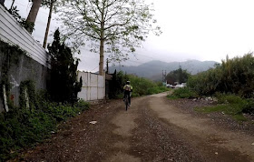
Not having done journey to the west since I’d acquired a video camera, it was my intention to record the key sections of the route, so the video was rolling as we turned off the Saddle Pass road. I’ve included stills from that video to illustrate what happened next:
The blocking gate can be seen just right of centre in the next still, but the well-defined track to the left wasn’t there the last time we came this way:
Wow! It looks as though this track has been here for ever:
…but I did notice where the previous ride-around went (behind the clump of elephant grass indicated by the red arrow). You will see it only if you look!
If you listen to the video soundtrack (link below), somewhere between the next two locations, I began to express doubts about being on the right track. Although I prefaced my comment with “I think…”, I knew we were going the wrong way, but I wanted to see Paula’s reaction.
She didn’t appear to notice that for a short distance, whoever constructed this track had used concrete, which by no stretch of the imagination is a cheap option.
The next images show the approach to a potential junction. Paula told me afterwards that she was hoping to rejoin the original route, but she would have had to have turned right here for that to have any chance of happening. She turned left, although, to be fair, if you watch the video, you will see that there was some confusion at this point.
The road was becoming narrower, a possible sign that we were approaching a dead end:
Dogs are a recurring hazard when cycling off-road in the New Territories, although only a small number are actually dangerous. Many are extremely noisy, but these ones didn’t even bark!
The next image shows a second point where a road branches off to the right, but in this case Paula had no hesitation in turning left. By this stage, it was obvious that the track we were following wasn’t new (just look at the condition of the surface):
I shouldn’t, therefore, have been surprised when we soon found ourselves on a ‘proper’ metalled road:
We both had a sense that what lay ahead was somehow familiar, but we’d almost joined it before we realized that what we could see was the road descending from Saddle Pass on the right:
This is the full video:
Naturally, we followed the road again to the point where the video started, and this time we went the right way, although as you might guess from this still from the video I shot the second time, Paula took some convincing that this was indeed the right way to go. The original track can be seen between two concrete blocks at the end of this short link.
You may wonder why I’d never checked out the metalled road at the bottom of the descent from Saddle Pass, but the answer is simple: a blind corner to the right, with a short uphill section, means that you can’t afford to look left here. However, you can be sure that the segment described here will now become an integral part of journey to the west, albeit in the opposite direction to the way it was originally explored. And this may well be the only instance ever of a video recording of initial explorations, because I venture down dozens of tracks, paths and alleyways to see where they might lead, and the vast majority are dead ends, which there is no point in recording.


