Monday, 26 November 2018

saturday morning adventure #2

When we first moved to Fanling in 2008, our regular Saturday bike ride was a trip to Sham Chung, in the Sai Kung East Country Park, to visit our friend Tom Li and enjoy his incomparable pan-fried noodles. This involved a 72km round trip, but the cycling itself was not particularly interesting, apart from the last 2–3km to Sham Chung. However, the noodles were well worth the time and effort required.

Unfortunately, I had an accident on our way back from Tom’s store on the last day of 2011, and we didn’t go again until January 2013. Shortly after that, we discovered that Tom was no longer there—the business had been taken over by his nephew—and the noodles were no longer worth the journey.

Meanwhile, I’d developed journey to the west, a much more exciting bike ride that we did every Saturday up to and including the winter of 2015/16 (with solo trips during the week, I did this ride 31 times that winter). However, changes at key points of the route have made it less attractive, and during the past two winters, we did it just twice each time.

Part of the reason for the switch to a new Saturday bike ride was the major upgrades to the long and winding road that I worked out in 2016/17. Until January this year, we ended our ride by doing ping kong ping pong, but that meant chopping off the last part of the long and winding road, and as things turned out, being unable to do three of the new discoveries that I worked out last winter (swiss roll; oriental garden; farmland fandango).

To provide some idea of how new discoveries transformed our Saturday bike ride, take a look at this entry from my cycling log for last winter:


It shows what Paula and I did on my first day back in Hong Kong. On that occasion, we didn’t do ping kong ping pong, which would have added an extra 8km to the distance, but we did include it subsequently on all Saturday rides up to the beginning of January. By that time, I’d started to look for ways to avoid the Drainage Services Department (DSD) access road that runs alongside the Sheung Yue River, because a new cycle track was being constructed (incidentally, when this is finished, we will continue to follow our new way, which is far more interesting—and exciting!).

Contrast the extract above from my cycling log with this one, which records our last bike ride before I returned to the UK in May:


You will see immediately that the total distance has increased by almost 50 percent with all the new additions. The superscript ‘4’ refers to the fact that since we stopped closing out with ping kong ping pong, we’ve chosen to do the spiral ramp twice! Most of the new additions—serendipity #1 and #2; way of the dragon; swiss roll; oriental garden; and farmland fandango—are the subject of YouTube videos, and I intend to record the others as soon as possible.

If you haven’t watched any of these, the following captioned stills from the videos may pique your interest:

way of the dragon

serendipity #1

serendipity #2

swiss roll

farmland fandango

I don’t expect to be able to add anything else to this ride, but I’ve thought that in the past and been proved wrong, so who knows what the coming winter will bring. More fun on a bike, that’s for sure!

Friday, 23 November 2018

aftermath

When Typhoon Mangkhut hit Hong Kong on 16th September, at least 55,000 trees were uprooted, and many more were damaged, having branches or tops ripped off. More than two months later, signs of the damage wrought by the most powerful tropical cyclone to tear through the territory since records began can still be seen everywhere.

I’ve been back in the territory for a week, and without travelling too far, I’ve been trying to record some of the more obvious signs of the disruption caused on that fateful day in September. Obviously, most of the uprooted trees have been cleared, especially where they blocked roads that in normal times would be busy, but some of the photographs below show trees that are likely to remain indefinitely where they fell.

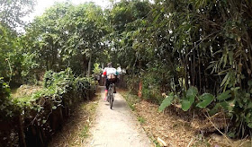
As usual on my first day back in Hong Kong, Paula and I go for a short bike ride along the frontier road. And this was the first sign of damage:


It looks as though this tree fell across the road, but now that the blocking section has been sawn off and removed, I imagine that what remains will simply be left to rot—or regenerate.

The frontier road eventually joins Ha Wan Tsuen East Road, which in turn leads to the frontier fence. The following photo of Paula cycling on this road also shows some of the damage here:


Although ‘Lok Ma Chau’ is the name of an MTR station and a border crossing point, the actual village of that name lies at the end of a road that leads nowhere else, which is why I don’t expect any more effort to be expended in clearing the fallen tree next to this road:


A bike ride along the frontier road means having to come back the way you came, but we always turn off at the top of the climb out of the frontier area to the village of Liu Pok, where I took this photo:


No uprooted trees here, but if you look closely, several trees have had branches or tops snapped off by the wind (in case you were wondering, we come this way in order to do Liu Pok Hill).

There are only two places where it is possible to cross the railway between Sheung Shui station and the border, and this is a view, looking east, of the one that we always use:


There are no major uprootings here, but notice the piles of smaller arboreal debris on the pavement (sidewalk). There are similar piles of debris in many other places, and it looks as though it is awaiting collection. I believe that it is all destined for landfill!

The next fallen tree is located close to the site of the previous photo and has been sawn into lengths that will be easy to remove, eventually:


The next two photos show a section of the footpath between the village where I live and Fanling. The first photo was taken looking towards Fanling, while the second is a view of the same location from the opposite direction:


The next two photos show trees that have fallen into a storm drain close to the village of Tsung Yuen Ha, which is next to the border northeast of Fanling. The Drainage Services Department (DSD) access road on the left of each photo is a part of my regular Sunday bike ride.


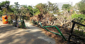
Whenever we cycle west of Fanling, we need to follow a tree-lined road through a part of Sheung Shui, and Paula has often commented on how picturesque this road is. We reach it by cycling through a squatter area from the Ng Tung River, and we arrive at the road by coming up the ramp seen in this photo:


The tree that fell on the railing must have been a big one, but it has since been removed.

Here are two photos that give some indication of the extent of the damage to trees along this road:


I photographed the next fallen tree next to the Ma Wat River, which marks the southern boundary of Fanling:


…while the next photo was taken further along the cycle track that runs alongside the river and shows more debris awaiting collection:


Ma Sik Road marks the eastern boundary of Fanling. On one side there are only high-rise apartments, while the other side is completely rural. The footpath in the next photo runs parallel to this road, and only the central section of the trunk of the fallen tree has been removed—to allow passage along the path:


My guess is that the rest of the tree will remain where it lies indefinitely:


I’ve included the next photo, from a location close to the Ng Tung River, because it shows a tree that has snapped rather than been uprooted:


The next photo, which was taken close to the west bank of the Ng Tung River west of the main railway line, shows another tree that may remain where it is indefinitely because it isn’t causing an obstruction:


Remedial work is still taking place, as this photo of a location adjoining the main north–south cycle track through Fanling and Sheung Shui shows:


My final photo is of the remains of what would have been quite a large uprooted tree in an enclosed plot next to Sha Tau Kok Road, an extremely busy road leading east from Fanling:


It is probably just as well that the #10 signal, the highest in Hong Kong’s typhoon alert system, has been issued just fifteen times since the Second World War. If this kind of devastation were to become an annual occurrence, I shudder to think how Hong Kong would cope.

Monday, 19 November 2018

no fun at all

In March last year, I posted a description of a short path that illustrated perfectly my contention that a typical country path, if it offers any difficulty, will present a different challenge depending on the direction of travel. You will probably not be surprised to hear that I called this account Two-Way Fun. The path is only 50–60 metres in length, but it has been an integral part of the final frontier, my regular Sunday bike ride, in both directions, merely to do a single manœuvre that is awkward in a radically different way depending on whether it is tackled from north to south or from south to north.

However, when I arrived at the start of the path on Sunday, I sensed immediately that something was wrong:


The path seemed wider, but it became obvious that it had been completely rebuilt only when I approached the crucial move:


If you compare this photo with the one that I took to illustrate the original problem, you will see that all intrinsic difficulty has been removed:


The difference is even more stark between the then and now photos of the manœuvre as it is approached from the opposite direction:


The start of the path from the northern end also betrays how things have changed:


So why would this apparently inconsequential path have been upgraded? If you look closely at the first photo above, you will see that someone has started to clear the land. Presumably this will be for building purposes, and it seems to me that this apparent upgrade of the path is in fact an upgrade of the storm drain that can be seen in some of the older photographs. Presumably, this is connected to the likely construction of new village houses.

One thing is certain though: it is no longer worth the short detour to take in this path—it is no fun at all—and the bike ride that I’ve been calling the final frontier is diminished as a result.

Sunday, 18 November 2018

impossible targets

In case you hadn’t noticed, I do a lot of cycling. And as I frequently tell Paula, I don’t do it ‘to keep fit’, although this is clearly a benefit. I do it because I enjoy it. And I like to set targets for myself. For example, at the start of the seven-month period that I spent in Hong Kong in 2015/16, I set a target of 5,000 kilometres for the aggregate distance to be cycled. This was a purely arbitrary figure that I thought would be easy to achieve.

I was comfortably on target after five months, but I reckoned without El Niño and its detrimental effect on the local weather, and I eventually fell short by almost 600km. However, I kept the same target for the following winter, and because there was almost no adverse weather, I reached it with some time to spare, as the following summary of my 2016/17 activity shows:


There was just one small problem!

The speedometer that I’d been using to record my activities for the past few years had occasionally malfunctioned—the contacts had become tarnished—and on my first time out upon returning to Hong Kong in October last year, it refused to work altogether. So I bought a new one and duly recorded the distance cycled, failing to notice that there was anything amiss.

On descents of steep hills in Hong Kong, it’s often necessary to proceed with caution because there isn’t a safe run-out at the bottom, but where there is a safe run-out, I like to see how fast I can go. And my second ride was around the final frontier, a highlight of which is the switchback. I had previously managed to reach 50km/hr on the two main descents here, but this time I couldn’t do any better than 46km/hr. Then it dawned on me: I’d transferred my old speedometer from a hybrid bike to a mountain bike without recalibrating it to take account of the latter’s smaller wheels!

This meant that all my records for the past few years were inflated by around 8 percent, and I hadn’t hit 5,000km in 2016/17 after all. Damn! As a result, I decided that not only should I aim for a genuine 5,000km this time, I should try to beat the false 5128.7km from the previous winter. It did cross my mind to try for 6,000km, but I dismissed this idea as unrealistic.

My second target was to improve on the false trip average of 52.33km. I did consider whether I should aim for a trip average of 60km, but in the end I didn’t think this would be feasible either.

Because so many of my rides in 2016/17 had covered less than 40km, I decided to set myself a target minimum of 40km per trip last winter, which wasn’t at all difficult to maintain for the first two months. However, due to a miscalculation, I failed to make the distance on one occasion, so at the beginning of 2018, I decided to increase the target minimum to 50km.

I don’t remember at what point I noticed that my trip average had been increasing steadily, but in mid-March I decided to increase the target minimum to 60km per trip. By the middle of April, my trip average had crept up to 60km, but then I experienced a minor setback. I was caught out in a thunderstorm and decided to abort, recording only 19.5km for that particular ride. This knocked my trip average below 60km again. Paula suggested that I not include it because it was in a sense an artificial reading, but I felt that this would be cheating, so it is included in the overall figures.

And I did hit 5,000km with a month to spare, so although I’d originally dismissed the idea as unrealistic, I thought that I might as well see whether I could reach 6,000km after all. And I did:


You will notice that after the minor setback in April, I was able to push my trip average above 60km again. So that was two ‘impossible’ targets achieved. But there was a third!

I’d been wondering for a while whether I could cycle 160km (100 miles) in a single day. Actually, the problem isn’t so much the distance as the location(s). A lot of my bike rides take in narrow paths and alleyways, where you would be lucky to average 10km/hr, and in order to do 160km, it’s necessary to average at least 16km/hr, which is achievable only on roads and official cycle tracks. So the problem is finding a long enough route that meets this criterion.

I had managed 123.6km in November 2016 by following the cycle track network around new towns in the New Territories, but as I explained above, this was a false reading. However, by expanding the options that I covered then, I managed to cycle 134.1km in a day in December last year. Finding an extra 26km was always going to be a problem, but I eventually succeeded in February:


I have no intention of trying to improve on these figures this winter, but that doesn’t mean that I don’t have some targets in mind. During November 2015, I cycled a total distance of 1341.1km, which remains the farthest I’ve ridden in a single month. This included a weekly total of 356.2km, also a record. However, as I’ve already indicated, these are false readings that need to be replaced. I do think that improving the monthly total is probably impossible, because among other things it depends on continuously favourable weather, but I will certainly be giving it a go.

Wednesday, 14 November 2018

…french and

Other languages have not been used in the compilation of this puzzle.
What do the following clues have in common?
• Africa has one.
• China has a great one.
• Arachnid.
• Playing card.
• Freshwater fish.
• Mediæval instrument of torture.
• One of the so-called four evangelists.
Clearly, some of these clues have more than one possible answer, but if you get two answers that appear to match, then it should be possible to connect the rest.

I shall be offline until at least Saturday because I’ll be travelling back to Hong Kong. I hope that someone will have submitted a correct answer before then.

Monday, 12 November 2018

penrith picture quiz

I’ve been looking for distinctive architectural features around Penrith that I could take photographs of and compile them into a quiz. Obviously, this will only be of interest to residents of or visitors to Penrith, but if you fall into either category you may find this quiz amusing. All locations are within a 250-metre radius of the Musgrave Monument, which most people would regard as the centre of town.

I’ll start with two stone arches that no longer serve any practical purpose:


There are probably other projecting windows on the upper floors of buildings, but where is the one seen in the next photo?


This stone recess was once a source of drinking water:


This may be the only example of a clerestory window in Penrith, although the whole structure is decidedly ramshackle:


A studded oak door:


This façade should be easy to place:


More arches that no longer have a purpose:


Is the next photo of a door or a window?


Where is the entrance leading to a short flight of steps in the next photo?


Finally, where are these two windows with wrought iron balconies? The ‘roof’ above suggests some kind of industrial use originally:

Monday, 5 November 2018

favourite photos: summer 2018

The title of this post may seem slightly odd, given that it’s November already, but for the past two years I’ve published a collection of photographs to coincide with my annual sojourn in the UK, and I’ve had to delay my departure for Hong Kong by four weeks this year. There is another difference this year: previous collections have focused exclusively on my time in Penrith, but this year I’ve included photos from visits to Cologne and Manchester in June. As usual, the photos are presented in chronological order.

I’ll start with two photos that I took in a park near our hotel in Cologne:


Nothing out of the ordinary; I just like the reflections.

Paula took this photo of a stone toad in the same park:


The next photo is of the cast iron side door of a church in Cologne. It depicts episodes from the Bible:


Starting at the bottom and working up, left to right, this is what I think these images represent:
Adam and Eve in the Garden of Eden / Noah’s Ark / Shadrach, Meshach and Abednego being cast into the fiery furnace / Cain and Abel / Moses and the Ten Commandments / baptism of Jesus / ? /the Last Supper / birth of Jesus…
I have no idea what the two images in the top right panel depict. Do you agree with my interpretation of the others?

I’ve included the next photo because I like the juxtaposition of secular and sacred. The exotic building in the background is Groß St Martin, one of the twelve Romanesque churches to be seen in the mediæval part of Cologne. The latest date for its construction is circa AD 1250.


My final photo from Cologne presents something of a mystery. The original image was a fairly unremarkable piece of street art, but why has someone spray-painted ‘HACF LTN’ over the key section of the image? I can only guess, but it seems likely that some kind of encroachment by the original artist on someone else’s turf is involved. Whatever the truth, the addition is as obvious a piece of vandalism as you’re ever likely to see:


You may have some difficulty interpreting my first photo from Manchester:


It shows reflections in a glass-walled building in the city centre.

The subject of the next photo is more obvious. It’s a Victorian railway bridge spanning the Rochdale Canal:


I didn’t have time to take a closer look at Manchester Cathedral, but these photos, taken from a distance, are a reminder that I should rectify this omission the next time I’m in the city:


This is another photo of a section of the Rochdale Canal:


I did think of turning this one upside down. Or is it already upside down? Note the graffiti along the towpath.

My final photo from Manchester is of an unusual modern building—unusual in that this is a city where most of the interesting buildings date from the nineteenth century.


A few years ago, I wrote about my discovery of caterpillars of the cinnabar moth on a clump of ragwort, and ever since I’ve been looking to see whether I could find more, without success. Until this summer. I took the following photo in my next-door neighbour’s garden:


I rarely photograph oil/petrol spills nowadays, but this one was so intense that I took several shots. Here are two:


Although such pollution incidents can be spectacularly colourful, it’s important to bear in mind that the pollutants will eventually end up in the sea!

I always seem to find at least one interesting scene to record in the Thacka Beck Nature Reserve, and this year has been no exception:


These are organically reared longhorn cattle that are brought in to graze the central marshy area during the summer months.

I don’t often walk past the location of the next image, but I swear that I’d never seen this statue of a bear before this year:


The odd thing is that it appears to have been carved from a tree trunk that is still rooted in the ground!

I rarely get a chance to photograph sunsets, but I took this photo on my way home from the pub one Sunday afternoon:


It would probably have made for a better photo 15–20 minutes earlier.

Finally, I include a couple of autumnal photos. I’m usually back in Hong Kong by the time leaves start to drop off the trees in earnest:


The first photo is a view of the avenue of trees in Castle Park leading down to the main entrance, which is also Penrith’s memorial to the two world wars of the twentieth century (the memorial to the Boer War is located behind the camera). The second photo is a view of Penrith’s Methodist church from the grounds of Christ Church.