Paula and I don’t often cycle out to Plover Cove, east of Taipo, even though there is a cycle track all the way there, mainly because it’s necessary to return the way you’ve just come. In fact, it is possible to continue, but the cycle track ends at Plover Cove, and it’s a legal requirement that cyclists get off and push their bikes up the initial hill. And the continuation road (Bride’s Pool Road) carries quite a lot of traffic, so it’s really only a practical option on Sundays and public holidays. However, on a ride out to Plover Cove last autumn, I noticed a new cycle track that branched off the one we were on, and I thought it might be worth investigating to see whether there was anything interesting to see.
And there certainly is. What follows is an account of a ride out to Plover Cove back in March, which included a detour along this unknown cycle track to see what we might discover. This is a map of the area of interest:
The cycle track to Plover Cove follows Ting Kok Road, the main road in the northwest corner of the map. The extensive grey area covering much of the peninsula that extends southeast from the main road is an upmarket low-rise housing estate known as The Beverly Hills.
The cycle track runs alongside the principal road but comes to an end just before the road crosses a causeway to an island. We continued along the road until it finally came to an end just before reaching the Luen Yick Fishermen’s Village:
Our initial attempt to continue was unsuccessful, but then we spotted a road leading off to the side:
And boy were we surprised! Wow! It leads to a UNESCO World Heritage site. So that’s the way we went. This is a view down this road:
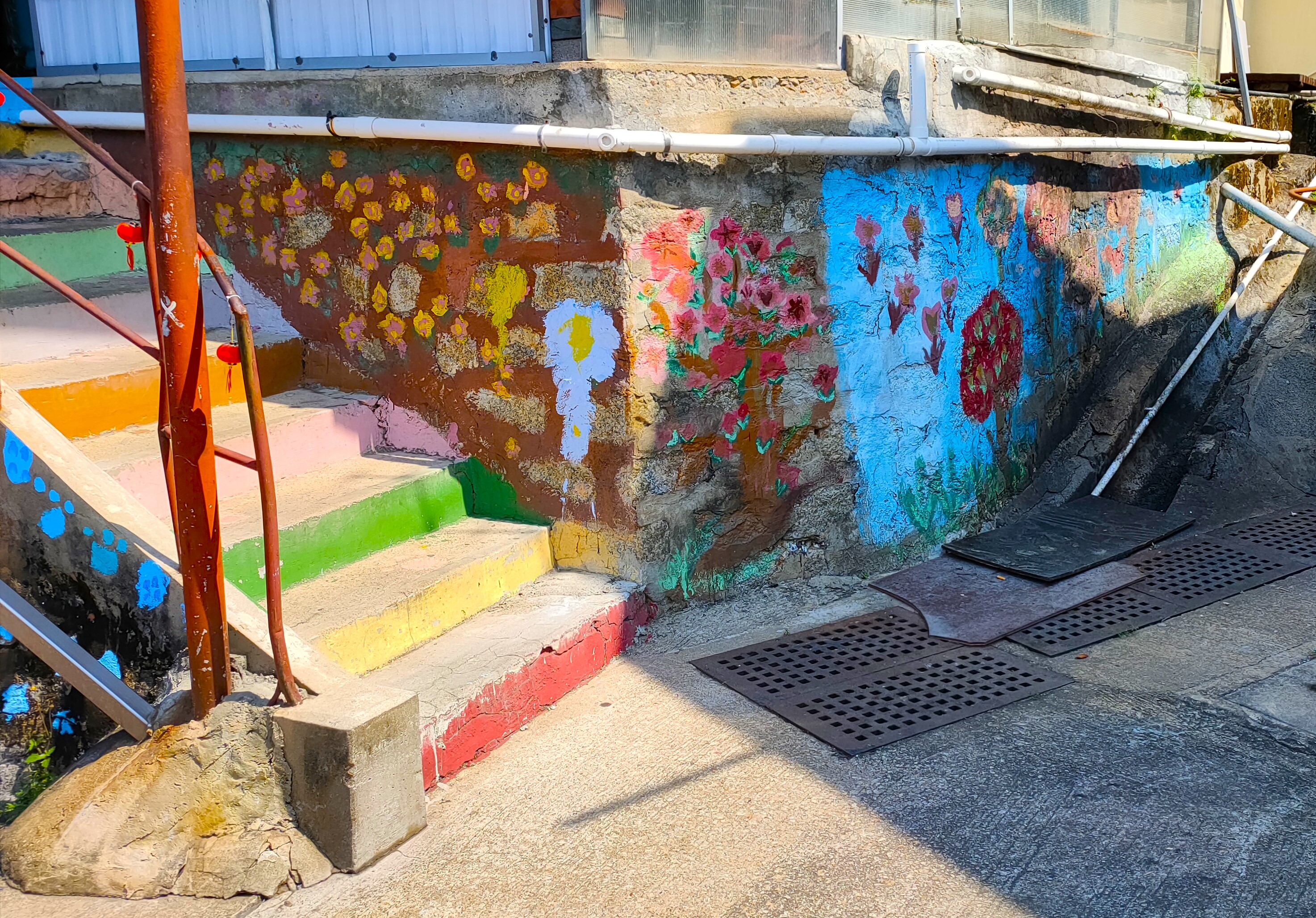
The first thing I noticed at the end of this road was a mural:
Although the above photo shows a view of the mural from the left, I photographed the rest of it working from right to left:
Although the artwork here is pretty crude, the last three photos appear to show a history of the area.
And this is a view overlooking the typhoon shelter, taken from approximately the same position:
You can see The Beverly Hills in the distance.
We continued for a short distance, and I took this photo to show an access point for the local fishermen to the typhoon shelter:
I’d noticed the footpaths marked on the map and had assumed that we would be able to cycle along them, as we do on countless other country footpaths, but I was soon disabused of this notion:
There was a sign on a wall on the left that proclaimed ‘Ma Shi Chau Special Area 1.5km’.
So we turned back and continued our ride out to Plover Cove, but I wanted to come back on foot to take a closer look at this ‘special area’ (see below).
As we rode along, I suddenly became aware of an intense redness ahead (see below), but we continued without stopping.
Plover Cove is an example of the ingenuity of the then British administration in attempting to resolve Hong Kong’s chronic water supply problems by damming the cove. And we always ride along the crest of the dam (about 3km), even though it’s a dead end, because there is no traffic, which makes for quite a serene experience. This is a view of the dam and the reservoir from the far end:
The mountain in the distance is Pat Sin Leng (‘Eight Summits Ridge’). There are many angles from which it is almost impossible to count the eight summits, but you can certainly see the full quota from this vantage point.
On the way back, I meant to take a photo of the sign at the top of the hill leading down from the crest of the dam to street level. It proclaims that cyclists must dismount and push their bikes down the hill. There are places in Tai Mei Tuk, the village at the end of the cycle track, where you can rent a bike for the day, and renting bikes is a popular activity at weekends. And I’ve heard reports of these ‘weekend wobblers’ being injured trying to ride their rented bikes down this hill. However, we’re not that incompetent, so we always ignore the sign.
On the way back, I made a point of stopping to take some photos of the ‘intense redness’ that I referred to above:
These are cotton trees, which flower before the leaves appear and are my favourite trees in Hong Kong.
I also took another photo from this location of Pat Sin Leng:
And that was our latest ride to Plover Cove. However, we wanted to see the UNESCO site, and by checking online I found that there is a bus service from Taipo Market station to the fishermen’s village. So we took this bus a couple of weeks ago, and what follows is an account of our ultimately unsuccessful attempt to see what all the fuss was about.
The initial flight of steps wasn’t a problem, but there was far worse to come:
Although I didn’t count any other steps, there are ninety-nine in this flight. I would estimate that the total number of steps we had to climb on this walk numbered in the high hundreds!
We encountered scores of graves on each side of the path as we proceeded, as you can see in this photo:
Note too the meticulous paving of the path, which reminded me of the roads built in the Andes by the Inca.
And this photo shows the Plover Cove Dam to the north:
Ma Shi Chau is linked to the island we’d just traversed by a narrow tombolo less than 5 metres wide that is tricky to negotiate. This is a view looking back along the shoreline:
When we finally reached Ma Shi Chau, there was a sign with an accompanying map that it was a two-hour round trip to the end of the island, which appeared to be the area of interest. However, after about 15 minutes of struggling with a tedious, seemingly nonexistent path, we decided to give up and turn back.
And this is the longest flight of steps on the return journey:
Another view of a section of path:
When we finally reached the fishermen’s village, I spotted these artworks alongside another access point to the typhoon shelter:
And that was our ultimately unsuccessful attempt to visit the so-called ‘geopark’. We don’t plan to try again, partly because I don’t think the geology here is likely to be particularly interesting to me. I think that the orange lump you can see in the first photo above is from the geopark. The colour is certainly unusual, but as a sedimentary rock it holds little interest to me despite my background as a geologist.


No comments:
Post a Comment
Please leave a comment if you have time, even if you disagree with the opinions expressed in this post, although you must expect a robust defence of those opinions if you choose to challenge them. Anonymous comments may not be accepted.