The basic route, which starts and finishes at the walled village of Kun Lung Wai, is not particularly interesting, but that is because it follows roads that are not a lot of fun on a bike. However, if you don’t follow Sha Tau Kok Road as far as its junction with Ping Che Road but instead turn left at the first opportunity, you will find this a better option. Both the aforementioned roads carry quite a lot of heavy freight traffic, especially the former, and it is advisable to use the sidewalk until you can turn off, although I do frequently see road cyclists who think they’re good enough to mix it with the heavy boys. Idiots!
The road that you turn on to starts by running through a mainly industrial area, but any industrial traffic is inhibited by speed bumps, which you can avoid on a bike, and areas of rough road that would slow anyone down. Just remember to turn left at the junction shown in the following photograph.

When I first came this way earlier this year, there was a sign just after this junction that read ‘Road Narrows Ahead. No Through Road to Exit’, but this was manifestly untrue, and the sign has now been removed. Just before this road reaches Ping Che Road, there is the option to turn left, which you should take. There are two further opportunities to turn right towards Ping Che Road, but if you continue straight ahead, you will eventually come to the village of Ha Shan Kai Wat, location of both the dangerous dog and the ‘no cycling’ signs referred to in N2S.
I’ve passed this way nine times in the past two months and not been stopped by anyone, but it should be obvious that turning up in a large group will seriously annoy the locals, who I’m sure would prefer that no cyclists whatsoever pass this way. However, if you follow the outskirts of the village on the right, you will come quickly to the start of the first of the narrow paths pictured in N2S. This leads to a typically quiet rural road that winds through fields before eventually reaching Ping Che Road, but about 50 metres before this happens, there is a public toilet on the right with a narrow path leading past it. If you follow this path, you will reach Ping Che Road exactly opposite its junction with Ping Yuen Road, which is where the route goes next.
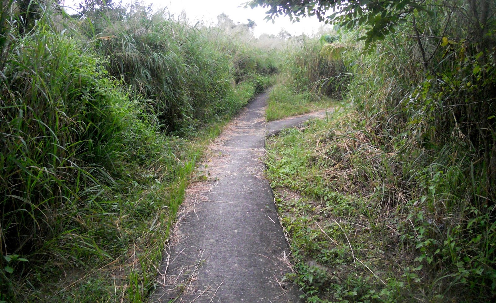
A short distance along this road is the entrance to ghost alley, which is shown in the following photograph:

This detour brings you back eventually to Ping Yuen Road—just remember to take the path to the right of the painted house—and, a short distance later, to the village of Ping Yeung. I take a rough dirt track around the western edge of the village before doubling back towards the southeast corner, where the following photograph marks the start of the second narrow path recorded in N2S:

Shortly after passing the traditional Chinese house seen in the first photo of this path in N2S, you will reach the following junction:

I originally turned left here, but I’ve since found that the right-hand path is a far better option because it avoids the need to pass through the construction site. The next four photos, in sequence, provide a flavour of this path:


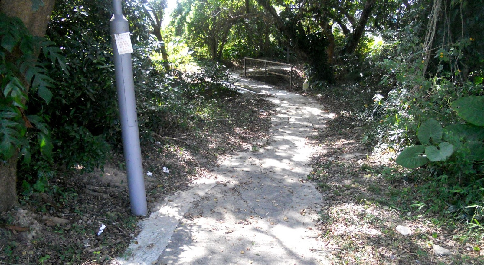
The route eventually emerges on Ng Chow Road, but it then takes an immediate U-turn along this Drainage Services access road:

At the end of the access road, the route crosses the stream via the footbridge shown in N2S and turns immediately right. There are several options as you ride downstream, but you will need to recross the stream at some point, after which a series of paths, followed by a road, lead back to the junction of Ping Che Road and Ping Yuen Road.
From this point, the route then follows Ping Che Road for several hundred metres to its junction with Kong Nga Po Road, at which point the latter is followed for about 100 metres to an obvious side road on the outside of a left-hand bend, which is signposted to the village of Lei Uk. One of the most exciting sections of the ride begins here. This is the start of the narrow path from Lei Uk to the village of Chow Tin:

The next section is the most nerve-racking on the entire route, and, for obvious reasons, you should not be coming this way as a member of a large group. The path starts with a series of rather tight turns, including this one:

This is just an appetizer! In the background, beyond the fire hydrant, the path takes a 120-degree turn, following the rail visible in the previous photo:

Don’t make this turn if you can’t back off should a cyclist or pedestrian be coming the other way. If this happens—and you won’t be able to see them coming when you set off on the path—the other person will almost certainly be unable to back off, and it’s highly likely that they will be a local, which in my opinion gives them the right of way. The next two photographs give some idea of the difficulty of this admittedly short section:


Phew! You’ve made it to the footbridge across the river, which leads to the next village, Chow Tin:

Be warned that the location of this village is not where Google maps claims it to be by at least a kilometre, although in terms of navigation it doesn’t really matter. You’re looking for the start of another path, on the western edge of the village:

There are no streetlights on this path, which is about 600 metres long, and I therefore suspect that it was built merely to provide access to graves on the hillside. It is level to start with but climbs steadily towards the end. Just make sure that you turn right at the junction shown in the first photo:


The path eventually joins an extremely rough dirt track, which is followed to a junction where there is a choice of turning left or right. The left turn leads, within a very short distance, to the start of the switchback described in N2S, but the route can be extended by turning right, to the north, at first on a dirt track:

…followed by a good concrete road as far as Lin Ma Hang Road. This road is followed to the right as far as the junction with Ping Che Road next to Ta Kwu Ling police station. There is some scope for confusion here, because although the route turns left, it is still following Lin Ma Hang Road! After about 600 metres, there is a turn to the right, which the route now follows past the entrance to the village of Chuk Yuen.
A short distance further on, at the top of an obvious hill, it is possible to turn left along an indistinct track (the ‘cart track’ pictured in N2S). This is another location where there are a lot of graves, and once the first group of these is reached, the track becomes much easier to see and follow. It leads to the village of Tsong Yuen Ha, from where it is possible to double back along Lin Ma Hang Road to Ping Che Road.
This is followed for about 200 metres, to a point where it crosses the Ping Yuen River, where you will find a narrow path along the southern bank. You should follow this as far as a turn through the trees on the left:
…which leads back to the village of Lei Uk. By backtracking along the road that brought the route through this village earlier, you will reach Kong Nga Po Road—and the start of the hard work. There is an isolated hill, about 600 metres in length, before you reach the switchback, and some extremely rough sections, but this road leads eventually to Man Kam To Road.
There is a lot of heavy freight traffic on this road, and my advice would be to ride on the sidewalk, although it is extremely narrow, there are no dropped kerbs to make it easier to cross the side roads that access various industrial premises, and there are quite a lot of tricky obstacles to negotiate. Fortunately, however, you are unlikely to encounter any pedestrians.
The final section of this exciting route follows the Drainage Services access road along the northern bank of the Ng Tung River and is peaceful and relaxing after all the earlier tensions. For me, the biggest plus point about this ride is that it can be done on Sundays. It is a long way from anywhere that hires out bikes for the day, so although I do see quite a lot of other cyclists, there is an implied minimum level of competence in the fact that they are so far from an urban area and are almost certainly riding their own bikes.


A wonderful, comprehensive description of this new route!
ReplyDeleteThanks Dennis
Thanks Martin. I should mention that Sunday is also when industrial traffic is at a minimum, especially on Kong Nga Po Road.
DeleteIt appears to be 'very interesting' and worth exploring...
ReplyDeleteYou already have!
Delete