Friday 18 February 2022

taming the dragon

The Wa Shan Military Road, which runs east–west along a ridge north of our house for about 6km, was built by the British Army during their occupation of the barracks that lie immediately below the south side of the ridge and are now occupied by the PLA. I’ve tried to find out the date of its construction, so far without success, although similar roads have permanent markers at their starts with information as to when and by whom they were built. This road has nothing along its entire length that provides this information.

Despite four days of fairly intense physical activity, including two 80km bike rides, we decided that a walk along this road would be a suitable activity for the fifth day, the Saturday before Chinese New Year. We opted to walk from east to west, mainly because we’d never traversed the ridge in that direction before. In fact, we have never traversed the entire ridge in the opposite direction either, although we did walk most of the road in that direction a couple of years ago when investigating a prominent military badge, an outing that I described in Hidden History #5.

Although I’d located the start of the road at the western end soon after moving into the area in 2008, I wouldn’t have known precisely where the eastern start is located had we not come down to it after checking the military badge. Mind you, I had guessed that it is a steep side road that joins an unnamed road that runs between the villages of Kwan Tei North and Ha Shan Kai Wat, which I started cycling along regularly in 2016 when the ‘frontier closed area’ status of the area northeast of Fanling was rescinded. This is a photo of the start:
Did I mention a lack of evidence of when and by whom the road was constructed? I’ve just noticed what may be a marker stone on the right of the previous photo. Unlike the stone that marks the start of the Robin’s Nest Jeep Track (see photo below), which is so much larger that you couldn’t possibly miss it, this stone is about the same size as a marker stone at the start of another military road a couple of kilometres south of this area. I shall have to check it out.

The road climbs steadily, passing two gates that are probably never closed nowadays:
The last photo was taken looking back the way we’d just come to avoid including people in the shot.

This is a view looking back from the first summit on the ridge:
There has clearly been a hill fire here recently—a common occurrence on Hong Kong’s upland areas. The mountain in the distance, just right of centre, is Hung Fa Leng (‘Red Flower Ridge’, otherwise known as Robin’s Nest, although I decry the use of gweilo toponyms where a local name exists).

And this is the continuation of the road:
The high-rise buildings in the distance in the first photo are in Shenzhen.

This is a view to the south, taken a little further along the road:
The high-rise buildings, which have risen to their present eminence in less than three years, are Queen’s Hill Estate, a much-needed public housing estate, even though it does blight the view from our balcony. The mountain behind is Lung Shan (‘Dragon Mountain’), so named, allegedly, because a dragon was once seen leaping across its slopes (Leaping Dragon)—you can see a photo of the dragon at the bottom of this page if you don’t check out the link. Incidentally, on the subject of gweilo toponyms, this is a really silly one: ‘Cloudy Hill’—every mountain hereabouts that is this high is wreathed in clouds more often than it’s clear!

Continuing:
This is probably the steepest obstacle on the road when travelling from west to east:
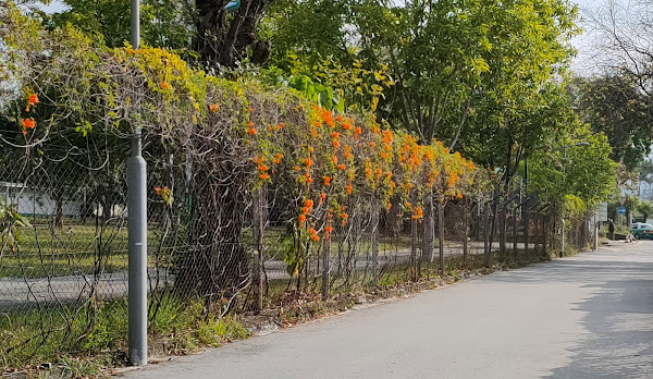
Although the road itself is in good condition throughout, it is somewhat overgrown in parts:
This is the next hill (downhill in this direction):
After seeing a few incidental views of Shenzhen thus far, this is a deliberately taken view of this relatively new, burgeoning metropolis from the next summit:
Although I took several more photos on the last section of the road, the remaining images in this compilation were taken the following Saturday, when we decided to follow the road in the opposite direction. I included a photo of the start in The Top Road.

Back in 2015, I decided to try to cycle along this road (Military Madness), starting from the west. I didn’t photograph the first part of the first hill on our recent walk, but this is the second part, separated from the first by a short, more gentle section:
After another more gentle section, the third section of the first hill is both longer and steeper:
When I reached the first summit in 2015, this is what I saw ahead:
I decided to turn back, partly because with 6cm tyres on a mountain bike, I had too much rubber on the road. Had I been riding my bike in the UK, which is a hybrid road bike with narrow tyres, I would probably have attempted to continue. And I would have had to deal with this hill, which is a real beast:
It looks even worse from the bottom:
The nearest group of houses at ground level in the view from the top of the hill is the village of Wa Shan.

So far, I haven’t mentioned that there is nothing at either end of this road to prevent access by motor cars. Because the road is barely wide enough for cars, and in a lot of places it’s almost impossible to step off the road, I regard anyone who decides to drive up this road as both selfish and antisocial (there are a lot of walkers at weekends), so I have no sympathy for whatever happened to this car, which is located at the bottom of the hill in the previous photo:
I can only guess, but my conjecture is that the engine overheated on the hill and burst into flames—the car looks as though it has been consumed by fire.

And there is another uphill section almost immediately:
Had I continued on my bike in 2015, I’d have been in deep trouble if I’d reached the point where the wrecked car is now located. The irony is that it should have been possible to cut across directly from the top of the first hill to the top of the second, so why the engineers who built this road decided to plunge down the hillside and back up again is beyond my ability to explain.

From both a walking and cycling perspective, the next section is much more amenable:
This is a view of a firing range originally built by the British Army but now used, occasionally, by the PLA:
More relatively easy going:
I’ve included the next photo because it shows the construction site that has disrupted our routines in the past year. It’s located directly in front of the left-hand group of high-rise apartment blocks in the distance:
A short distance further on:
The next view, looking south, shows what is now known as San Wai Camp (nearer the camera) and San Wai Barracks (further away) but in British times was known as Gallipoli Lines:
Why the British chose to name one of their army bases in Hong Kong after one of the worst military disasters in their history is yet another mystery.

Finally, this is a view of the descent to ground level towards the end of the road:
The horizontal line that you can see in the distance is Heung Yuen Wai Highway, which emanates directly from China and was built in the past few years. It includes a long tunnel underneath Lung Shan. It is with some regret that I didn’t cycle along it after it was completed but before it was opened—something that I obviously cannot do now, although it currently carries very little traffic because of the present border closure.

The Wa Shan Military Road is discussed on several websites, where it’s often referred to as a second ‘Great Wall of China’. You can see that it’s vaguely reminiscent of that well-known edifice, but the road reminds me of the sinuosity of a Chinese dragon, which is totally unlike the representations of dragons in European heraldry. Hence the title of this post.

Thursday 3 February 2022

jeepers creepers #4: part 2

…continued from Part 1.

Last weekend, I spent some time checking out alleyways south of Sha Tau Kok Road that I don’t use much and may never have walked along at precisely this time of year. This is what I spotted down one such alley, which is probably in Wing Ning Tsuen:
One to watch in future years?

The next village to the south of my home village is San Uk (‘new house’), and thanks to the construction work that I’ve mentioned in several recent posts, we’re obliged to walk this way into Fanling nowadays. There is nothing of interest along the path we follow (apart from a study hall and a few traditional houses), but the only time we ever walk through the eastern part of the village is late at night, after alighting from a minibus on Sha Tau Kok Road. Were there any firecracker vines in this part of the village? Yes:
I included a photo of the next specimen, which I came across as a result of my attempt to find a mysterious tower just off a very minor road on the south side of the Ma Wat River in Jeepers Creepers #2. (This location is marked on Google Maps, but the tower was in a different location, and I now know that it no longer exists):
I took the following two photos of this location nine days after the first photo. They show parts of the extensive display here from different angles:
Having complained about the weather earlier, we did cycle ‘out west’ on Tuesday last week, when we included a ride around the Tam Mei valley for the first time this winter. This is the firecracker vine next to the minibus terminus in Yau Tam Mei, which I included in Jeepers Creepers #3, but it has a much higher flower density this year:
I have no idea how I came to miss the next example, alongside the road that we follow around the valley, but I’ve no record of ever having photographed it before:
You could argue that the two bougainvillea around the gate outshine the firecracker vine here.

I included a frontal view of the next firecracker vine on the route around the valley in Jeepers Creepers #2, but that photo was taken shooting into the sun, and on Tuesday, despite a forecast of ‘sunny intervals in the afternoon’, it remained quite murky all day, so I was able to take a much better photo this time:
…and this is the side view (also included in Jeepers Creepers #3):
The purpose of the expedition I described in Educational Excursion was to check out a firecracker vine that I considered the most spectacular I’d seen anywhere (see the first photo in Jeepers Creepers #2). I was surprised to discover two other vines that hadn’t existed the last time I visited the area at this time of year. This is the first, located just before the last of several right-angle bends in the path through the houses:
Rounding this corner, I was also surprised to see the vine on the right for the first time:
These photos provide a closer look at this ‘new’ vine:
…while the vine that I came to see was as impressive as it had been when I first saw it:
Last Saturday, Paula wanted to walk along the Wa Shan Military Road, an adventure that I’ll be writing about in the next few days, but to reach the start (from the eastern end), we had to walk along an unnamed road that I originally included as part of my ‘final frontier’ bike ride. This ride now takes a different route, which is probably why I’d never seen this firecracker vine before:
Judging by the amount of flower debris below the vine, this display was already past its best by the time we saw it.

Just before we reached the start of the military road, we passed an impressive display along a side road, a photo of which I included in Jeepers Creepers (this section of the road remains part of ‘the final frontier’):
I photographed the next example near the start of the Hok Tau Country Trail #2. This is another example of a vine that would probably have looked better a few days earlier:
Finally, we were cycling ‘out west’ again last Thursday, and this time we included all ‘the outer limits’ paths. As I explained in Jeepers Creepers #3, path $3 passes an unusual example of a firecracker vine that I didn’t notice when cycling past. However, we were shooting a video at the time, and I spotted it when watching the result. So we went back to take some photos. This firecracker vine is strange because while almost all the other examples I’ve seen are cultivated, this one is wild! This is what it looks like this year:
‘Unusual, but not unique’. That is how I described a less impressive wild firecracker vine in Educational Excursion. This is a photo that I took, from a distance, on our way back home after completing our walk along the military road:
And that’s the best of this year’s firecracker vines. I’ve found several other locations that I didn’t think were good enough for this year’s larger than usual collection, including another wild specimen, but I’ll be checking them again next year for possible inclusion in next year’s collection.

other posts in this series
Jeepers Creepers
Jeepers Creepers #2
Jeepers Creepers #3

jeepers creepers #4: part 1

Although Chinese New Year is my favourite time of year, the festival was a non-event last year thanks to the pandemic—no dancing lions, no firecrackers, no roast pig, and, above all, what may well be the best such display in the world, no fireworks over Victoria Harbour on the second day of the new year. And it’s looking like a repeat ‘performance’ this year. At least there’s one thing that no bloody virus is going to interfere with: in the run-up to the new year: firecracker vines have, as usual, been intoxicating the eyes with their dazzling floral displays for the past couple of weeks.

Unfortunately, the weather hasn’t been particularly clement recently, so almost all the photos in this collection were taken within walking distance of our house and include new photos of locations that I featured in earlier posts, with hyperlinks to the relevant collection where applicable.

I’ll start with a car park that I think is in the village of Wing Ning Tsuen (all the villages in my neighbourhood south of Sha Tau Kok Road form a single suburban entity, and most of the time it isn’t possible to determine where one village ends and the next one begins). I included a couple of photos of this car park in Jeepers Creepers #2. This is a general view from the eastern end (access to the car park is possible only for pedestrians here):
…and from the western end:
I hadn’t noticed the path on the right of the previous photo on earlier visits, but this is what it looks like on the other side of the hedge:
…and from the opposite direction:
There is an equivalent alleyway on the other side of the car park, and I included photos taken here in Jeepers Creepers #3. The intensity of the flowering is similar in these photos, but with a different camera, I think that the following photos are better. The first photo was taken close to the entrance to the alleyway:
Before taking a photo from the far end, I lifted my camera above the flowers to see what I might capture:
…while this is the view looking back along the alleyway:
Finally for this location, here are three general views of sections of the car park itself:
The next photo is of a firecracker vine that I featured in Jeepers Creepers #2, with two photos taken in different years. It’s located close to the car park, but it’s on a path that I don’t think many local residents even know about:
The next photo shows the perimeter fence of what was, in colonial times, a British Army base known as Gallipoli Lines. It is now occupied by the PLA, which probably doesn’t employ any gardeners, so it has never looked particularly impressive, but this is the best I’ve seen it:
So far, I haven’t included any locations that I hadn’t known about before this year, but last week, Paula and I were walking along Po Kak Tsai (‘poke in the eye’) Road when she spotted a firecracker vine ahead that we hadn’t seen before:
I cycle along this road regularly, but my focus then is obviously on the road. However, walking gives you time to look around. This is what this vine looks like from a side road:
And there’s another firecracker vine on the opposite side of the side road:
The next photo illustrates a problem with recording firecracker vines that are beyond walking distance from our home, where it’s a matter of luck whether I capture a vine at peak flowering intensity. The next photo is of the same vine as that in the previous photo, taken nine days later:
I included two photos of the next firecracker vine, taken eleven days apart, in Jeepers Creepers #3 in the grounds of what I conjecture is a Buddhist nunnery but which I tend to refer to as the Tin House Temple (because Tin Hau is the goddess of the sea in Taoist cosmology, and I don’t think the building would survive a direct hit by a typhoon!):
Based on that juxtaposition, I shall have to take another look in a few days. And it never occurred to me when taking the earlier photos to look at the other side:
I also included photos of the car park in Siu Hang, the next village to the one where we live, in Jeepers Creepers #3, so a few days ago I decided to go there to see what the display was like this year. It was nowhere near as impressive as last year’s, so I haven’t included any photos here.

However, Siu Hang is a large, sprawling village, and I wondered whether there were any other firecracker vines here that I hadn’t see before. So I wandered along a path that I was already familiar with, and as I did so, I spotted a couple of examples some distance away among the houses. Although I did take photos from the path, the firecracker vines were too far away to justify including them in this collection. I did wonder whether I could get any closer though. And I could:
This is an inside view, but when I continued along the path, I found that the outside view was much more impressive:
And this is the closest I could get to the second vine, so I’ve no idea what the view looks like directly outside the entrance:
Continued in Part 2….