When you cross a road via a light-controlled crossing, do you follow the signals? Or do you cross when you deem it safe to do so, regardless of the state of the lights governing the crossing? What follows is an account of my reasons for taking the second option.
I should start by pointing out that here I’m discussing the crossings associated with light-controlled road junctions. Isolated light-controlled pedestrian crossings follow a different operating logic: the traffic is stopped only when someone presses a button at the roadside; and if the crossing hasn’t been used for several minutes, the traffic is stopped immediately.
However, the crossings associated with light-controlled junctions operate differently, and most are not pedestrian friendly. The exceptions are the junctions that have a universal pedestrian phase, where all crossings are green simultaneously. There is a sequence of three such junctions along Ma Sik Road, a dual carriageway that used to mark the northeast boundary of Fanling. There is one small problem: unless someone presses one of the buttons, the pedestrian phase doesn’t kick in. A surprising number of people don’t know this: I often see small groups of people waiting to cross the road at these junctions, but nobody has pressed the button.
Anyway, here is a closer look at some of the junctions/crossings that I have to negotiate regularly, either on foot or on my bike.
The first junction I will discuss is one that I never used to go anywhere near, but with the construction work associated with the Fanling North New Development Area (NDA), I now have no other option. It is the junction between Sha Tau Kok Road, which is the main road here, and Ma Sik Road. The first two photos illustrate the problem at this junction:
Notice that the pedestrian lights in the first photo on both parts of the crossing are red. This is because a lot of traffic on the main road turns right here, and a lot of traffic off Ma Sik Road turns left (I must have taken this photo early on a Sunday, given the lack of traffic in the photo).
In the second photo, the pedestrian light is green for the second half of the crossing, yet it’s red for the first half. This means that traffic is still turning left here, while traffic in the right-hand lane of the main road has the green light to continue to turn right. This is the only time in the entire cycle when the exit road from a junction is green for pedestrians, but by the time you get the green light for the first half of the crossing, the second half has turned red again, and you will have to wait several minutes before it turns green again, hence my comment about such crossings being pedestrian unfriendly.
Crossing is easier when coming in the opposite direction. In the next photo, the second half of the crossing is green, but the first half is red. However, the only direction from which traffic may come is the left-hand lane in the second photo above, and in this case, a quick glance over the right shoulder shows that the lane is empty, so I cross:
Incidentally, this is quite a complex junction, so to illustrate the general principle of crossing when it’s safe to do so, regardless of whether the little man is red or green, I will discuss two T-junctions on Fan Leng Lau Road, which we have to negotiate whenever we cycle ‘out west’.
Although the next photo shows a red light for the first half of the crossing, I can see just from the photo that it’s safe to cross: the traffic light is red for traffic on the main road travelling in the same direction, while there is absolutely no sign of traffic coming in the opposite direction:
This is the same crossing from the opposite direction:
It isn’t possible to judge from the photo whether it’s safe to cross the second half, but there’s certainly no traffic coming in the opposite direction.
Here are two views of the second junction:
The first photo shows a green light for the first half of the crossing, which only ever happens when the second half shows a red light. However, if you cross in a leisurely manner, the second half will probably have turned green by the time you’ve negotiated the central refuge.
The second photo shows a need for more urgency in crossing. The green taxi is clearly going straight on, but the white car is probably turning right, although because it’s still almost stationary, you can still cross. Just don’t hang about! You can dawdle across the second half, because next in the cycle is the traffic travelling in the same direction.
To illustrate the kind of absurdity produced by a system in which the only time the exit from a junction is green is when the entry to the junction that corresponds with that exit is red, I will conclude with two photos of a crossing on Sha Tau Kok Road that we have to negotiate whenever we are on our way home after a bike ride. You can’t describe this junction as a crossroads; it’s just two minor roads that happen to join the main road at the same point and are governed by the same set of traffic lights:
In the first photo, the first half of the crossing is red (a minibus has just pulled out into the main road), although the second half is green. However, by the time the light for the first part of the crossing has turned green, the light for the second part has turned red again, and you will have to wait several minutes before the green man reappears. And here’s the ludicrous part: almost the only traffic that turns into this side road is coming from Fanling, and it’s subject to a discrete phase in the traffic light sequence so is easy to look out for. I’ve never seen a vehicle turn left here or cross over the main road from the other side road, although if I want to cross the main road here on a bike, I ignore the pedestrian crossing and wait on the side road for the traffic light to turn green. I may not obey the signals when crossing a road on foot or on my bike, but if I’m actually cycling on a road, I always follow any traffic lights, which a lot of cyclists ignore, both in Hong Kong and in the UK.
I should conclude this analysis by pointing out that it’s actually a legal requirement that cyclists get off and push their bikes on all road crossings, but hardly anyone does, and I think it’s safer to ride across, especially if you wait for the green man on all designated crossings, which, as I’ve just been explaining, I don’t do. However, I don’t take silly risks either.
Were someone who lived in Fanling a century ago to come back to visit the area, they wouldn’t recognize anything. For a start, most of what is now the built-up area was open fields, and the only sites that existed then and still survive would have been Fanling Wai—the enclosing walls were probably still intact a hundred years ago—and the associated Pang Ancestral Hall, Tsz Tak Study Hall and Sam Shing Temple, all of which are some distance from the site that I’m about to discuss.
Since the start of construction work on the Fanling North NDA (New Development Area) last year, we’ve stopped following the Drainage Services Department’s access road along the Ng Tung River whenever we want to cycle ‘out west’. Instead, we follow the dedicated cycle tracks that run through Fanling and Sheung Shui, starting with the cycle track that runs alongside Sha Tau Kok Road, a dual carriageway that is the only road out of Fanling to the east. This is an inferior option, not least because we have to negotiate no fewer than six light-controlled junctions before we reconnect with our original route.
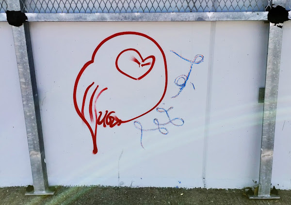
Between the junctions with Ma Sik Road and Fan Leng Lau Road, there is only one road that turns left, into what is now Fanling’s industrial district: Lok Tin Road:
Not many vehicles turn left here, but you certainly don’t have time to look at anything, although just before the crossing point, I couldn’t help but notice the graffiti on the walls to my left from the opposite side of the road, which I subsequently visited on foot to take photos (I wrote about them in Scrawl on the Wall). However, I didn’t notice the subject of this post at the time.
This is a view of the same crossing point looking east:
Incidentally, the blue sign reads
Cyclists dismount
Use pedestrian crossing
It is actually a legal requirement that cyclists get off and push their bikes whenever they cross a road, but it’s a rule that hardly anybody follows. After all, there is no pedestrian crossing here! And even if there were, my contention is that if you push your bike across the road, you are in the potential danger zone for longer, so it’s safer to check for traffic then ride straight across.
There would be nothing else to say about this location, except that on a recent walk around the Lung Yeuk Tau area, we needed to go into Luen Wo Hui (signposted on the first photo above) to do some shopping. And that brought us to Sha Tau Kok Road at precisely this location. Notice the semicircle of construction barriers in both the above photos. Paula spotted the stone tablet that these barriers enclose:
And this is a closer view of the tablet:
Apparently, it commemorates ‘reconstruction’ of Tai Po, the name of a location that no longer exists, even as a name; so this is probably the only extant reference to the place, although On Lok, a village now subsumed by Fanling’s industrial district and therefore also no longer existing as a physical entity, is still signposted before the turn off Sha Tau Kok Road.
The main ‘text’ of the tablet appears to be a list of contributions to the project, written in an old Chinese tabulation style:
There are three dates on the right (1908, 1917 and 1921) so this reconstruction, whatever its nature—and this isn’t explained on the tablet—took place in three phases.
After discovering this tablet, I can’t help wondering whether there are any more in the area, although as I pointed out above, almost this entire area was just fields a century ago.
I don’t often go out cycling by myself nowadays, Paula having retired and being available for a bike ride whenever we feel like it, but I did go out by myself last Wednesday. And what a day I had! I never explore new paths whenever I’m with someone, so I was in full explorer mode. And after rebuilding fitness following a four-week break from cycling in December, occasioned by aggravating an old lower back injury, I was ready for my first attempt to ride 100km in a day this winter.
As usual for a mid-week ride, I planned to head west, and there is just one practical way to leave Sheung Shui / Fanling: by following the cycle track that runs alongside Po Shek Wu Road, a four-lane dual carriageway. At one point, the road crosses a bridge over the railway and expressway, which involves the first hill of the day. On the previous Friday, I’d gone out cycling with Paula, and we couldn’t help but notice what appeared to be newly daubed, interesting graffiti on panels of the bridge parapet as we passed, although we didn’t stop to take any photos. On Wednesday, I did:
The Chinese characters above the steaming bowl of noodles translates as ‘guaranteed very good’.
Incidentally, the wire mesh is a suicide prevention measure—it’s a considerable drop to the road and rail levels from this point.
Wait a minute, I thought. I seemed to remember two images of guitars, but graffiti are regarded as a form of vandalism in Hong Kong. Surely they haven’t been scrubbed off already. So I continued, and there were indeed more images further down the far side. First, a Buddhist monk sweeping the courtyard of his monastery:
Then an intriguing image of a tropical island (the Sun appears to be sipping a cool drink through a straw!):
It might seem that ‘233’ is a random number, but due to the number of homophones in Chinese, ‘two three three’ sounds like ‘easy to accumulate many riches’.
And there was indeed a second image of a vaguely anthropomorphic guitar:
Since the opening of a cycle track to Yuen Long two years ago, we’ve been following that where convenient, but thanks to an increase in construction work associated with the Kwu Tung New Development Area (NDA) recently, which adds to the disjointed nature of the track through this area, we’ve started following ‘the frontier road’ instead.
A while ago, we had discovered that this usually quiet road had been transformed into a cart track by the passage of large numbers of big, fully laden tipper trucks—this area is also under development, in this case to build a science park—and I’d decided to avoid it in future. However, Paula cycled along it a while ago and reported that the road had been resurfaced, so it’s back on the itinerary. If you want to see what the frontier road looked like before the development started, this is a video that we shot a few years ago:
Nowadays, despite the existence of the new cycle track, we prefer to follow San Tin Tsuen Road, which loops around the northern edge of the group of villages collectively known as San Tin after reaching the end of the frontier road, partly because it’s very quiet but mostly because it’s a far more scenic option. The road is alive with bougainvillea, and there’s quite a lot of wildlife. I featured an account of hundreds of egrets in a fish pond in a recent blog post, and while there are only a handful of these birds in this photo, it does provide a good view of Shenzhen in the distance:
I didn’t take any more photos until I reached the Kam Tin River, and I always stop at the first point of contact, to take a photo. Yesterday’s photo isn’t one of the best I’ve taken here, but it shows a cluster of aquatic birds, mostly black-winged stilts with one or two egrets, and a view of part of Shenzhen in the distance. The river is lined on both sides by mangroves:
My first objective after crossing the Kam Tin River via the only road bridge was a road into the Nam Sang Wai wetlands that I’d spotted on one of the maps that I’d consulted for clues as to what might be worth checking out. As I cycled along this gravel road, I thought to myself, that looks like a statue of a woman ahead. No, it must be a trick of perspective.
But it wasn’t! Why would anyone place such a sculpture here, where almost no-one will see it? And why is it an image of an obviously Western woman in a medidative pose?
And this woman isn’t just fat. She’s enormous:
This foray turned out to be a failure. The map had shown a path leading off the end of the road, but I could find no sign of it. And I was attacked by dogs near the end of the road—a common hazard in the New Territories. Needless to say, I won’t be coming this way again, although I might go as far as the statue if I’m with someone who’s expressed an interest in seeing it.
My next venture away from the ‘standard’ route was more successful. When cycling along the ‘hospital path’ previously, so named because it was discovered by a blind side wing forward with a pronounced lisp (not really—I gave it this name because it passes Pok Oi Hospital before emerging onto the main road), I’d noticed another path leading off to the side. Time to check it out. It led through a series of alleyways that were easy to follow to a minor road. At this point, my sense of direction told me that turning left would merely have led to the main road, so I turned right. Within a short distance, I was confronted by an apparent cul de sac. However, I recognized where I was. And I knew that there was an abrupt right turn at the end of this blind alley—with a difficult steep ramp immediately around the corner! We’d come this way before, approaching from a different direction, and had omitted it from the regular route because the approach was not particularly pleasant. It’s now back on the itinerary.
This is a short clip from a video that we shot a while ago, when we were still coming this way, that shows the hidden ramp:
When the hospital path reaches the main road, the only way to cross is via a footbridge, which is quite tricky to negotiate. However, there is a side road leading off from the foot of the bridge that leads to the start of a narrow path that we use to reach the area known as Shap Pat Heung (‘eighteen villages’), the focus of most of my exploration during the past two years. However, there is a side road leading off to the right almost immediately, and on the spur of the moment I decided to see whether it led anywhere interesting. It did.
However, there were many possible paths and alleyways that I could have chosen to take, although I managed to find a way through with only a couple of forays down blind alleys, eventually emerging onto the path I’ve just referred to. This leads to a path, eventually becoming a road, that runs alongside a massive nullah (the local word for a storm drain) until it reaches a public gazebo where I could stop and sit down for a short break.
Next on my itinerary was a trip to the big tree temple, a route to which I’d already established, although I did want to see whether there were alternatives to avoid a short road section. That quest was also successful.
On my way back to the main road and the next section of my intended route, I spotted an alleyway that I hadn’t noticed before, and naturally I wanted to see whether it led anywhere interesting. After a short but straightforward section, I found myself following a concrete path that ran alongside a small nullah, crossing and recrossing the nullah via small bridges, and I did cross at one point where I didn’t need to, because that appeared to be the more interesting option, only to come to a dead end.
Having retraced my route, I continued along the path until I noticed ahead what appeared to be the kind of masonry facing that is often used in Hong Kong on slopes of doubtful stability. However, this one wasn’t particularly steep, so I could easily ride across it. On the far side, there was another path, where I could choose to turn left or right. I opted to turn left, because turning right would lead back in the general direction of the massive nullah.
My choice was yet another dead end, but I’d noticed a turn to the left before reaching the end, so I simply had to check it out. After a short distance, I spotted another path joining from the left that I rejected immediately as an option because it appeared to have an initial gradient of 35–40 percent. However, the path I was following degenerated into a dirt path that steepened up gradually, and I was soon in bottom gear. The path slowly levelled out and began to descend again, crossing the front of a couple of graves, until it reached the steep section of path that I’d eschewed in the uphill direction just a few minutes earlier.
So I would find out where a right turn at the masonry facing led after all. And it did take me back to the road from which this venture had started. I’ve given this new path the provisional name ‘Yuen Long (south) path #4’, but I shall have to think of a better name, because it’s one of the most exciting that I’ve discovered anywhere and is quite a test of one’s bike-handling skills. In the past, I’ve switched on my video camera whenever I venture down a new path, to help me remember the route until I’m thoroughly familiar with it, but I’d started to worry that someone would steal the camera while I’m using a toilet—it’s easy to remove, but a real pain to mount in the first place. So I didn’t have it available, and I’m going to have to do it a few times before I can avoid going the wrong way.
Once back on the main road, I followed a cycle track until I reached the Kam Tin River, where I could bump my bike down a flight of steps to reach a Drainage Services access road that runs alongside the river. Because it’s a dead end, there is almost no traffic, and I can therefore enjoy the scenery—and at low tide the bird life—as I cycle along. Where that road reaches a major road, I crossed a bridge over the south branch of the river and immediately turned down another minor road, from where I took the following photo:
I’ve taken several photos of large numbers of black-winged stilts on the inflatable dam that you can see in the photo, where they wait until low tide provides access to food in the main river, but I took this photo because they’d chosen somewhere different to congregate this time. The spectacular viaduct in the distance carries the Mass Transit Railway’s West Rail Line, and you can see the road that I’d just been following running alongside the river.
My next stopping point is in the village of Shui Mei, where there is a public toilet and I can sit down for a few minutes before continuing. My next objective would be the five ‘outer limits’ paths, so named because you can’t go any further, at least in that direction. Incidentally, although I refer to these paths merely by numbers, the number sequence reflects the order in which they were discovered. The ride order is #3, #1, #2, #5, #4.
The only incident of note to report was at the start of path #4. There is usually a car parked in the entrance to this path, but on this occasion there were two. And the gap between them was no more than about 30cm. Damn, I thought, I’m going to have to go back to Shui Mei entirely by road. Then I had a bright idea: if I pull my bike up into a vertical position and turn the front wheel to one side, I might be able to get through the gap. And if my pedals happen to scratch either of the cars, it would serve them bloody right. I’m not the only person on two wheels who uses this path. You can see parked motor scooters in this video:
So back to Shui Mei. I haven’t mentioned cotton trees (Bombax cieba), which are my favourite trees in Hong Kong, and this is the time of year when they flower. These trees have two unusual characteristics for broadleaf species: like conifers, they have straight trunks, and several branches start at the same height on the trunk; and the flowers come out before the leaves. Having said that, I took this photo of a tree that is right next to our usual stopping point here because it has clearly been hacked about a lot and therefore looks nothing like a conventional tree:
It was now time to head back home, although that is a rather misleading concept. First, I wanted to test an alternative route out of the village, which to my surprise took me past the famed Kam Tin Tree House, which is marked with a ‘balloon’ on Google Maps:
I’d visited this tree once before, several years ago, but I couldn’t remember the precise location. I won’t forget now. It is probably the oldest— and largest—banyan (Ficus microcarpa) in Hong Kong. There is an information sign on the fence that dates it to the early Qing Dynasty, which would make it around 350 years old. Incidentally, you may be wondering why it is called a ‘tree house’. Apparently, it grew slowly around an old stone building that was purportedly either a temple or a study hall, but we’re in the realms of folklore here, so I won’t speculate. I vaguely remember seeing remnants of a building when I first visited the tree, but there is certainly no sign of it now.
An unusual feature of banyans is that they have aerial roots, thin tendrils that hang down from the branches and extract moisture directly from the air. Once they reach the ground, these tendrils quickly thicken up and become woody. And although these so-called prop roots may look like different trees in old specimens like this one:
…this is just one tree!
There is a small park that is a good place for a brief sit-down on the right-hand side of the tree, relative to the previous photos, from where I took this photo:
Sadly, however, a sign on the fence in this park states that the tree was diagnosed with brown root rot, a disease caused by a fungus, Phellinus noxius, in 2014. Its condition is being closely monitored according to the sign, and another sign warns that ‘pesticide’ has been applied around the area, which implies to me that the authorities think that the disease is caused by an insect or similar pest, not a fungus, which isn’t mentioned in either sign. Odd!
When I established ‘journey to the west’ in 2013, the way I took on the return journey out of Shui Mei was along the Drainage Services access road on the opposite side of the river to the road that I followed upstream earlier, which you can see in the photo above. However, this one-way road is often used as a rat run by local drivers who have scant regard for cyclists, zooming past with minimal clearance. I needed an alternative, and I found one: the cycle track that runs alongside Kam Tin Road. However, this is boring, and my standard route now follows a road that loops around the village of Sha Po and carries almost no traffic.
But there’s an even better option, which is a lot longer but includes a tortuous sequence of alleyways that is quite exciting and eventually joins the road around Sha Po. However, the last time I followed this option with Paula, we encountered several cars coming in the opposite direction on our way to the start of the alleyway sequence that didn’t give us enough room, despite there being around 1.5 metres of space between the nearside of each car and the kerb. My usual tactic when this happens is to pull out in front of the oncoming car to force the driver to move over slightly, but I don’t feel comfortable having to do this given the relative weakness of my physical situation. Is there an alternative approach to the start of the first alley? Yes there is, along a rough gravel track, and that was my final piece of exploration on the ride.
Apart from detours through the fish ponds between the Kam Tin River and Fairview Park and around the Tam Mei valley, which I added after establishing the basic route to add more distance to the ride, the journey home was straightforward, although I did take two photos in the Tam Mei valley. There are three roads up this valley, and the two outer ones form a contiguous loop, but the Drainage Services access road in between is a dead end. Nevertheless, this is the way I go nowadays, because—you’ve guessed it—there is a path that starts at the end of the road and leads to the outer loop. I took the following photo close to the end of the road to illustrate what a typical cotton tree looks like from a distance, although in reality it was a lot more striking than the photo suggests:
The start of the path I mentioned is off the photo to the right.
After negotiating an interesting series of alleyways, I returned to the Drainage Services access road to exit the valley. However, as I neared the road that would take me homewards, I spotted a large truck ahead that had stopped and was therefore completely blocking what is just a single-track road. No problem! I simply doubled back to the first footbridge across the river that runs up the valley, which connects to the most northerly of the roads up the valley. But as I crossed the bridge, I heard the distinctive sound of goats, so I stopped to take this photo of a small herd that was grazing on the banks of this canalized watercourse:
Towards the end of the ride, partly as a result of needing to avoid the construction work that I referred to at the beginning of this report, I followed a different way into town to the one we usually take, one that I already knew about that included a ride through ‘oriental garden’.
There was just one negative aspect to what had otherwise been an enjoyable, albeit tough, bike ride. Following the recent surge in coronavirus cases in Hong Kong, the government has been building temporary isolation centres wherever there is empty space. One such site is located along the Kam Tin River. The newly constructed cycle track has been completely destroyed for a short distance, making it necessary to follow the Drainage Services access road for a short distance. No problem, you might think. After all, it’s the route I used to take before the cycle track was constructed. However, there’s an almost constant stream of big construction vehicles on the road, and they’re trailing large amounts of mud onto the road. To make matters worse, the road is being ‘watered’ regularly, presumably to reduce dust, so it's necessary to proceed very slowly to avoid getting my bike splattered with slime. I wish I knew an alternative that avoids this hazard, but there aren’t any obvious options in this area. I think I will look for one the next time I cycle out west though.
One final point: I’d being saying that if the wearing of face masks ever became a legal requirement, I would stop cycling for the duration of the mandate. However, it turns out that this caveat applies only to surgical masks, which have an impermeable layer that would hamper breathing, especially on hills. I’ve started wearing a government-issued mask that works on a different principle—it is impregnated with colloidal copper, which kills the virus rather than merely keeping it out, or in—and although I’d prefer to forgo any kind of face covering, this mask doesn’t impede my breathing, even on hills.
I finally arrived home well after six o’clock, with a prominent orange glow illuminating the entire sky, having been out for ten hours. So did I hit my 100km target? Yes! In fact, I managed 105.33km. Not bad for an old man, although I was utterly cream-crackered at the end of the day.
When I wrote about the witch’s house in 2016, I did so because it was a classic example of ‘strange and unusual’. I gave it that name because it reminded me of the house made from gingerbread that was discovered in the forest by Hansel and Gretel, who also found that it was owned by a wicked witch who liked to eat children.
However, the witch’s house may have been strange and unusual (I’ve used the past tense here because the last time we passed it, the house appeared to have changed hands, and all the external artifacts and ornamentation had been removed), but it certainly wasn’t unique.
A few days ago, Paula and I were walking through the village of Tong Hang, on the southern outskirts of Fanling, when we came across another strange and unusual house without the sinister connotations of the witch’s house, hence the name (Paula’s coinage). We used to pass it regularly when cycling ‘down south’, which we rarely do nowadays, and whoever lived there at the time was often outside and always offered a friendly greeting as we passed. We never noticed anything unusual.
This is what the house looks like now when approaching from Fanling:
…and this is the strange creature in the first of three windows that initially attracted my attention:
The following seven photos show the points of interest in sequence from left to right, with comments/explanations where necessary.
The first photo shows what appears to be just an ornamental plant holder, but notice the two tiny people, who appear to be surfing the wave in canoes—or are they just leaves?
The first thing I noticed about the walled flower bed in the next photo was the toadstools, but notice too the eggs, for which I can offer no explanation. And is that a gnome between the two toadstools on the left?
Of course, the inspiration for the toadstools is obviously fly agaric (Amanita muscaria), which is only ever red with white patches, but I’m not going to quibble.
The next photo shows a large owl perched on the house’s mailbox, which includes the name of the village in addition to the house number (a common practice):
It was only when I examined the photo that I spotted the lion to the left of the owl. There appears to be another on the far side of the door. Pairs of lions, obviously much larger than the ones here, are often seen guarding temples and other important buildings, but I’ve occasionally seen ones like these outside other houses, although they’re usually firmly on the ground rather than being mounted in alcoves above the ground, as here.
This is the door. Nothing strange here, apart from the two crescent wrenches that have been glued to it:
Personal shrines are common outside front doors, and the next photo shows this house’s version:
There is nothing unusual about the shrine itself, although I can’t identify the specific objects of veneration here. The fruit and the three cups of wine are offerings. However, notice the anthropomorphic plant pot on the top, the multi-legged creature alongside it—probably a prawn—another owl, and the two silly faces on the right.
Apart from the objects in the previous photo, there are just two points of interest in the next photo: the ‘insect’ on the left of the horizontal plant holder above the window, and the ‘snake’, which is a banded krait, probably the most common venomous snake in Hong Kong:
The object in the next photo may not actually look like a cat, but it’s decidedly feline in appearance:
Finally, this is a view of the front of the house, looking back the way we had just come:
As I’ve mentioned, we don’t often pass this way nowadays, but I’ll certainly be checking the house for new additions whenever we are in the area in the future.
I'm an ex-geologist, an ex-Outward Bound instructor and administrator, an ex-journalist, and an ex-book editor. I still consider myself a scientist. I'm now retired and spend seven months of each year in Fanling, a town in Hong Kong's New Territories, and five months in Penrith, my home town in England.
Although many people regard graffiti as just another form of vandalism, I’m a huge fan and consider it a valid art form. The Writing on the Fence, which I recorded in Manchester in 2018, underlines my view.