Friday 17 June 2022

photographic highlights 2021–22: part 3

…continued from Part 2.

The first photo is a shot of the Ng Tung River about 2km upstream from where it flows past our village. I have no idea what kind of plant is creating these green splodges, which I’ve never seen anywhere else:
Notice that like all significant watercourses in the northern New Territories, the river has been canalized. I shudder to speculate what intensity of rainfall would cause the flow to overtop the banks.

There is just one cotton tree in our village (a big one), and this is what the ‘mess on the ground’ looks like when the flowers drop:
The next photo shows another bougainvillea that I’d never seen before. It is located alongside a dirt road that we now refer to as ‘accidental tourists’ (so named because we were shooting a video, and Paula went the wrong way, inadvertently discovering a through route that we hadn’t previously known existed):
Paula spotted this moth on the west wall of the local wai (‘walled enclosure’). The wingspan is almost 15cm:
The cycle track from Taipo to Shatin runs along the shore of Tolo Harbour, and I stopped to take this photo of a large group of egrets on an artificial island close to the shore:
The right-hand half of the ridge in the distance is Pat Sin Leng (‘eight summits ridge’).

I spotted this ceramic ornament, apparently discarded, lying on the ground next to a tree. I’ve no real idea of what it depicts, although there is a tale in Chinese folklore about eight fairies (which is also an alternative translation of ‘Pat Sin’). However, there are only six on this object:
I’ve taken photos of this bougainvillea, in the grounds of a school next to the cycle track that runs alongside Jockey Club Road, before. I didn’t realize at the time I took this photo that someone else was also taking a photo of the display:
Dry-stone walls are an integral part of the scenery where I come from in England, but I never expected to find one in Hong Kong. I discovered this wall off the beaten track somewhere between Fanling and Taipo:
I was surprised to see this graffito, on the abutment of a bridge over a large nullah (‘storm drain’) in the Kam Tin area, as I cycled past. It reads ‘FREEDOM’, so it probably dates to the anti-government protests in 2019, although it’s in a location where few people will see it:
The final bougainvillea photo in this collection is of a plant adorning a covered seating area next to the cycle track that runs along the side of the railway and expressway in west Fanling. This location is a short distance south of the construction site that I wrote about in Constructivism. I never used to come this way, but thanks to the disruption caused by construction along our local river, this cycle track is now our standard way home after cycling ‘out west’:
After taking the photos that I used in Constructivism, I walked back home through Sheung Shui along a route that took me past S.K.H. Chan Young Secondary School. I photographed these two paintings on the wall of the school by poking my camera through the railings:
Last month, I was cycling ‘out west’ by myself, and on the spur of the moment I decided to explore the area south of the big tree temple, which I’d never checked out previously. Among the things I discovered here was this house, which has the date 1936 above the portico on the left. To my surprise, it is marked on Google Maps, where I learned that the house was built by an Indonesian Chinese man and is known locally as ‘the Great Beam House’. It appears to be abandoned, but it isn’t possible to go inside:
I had intended to create a post specifically about flame trees, but almost all the trees that I’ve seen this year produced only patchy displays of colour. The next photo shows one of the few exceptions. It was taken looking west along Ting Kok Road, on the eastern outskirts of Taipo:
Paula and I were cycling along the approach road to ‘the hospital path’ when I heard a shout from behind. My wife had spotted a large cluster of toadstools next to the road. I took quite a few photos, of which this is the best (there were many more toadstools that are not in the photo):
Another fungal photo. This one shows a bracket fungus on a section of fallen tree trunk next to the pavilion in the village of Shui Mei where we always stop for a short break:
I was up on our roof recently playing about with the telephoto function of my camera. This was the result:
My final photo in this year’s collection was also taken on our roof. A few days earlier, we’d noticed a hornet that appeared to be in the process of building a nest, and it had clearly been extremely busy in the interim. The vertical dimension is about 15cm:
Paula thinks we should destroy it, but I want to see what, if anything, happens next.

previous highlights collections
Photographic Highlights: 2015–16
Photographic Highlights: 2016–17
Photographic Highlights: 2017–18
Photographic Highlights: 2018–19
Photographic Highlights: 2019–20 (Part 1)
Photographic Highlights: 2019–20 (Part 2)
Photographic Highlights: 2020–21 (Part 1)
Photographic Highlights: 2020–21 (Part 2)

Wednesday 15 June 2022

photographic highlights 2021–22: part 2

…continued from Part 1.

I was walking past a small ornamental garden in Sheung Shui back in November when I noticed this:
Believe it or not, each of the ‘sticks’ making up these ‘vases’ is an individual living plant!

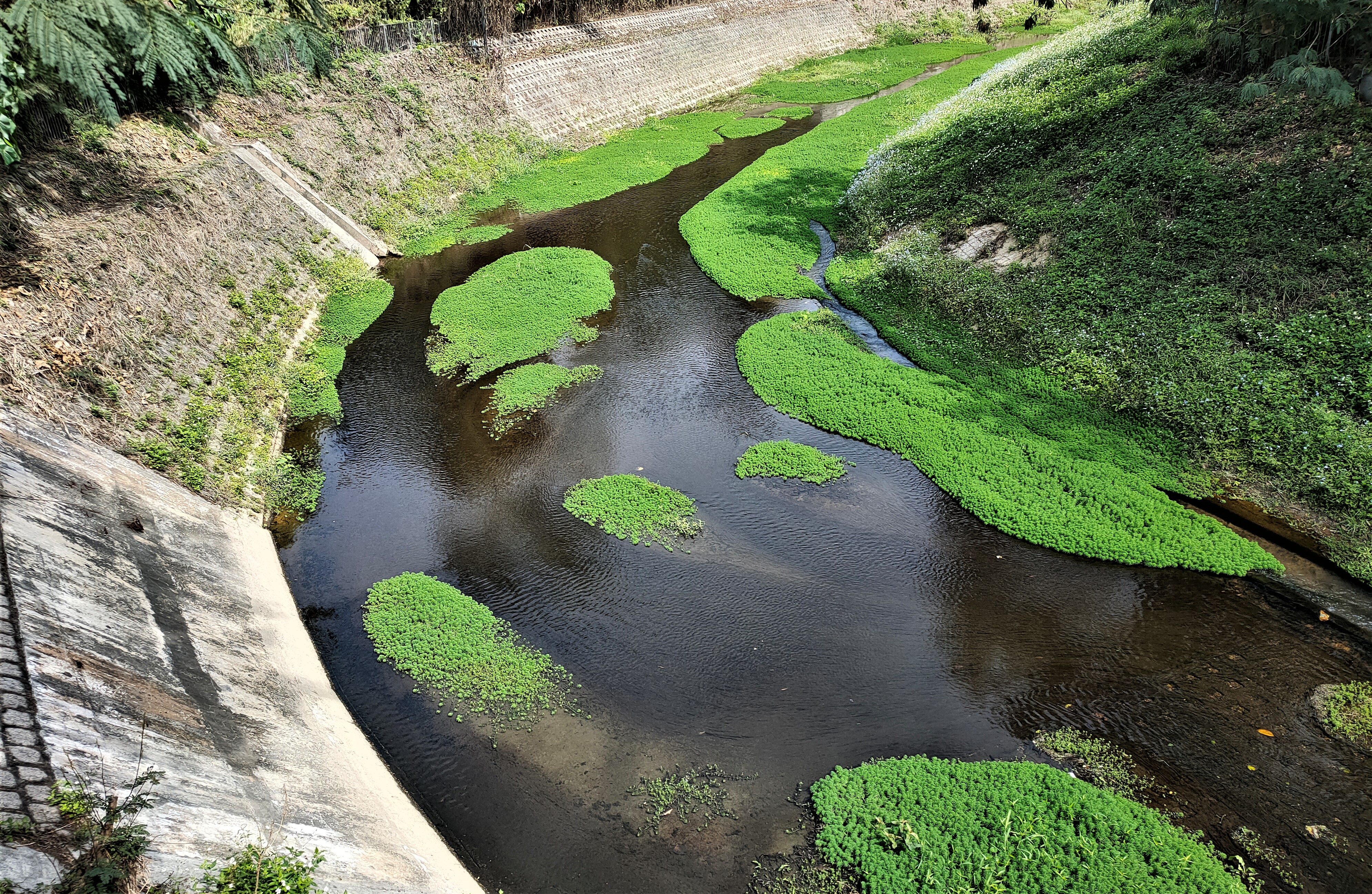
The next photo is a view of the Kam Tin River, looking downstream. The elevated railway is part of what was once known as the West Rail Line. There used to be a cross-platform connection with the East Rail Line, which inter alia runs through Fanling, at the Hung Hom terminus. However, the Ma On Shan Line, formerly a mere branch line connecting the new town of Ma On Shan to the network, has now been connected to the former West Rail Line, which terminates in the most westerly of the new towns in the New Territories, Tuen Mun. Unsurprisingly, the West Rail Line has now been renamed the Tuen Ma Line:
This is a view of the same stretch of river, looking upstream:
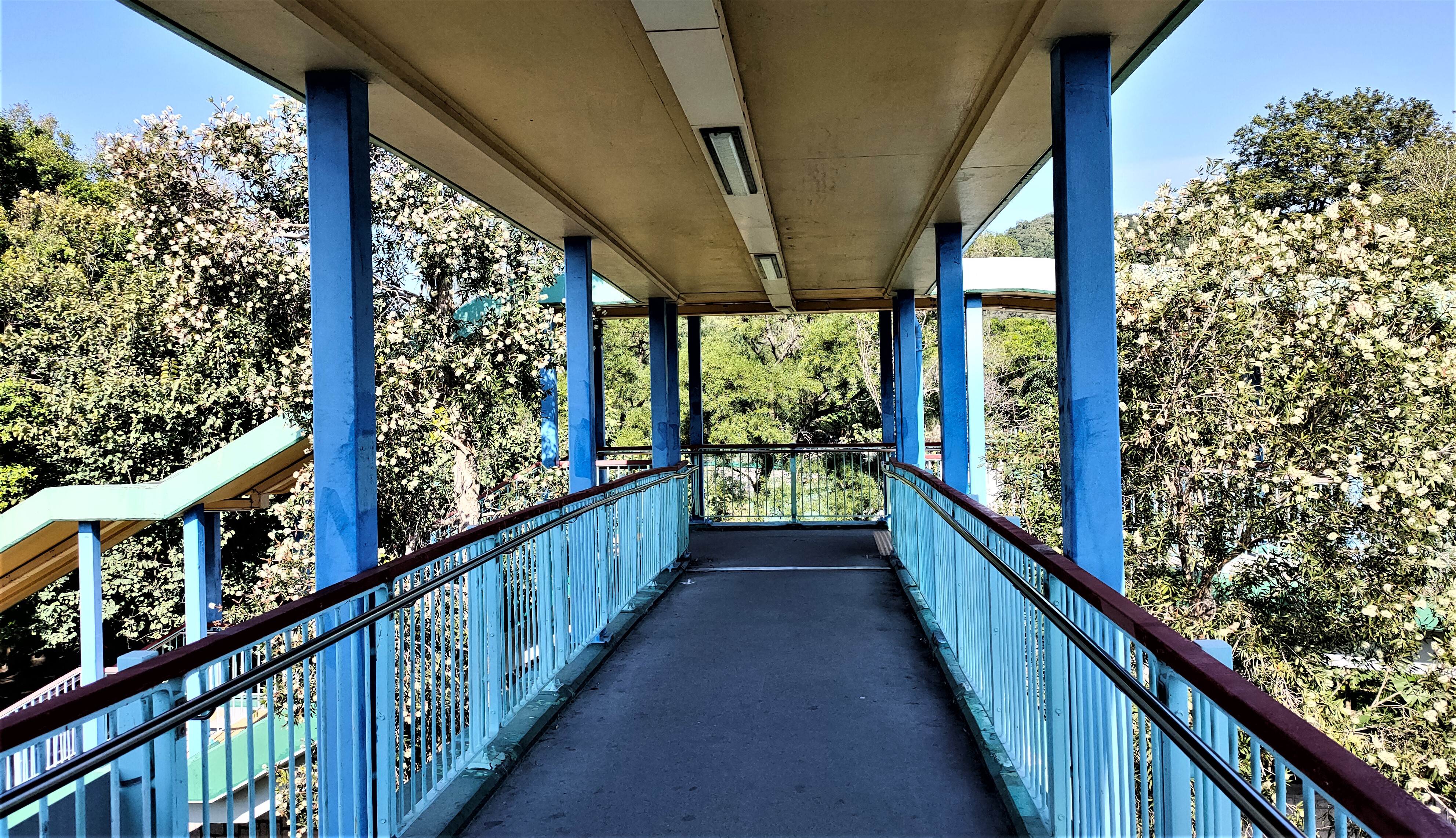
The second photo was taken on a subsequent occasion. When we’re cycling through the area, the vantage point from which this photo was taken is reached first.

I photographed these yellow pom-pom flowers in a small private garden on the road out of our village towards the river. They were gone within a few days:
I’m not sure where I took the next photo, but I think it’s somewhere near the Prince of Wales Hospital in Shatin, where I’ve been an outpatient recently. It shows a housing estate that is under construction, with a tower crane on each block:
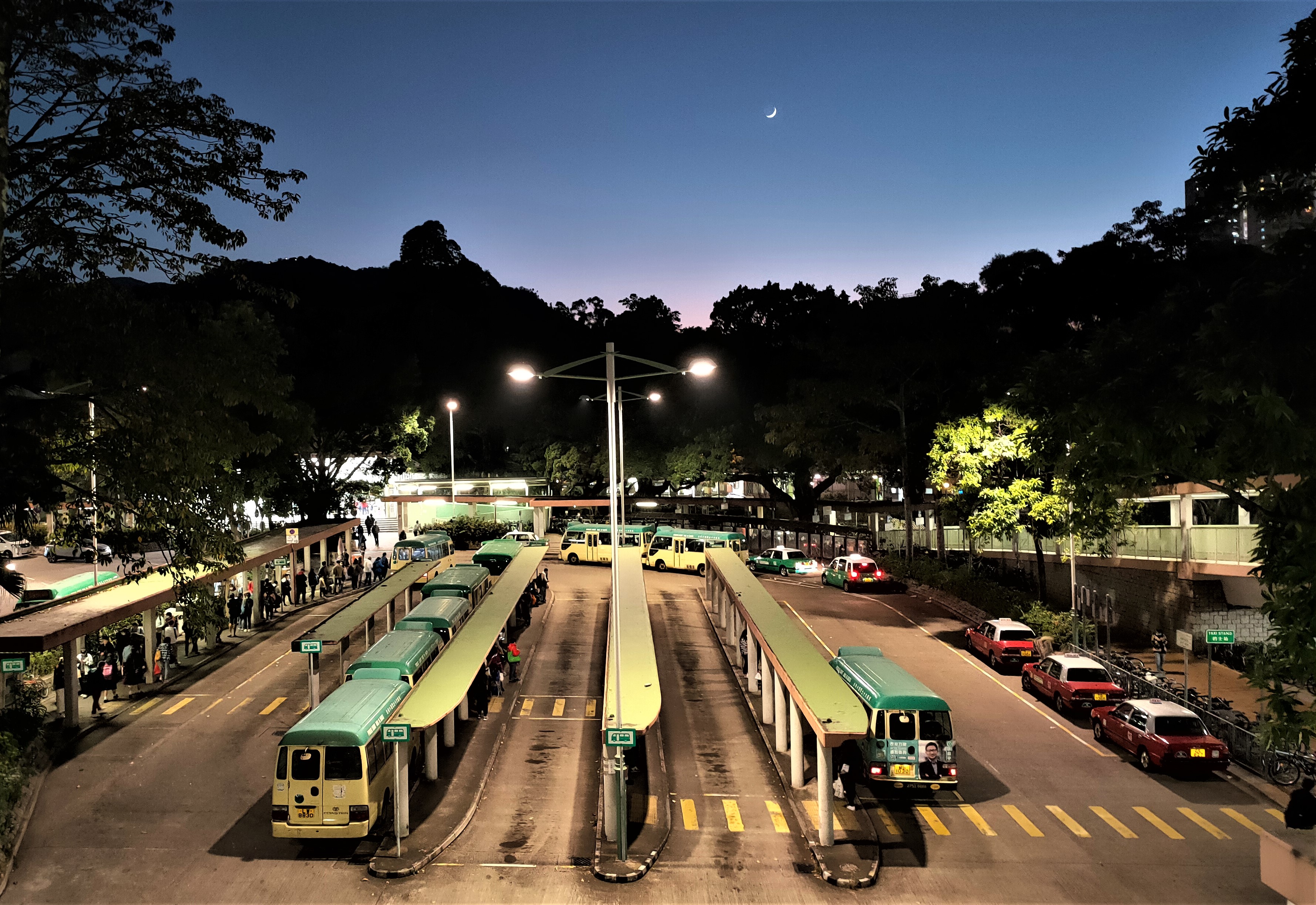
I took the next photo, which shows the minibus station next to Fanling station, entirely because of the tiny crescent moon. The left-hand of the two empty bays in the centre of the photo is where we would catch a minibus to our village:
In the past, I’ve devoted entire posts to displays 0f bougainvillea (Bougainvillea Boogie, Bougainvillea Boogie #2, 
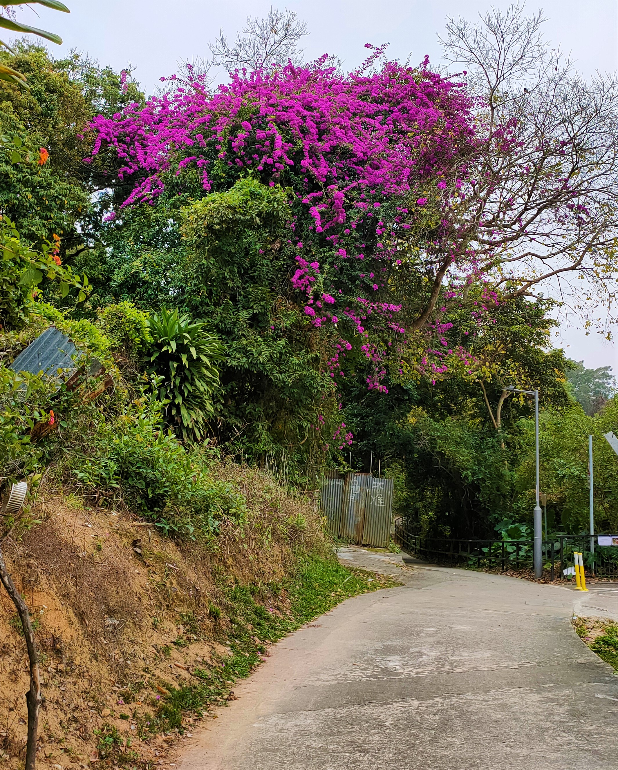
Bougainvillea Boogie #3), but I don’t see many new examples of this impressive show of colour nowadays, so I’ve decided to include the ones that I’ve seen during the past few months in this collection. This one can be seen in Kwu Tung North, a couple of kilometres east of Fanling:
I can’t comment on the traditional Chinese building in the background, because it’s not possible to gain access to take a closer look.

A lot of trees in Hong Kong have roots that can be seen above the surface, but what drew my attention to the tree in my next photo was the way the brick paving has shaped the direction the roots have grown. This example, in Luen Wo Hui, is one of a line of trees of the same species, all of which have had their root systems modified, albeit less dramatically, by the paving, which follows the single basket-weave arrangement that is almost ubiquitous in Fanling:
I don’t think I need to explain why I took the next photo. Jockey Club Road is probably the busiest road in Fanling, and most of the street signs are spelled correctly, but I’ve seen at least one other sign where the name has been misspelled like this:
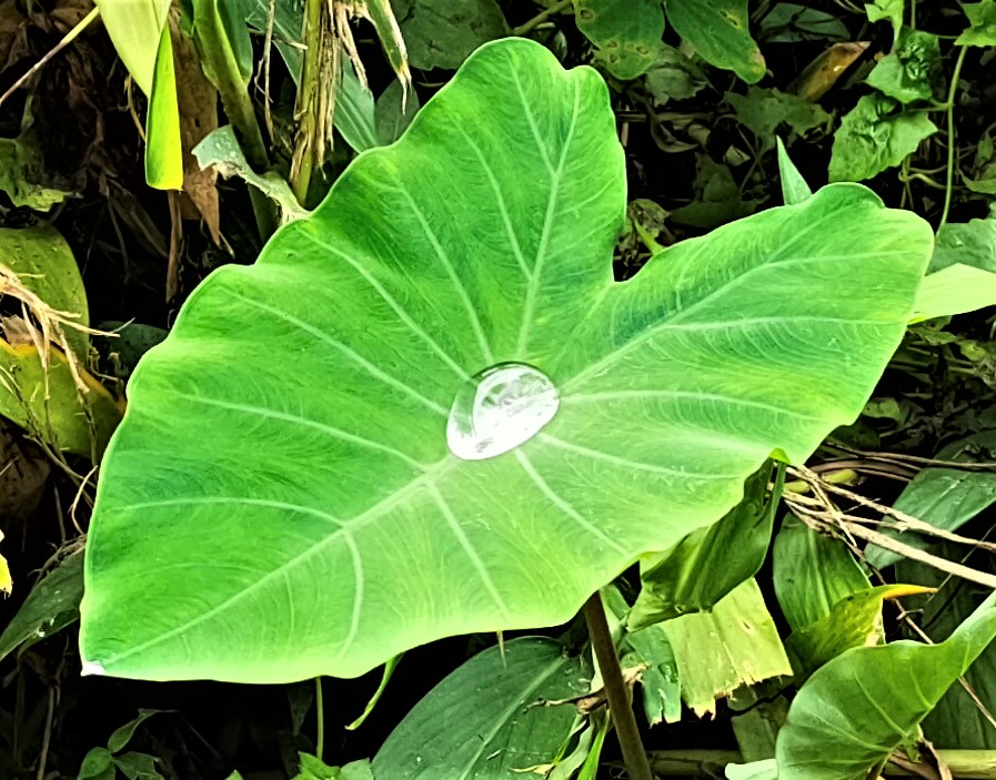
Large leaves like this are ideal for collecting rainwater, although it probably isn’t safe to drink:
This is another view of the minibus station next to Fanling station. This photo was taken in the late morning of 1st January, which was a public holiday. The inordinately long queue is for a minibus to Hok Tau in the Pat Sin Leng Country Park, which is a popular destination for day trippers from the city for hiking and barbecues:
The queue is so long that it extends into the next bay, which would make it awkward to catch a minibus to our village because we would have to push through the crowd.

I’ve no idea why the occupant of the house in the next photo has decided to hang up hundreds of empty bottles, although I conjecture that it may create an unusual lighting effect inside (this wall faces west):
The road past this house, which is located west of Fanling, is a cul de sac, so it carries almost no motor traffic, which makes it ideal for cycling (it’s a dead end only for larger vehicles).

Three black-winged stilts (‘red legs’) in the Kam Tin River:
Almost all the examples of bougainvillea that I see are cultivated, with the colour displays hanging over people’s boundary walls/fences, but this one, on a little-known road on the southern outskirts of Fanling, is completely wild:
I probably cycled past this truck, parked alongside the unnamed road linking Kwu Tung North and Ha Shan Kai Wat, quite a few times before deciding to take a photo:
There! You have it on good authority. Paint is dead! I didn’t realize it was ever alive.

(storm drain I photographed these two large dolls on the other side of a nullah (‘storm drain’) that runs alongside Hok Tau country trail #1. The one on the left is meant to be the front half of a dancing lion:
Continued in Part 3

Monday 13 June 2022

photographic highlights 2021–22: part 1

I shall be heading off to the UK for the summer in a few days, and as usual I’ve compiled a collection of what I consider to be the most interesting photos among the more than 2,000 that I’ve taken during the past eight months. Also as usual, I’ve not included photos that I’ve used to illustrate other posts. Also, I don’t regard any of the photos in this collection to be the ‘best’ I’ve taken (check out Guess Who We Met Today if you want to see those).

The first photo is a night-time view of our local river, looking downstream from the first footbridge reached when walking from our village:
My bike ride ‘the final frontier’ passes through the village of Tai Po Tin, northeast of Fanling, and there is a field on the outskirts of the village that is usually flooded, but on one occasion I noticed that it had been allowed to dry out. I couldn’t resist taking a photo of the mosaic of cracks in the dry mud:
Whenever I went into town (not often), on my return journey, I used to catch a train heading in the opposite direction to that which would take me back to Fanling so that I could be sure of a seat. It meant sitting in an empty train for a few minutes at the terminus in Hung Hom, where I took this photo:
That photo was taken in a 12-car train, which had transverse seats at each end of each carriage, allowing me to look out of the window. However, these longer trains have now been replaced by nine-car trains, which have only parallel seating. Of course, I can still see out of the window, but seeing is not the same as looking. What’s more, Hung Hom is no longer a terminus—the line has been extended to Admiralty on the Island—and it is pointless to travel to the end of the line in the expectation that you will be guaranteed a seat. Nine-car trains were introduced before the extension to Admiralty, which can’t accommodate the longer trains, and I took this view of one in the old Hung Hom terminus:
This a photo of a swallowtail butterfly on the bougainvillea on our balcony:
Cheung Wah Estate is a public housing estate a few minutes walk from Fanling station. I wouldn’t usually have any reason to come here, but for some reason I did walk through the estate once, when I came across this bizarre mural:
This is a closer view of the left-hand side of the mural:
I will not attempt a detailed interpretation of the mural—I leave that to the reader—but the kaleidoscopic eyes of the creatures portrayed suggests that they’ve been eating the toadstools depicted here, although I should point out that they’re the wrong colour for Amanita muscaria, which is presumably what the artist had in mind. Notice too that most of the creatures here do not have legs, apart from four at the right-hand end.

This is another mural, presumably by the same artist, directly opposite the first one:
Once again, the captain and his mate have no legs, but the dog, rabbit and cat in the stern of the boat do. There is an artist’s signature on this mural, but there is no such identifier on the larger mural opposite. Incidentally, after discovering these murals, I scoured the estate to see whether there were any more. There weren’t.

The next photo was taken from the same point as the night-time view above. The river surface is rarely this smooth:
The previous photo was taken on 7th November, and the next was taken from almost the same position on 6th February. Notice that the vegetation on the left (south) bank has been completely cleared:
This is an impressive floral display that I photographed alongside the path that we now need to follow if we walk into Fanling:
I’ve been unable to identify the species, and I haven’t seen other examples anywhere else.

Paper-bark trees, which are extremely common in our neighbourhood, flower in autumn, and I photographed this example during a walk in November:
There is only one footbridge over Sha Tau Kok Road, the only road out of Fanling to the east—the usual way to cross this busy road is via light-controlled pedestrian crossings. This is a view along the bridge, with paper-bark trees on each side:
…and this is a close-up of the tree on the left:
There is a grassy area next to the Ng Tung River a short distance before it flows across the border into China that used to be a popular camping ground—until the Drainage Services Department installed a gate across the access road that prevented access by car. It’s also popular with the local free-range cows—they aren’t feral, because I’ve seen them being herded—and this is a typical photo:
Notice the cattle egrets.

This is another view of the same grassy area, taken on a different occasion:
Continued in Part 2

Friday 10 June 2022

mauve magic

I would normally be back in the UK by now, but the airline that we’d booked with (BA) suddenly decided to cancel all its flights into and out of Hong Kong for three months. We’ve managed to rebook (with Cathay Pacific), but we won’t be heading home yet for another 10 days. However, looking on the bright side, I thought that for the first time in many years, I’d get a chance to see flame trees, which normally flower in June, in full bloom. That hasn’t worked out though. Flame trees are quite common around Fanling, but every one I’ve seen recently, including the two that are visible from our balcony, has provided only a patchwork display, not the full-tree coverage that I’ve seen in the past. And what flowers there were are gone already, thanks to the almost constant heavy rain of the past fortnight.

On the other hand, a tree species that I’d originally noticed on the Drainage Services Department (DSD) access road that runs alongside our local river has been flowering recently. Almost all these trees have since been destroyed to make way for the so-called Fanling North bypass, but I’ve noticed examples in a few other locations, and although they are nowhere near as spectacular as flame trees in full bloom, I’ve taken a few photos, which I present here in a sequence that I would follow if walking home from Fanling station.

There is an elevated cycle track/pedestrian walkway leading away from the north end of the station, and the first photo was taken from this overbridge:
After seeing this photo, you might be questioning the title I’ve given this account, but it’s quite common for tree flowers to fade if the colour was a pastel shade to begin with.

The overbridge reaches ground level again in front of the North District government offices, at the end of which my route turns right into Pik Fung Road, a relatively minor road that connects San Wan Road and Jockey Club Road, both of which are major north–south dual carriageways. The next two photos were taken in the car park attached to the government offices:
The flowers on these trees are mauve (or is someone going to argue that they’re actually purple?). The building in the background of the second photo is the Fanling Law Courts Building, and this is a view of that building from Pik Fung Road:
The next example is located at the junction of Pik Fung Road and Jockey Club Road:
The building behind is the Fanling Family Medicine Centre (aka Fanling clinic), while the fencing on the left encloses a new construction site—I’ve no idea what will be built here, but there’s room for just one high-rise building. The site was still occupied by tennis courts—a singularly inefficient use of a scarce resource (land)—last year.

After crossing Jockey Club Road, there are no more of these trees to be seen until you reach Luen Wo Hui, the district of Fanling closest to where we live. I photographed this one in the ornamental garden in front of Union Plaza, one of four private housing estates in Luen Wo Hui, each with its own shopping mall:
The high-rise blocks in the background are part of Wing Fok Centre, which I believe is an estate for first-time buyers. I base this assessment on the architecture and also on the absence of a shopping mall as an integral part of the estate.

Until last year, the most convenient route home was across the fields of Ma Shi Po, but this is now a gigantic construction site. However, there is still a path to the river, which I follow. As I’ve mentioned, most of the trees like the ones I’ve included here have been destroyed, but upstream from where the proposed bypass will cross the river, there is a ‘sitting-out area’ with a Chinese gazebo:
Gazeboes like this are very common around the northern New Territories, although most have just four supporting pillars. I’ve lost count of how many times I’ve used one to shelter from torrential rain when out cycling. Incidentally, I expect this one to disappear eventually in the name of ‘development’—although the bypass will not come this way, I suspect that a new connecting road is in the plans, because three large eucalyptus trees a short distance further up the DSD road have been marked ‘fell’.

Here are two more views of the tree next to the gazebo:
…and a close-up of the flowers:
The round seed pods will split open in six places when ripe.

At the upstream end of this sitting-out area, there is another example of this tree:
Finally, although I wouldn’t pass this way on the route home that I’ve been describing here, this is a view of the path we must now follow if we want to go into Luen Wo Hui by the shortest route:
Paula and I never use this path when cycling, because it’s used by a lot of pedestrians, but that doesn’t deter local cyclists, many of whom represent serious hazards for people on foot. The green area on the right is Suen Douh Camp, some kind of outdoor pursuits centre run by fundamentalist Christians, who simply do not interact with the locals. It has been closed since the start of the pandemic, although the grounds are still being maintained.
*  *  *
I’ve not been able to find out much about this tree species, although I’ve tentatively identified it as queen’s crepe myrtle (Lagerstroemia speciosa). According to my observations, it grows no more than 6–7 metres tall, except when crowded for space, when they might reach 10 metres.