Thursday 29 March 2018

cycling: video action #2

Although I hadn’t intended to post links to more YouTube videos, there is quite a lot of background information to attach to this latest collection. All feature Paula riding in the front.

Way of the dragon’ is undoubtedly the best of my recent discoveries, although my first two attempts to shoot a video were failures. For my first attempt, I started filming at the beginning of the rough road leading off Ma Tso Lung Road, but when we started to go off-road, Paula went straight on at a point where she should have turned right. My second attempt was a much bigger disappointment though.

This is a still from that first video:


There is a drop of almost a metre from the concrete at the bottom of the photo to the dirt where Paula is, which means that it’s necessary to go very slowly. However, going slowly affects one’s stability, and Paula toppled over into the vegetation on her left. She wasn’t hurt, but here’s the rub: for reasons that I can’t explain, the video camera wasn’t behaving as it had done on its first day out, and there were no distinctive beeps to tell me whether I was turning it on or off. And I turned the camera off when I thought I was turning it on, so I missed all the drama. Paula was happy about that!


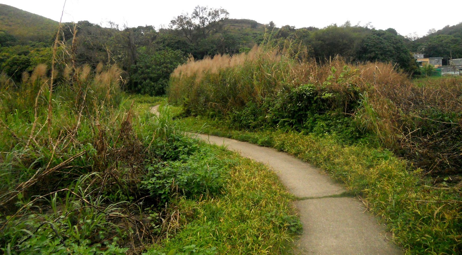
I explained how I discovered the first of the serendipity alleyways in Serendipity #1, but the first video I shot covered only the alley itself, and the complete connection between Ho Sheung Heung Road and Ma Tso Lung Road also includes a road that presents its own problems. If you watch closely, a lot of concrete has been slathered across this road, creating many 2–3cm lips that are uncomfortable to ride over on a bike.

The interesting point to note about the alleyway itself is the hill. This still of Paula near the bottom provides a flavour of this section:


I don’t think it’s particularly steep, but my legs always feel the strain. I think that this is because it’s natural to attack a hill on a narrow path to avoid wobbling, while the same gradient on a road can be treated more casually because wobbling a bit really doesn’t matter.


For something that really is steep and narrow, look no further than swiss roll:


This photo was taken from the top of the ramp, which I’d originally come across while exploring the road that runs past the top. However, once I’d established that there is a through path here, it was obvious that I would arrange things so that we cycled up, not down, this ramp.


I’ve included a second still image here because of the look of incredulity on the Filipina domestic helper’s face: did someone really just cycle up that hill? I don’t think anyone else does.


I’ve already posted videos of some sections of the long and winding road, but one of my favourite parts is the iron bridge path:


A few months ago, just before we reached the iron bridge, we met a man who told us “there is no way through”. Of course, we knew differently, but if you watch the video, you will get a sense of why a non-cyclist might think there really is no way through here:


When I established ping kong ping pong last year, we started linking this ride with the long and winding road. However, this meant missing out the last section of the original route, and in the last couple of months we’ve reverted to that original.

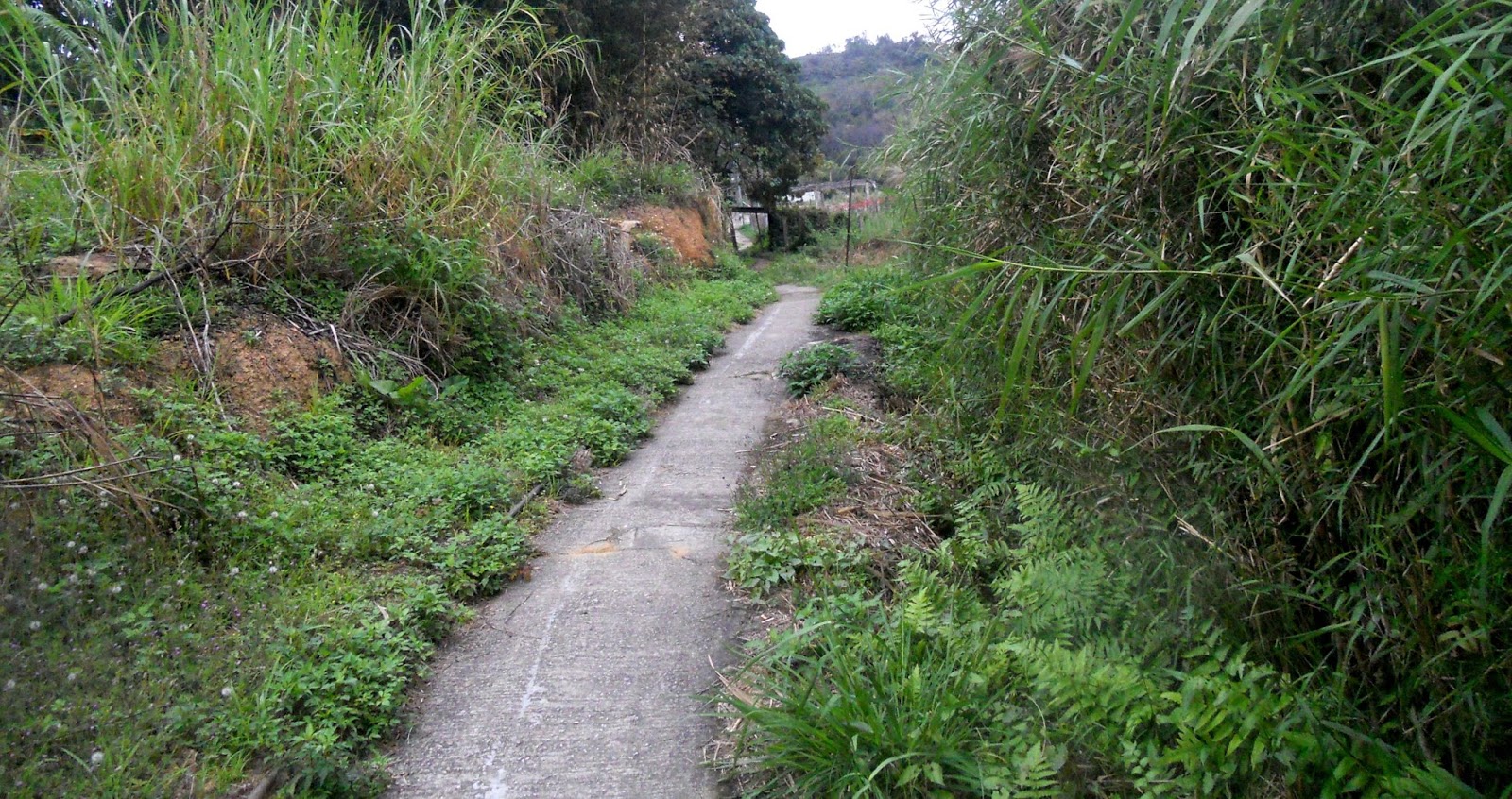
The first section is yet another uphill narrow path that feels steeper than it is, while the second still shows where the path joins a dirt road that provides an exciting finale:


Monday 26 March 2018

bougainvillea boogie #2

When I posted Bougainvillea Boogie last year, I did so to illustrate the visual qualities of this breathtaking tropical plant. But I was mistaken! This year’s examples are far more spectacular. Take a look.

My first example is the only repeat from last year’s post:


This was the penultimate example in that collection, and a comparison reveals that this display is more impressive. I took the photo at the end of October, and I’m puzzled as to why at the moment there is absolutely no sign of colour here whatsoever, given that all the following photos were taken in the last couple of weeks, suggesting that this is the time. However, several more of the locations that I featured last year have also failed to burst forth.

The next photo shows two separate plants in the grounds of a school in Sheung Shui that we cycle past every time we ride out west:


…and this is the kind of thing we see ‘out west’:


This photo was taken along Hang Tau Road, the only exit to the outside world if you live in the village of Hang Tau (unless you ride a bike), while the next photo was taken where an unnamed road is about to join Hang Tau Road.


The following photo was taken on the path between Fanling and Taipo. The Hong Kong government built a dedicated cycle track between the two towns a couple of years ago, but I still use the old path, not least because the new cycle track has subsequently been disrupted by major construction work involving a road tunnel through the mountain to the east. Any sensible planner would have finished this project before building the cycle track, but, then, this is Hong Kong!


However, if you decide to follow the cycle track rather than the path, then you will see this example, outside the entrance to a quasi-industrial site:


The next photo may not seem as impressive, but it was taken from quite a distance. It is located on the banks of the Sheung Yue River and is viewed from the opposite side:


I’ve spent a lot of time recently exploring an area known as Long Valley, between the Sheung Yue and Shek Sheung rivers. There is quite a network of narrow paths here—and some of the most spectacular examples of bougainvillea that I’ve encountered. The next three photos were taken in this area:


The next example can be found in the village of Ma Tso Lung, which wasn’t part of my usual cycling itinerary until I discovered ‘the way of the dragon’ a couple of weeks ago.


I’m struggling to remember where I took the next photo, which I’ve included because it is a redder shade than most of the other examples:


Closer to home, the next photo is of a squatter hut next to an unnamed road that crosses the Ng Tung River:


…while, further downstream, this specimen can be found next to the Drainage Services access road:


The white ‘spots’ are actually the plant’s tiny flowers, the intense red bits being modified leaves, or bracts.

I took the next photo in San Uk Tsuen, the next village to where I live:


You may be thinking at this point that bougainvilleas are always some variant of red, but the next example, also found in San Uk Tsuen, is anything but:


…and I came across this specimen while looking for an alternative way to reach the Hok Tau country trails, east of Fanling, having almost run into wet cement on my usual route in this area:


Several of the examples above could probably be described as ‘pink’, albeit a shocking variant, but I spotted this delicate shade of pink while on ‘the final frontier’, near to the ‘zoological garden’:


My final photo is not particularly special. I just thought that I’d include it because this specimen is located right next to the previous example:

Yes sir! I can boogie.
I can boogie-woogie all day long.

Tuesday 20 March 2018

a hidden gem

There are not many places I’ve seen in the Hong Kong countryside that I would describe as picturesque, but I found one last week. I had decided to investigate Kwu Tung South Road, a cul de sac leading off the major artery of Kwu Tung Road. I had no idea what to expect, although my principal reason for wanting to take a look had been the existence of some kind of lake, presumably a reservoir, which can be seen on the satellite photo of the area and which is also recorded on Google Maps:


This road turns out to be of a kind that usually doesn’t carry a name—there are plenty of unnamed roads in the New Territories—and it degenerates into a rough track before the lake is reached. I cycled to the far end of the lake, from where I took this photo:


What appears to be a dam can be seen at the other end of the lake, but I decided not to investigate further then because I wanted to show Paula what I’d found. Consequently, we came here at the weekend as part of our usual Saturday bike ride and took a closer look at the dam:


This photo was taken from the lake shore at the far end of the dam from the road. At the far end of the dam, there is a footpath that continues around the lake, at least as far (I assume) as the grave(s) visible just right of centre in the next photo:


At the start of this footpath, there is a long series of steps leading up the hillside to two graves, and the next photo was taken from this more elevated position:


Although the theoretical underpinnings of fung shui are not to be taken seriously, I can see why this kind of location would be considered an auspicious site for someone’s last resting place. It’s unfortunate that the occupant isn’t resting. They are dead.

The next photo provides a look along the dam from ground level:


…while this is the same section looking in the opposite direction:


I wouldn’t recommend riding a bike along the first section of the dam from the road. It is half the width of this section, and there is a railing on only one side. The drop off the other side is big enough to kill you!

Finally, here is a view looking downstream from the dam:


We didn’t cycle along that section either, but there did turn out to be a cycling aspect to this excursion. At the point marked ‘X’, there is a steep ramp and a flight of steps leading downwards. I didn’t want to leave my bike unattended while I investigated on foot, and I didn’t want to cycle down in case I had to cycle—or try to—back up. However, when I did come back a few days later with Paula, I was able to confirm on foot, while Paula kept an eye on the bikes, that this path is not a dead end.

In fact, the path emerges on familiar ground at the witch’s house (‘Y’ on the map above). And once we’d established that there is a through route, it became obvious that the best way to take this path would be the reverse of the way we’d originally explored it:


Unfortunately, when we did tackle the path on Sunday, Paula made an absolute pig’s ear of the ramp:


She was not in bottom gear!

So it was left to me to be first up:


In case you’re wondering about the name I’ve given to this path, I should point out that it passes through an upmarket private housing estate, all the roads in which are named after cities in Switzerland. I did try to follow this path a couple of years ago starting from the witch’s house, but when I entered the estate, I turned back because I didn’t realize that the path I was on was some kind of public right of way. I know better now, and this path will now be a regular part of our Saturday bike ride.

footnote
Another cycling challenge awaits here. Notice the sinuous road that branches off Kwu Tung South Road about 80 metres west-southwest of the red ‘X’ on the map. It leads to the Kwu Tung Freshwater Service Reservoir, which is basically a giant water tank. It’s the kind of hill you do only once—to prove to yourself that you can do it—but I decided to put off the day of reckoning at the weekend. However, it does look easier than the road up to the Ping Che Freshwater Service Reservoir, which I’ve done twice.

Incidentally, the lake/reservoir I’ve described in this post does not appear to have a name.

Thursday 15 March 2018

cycling: video action

I’ve often toyed with the idea of trying to put together a kind of ‘documentary film’ of my bike rides around the New Territories, particularly the long and winding road. However, it was just an idle fantasy, until a few months ago, when Paula decided to buy a suitable video camera. She was not prompted by my idea, which I kept to myself, merely by the fact that it was an old model at a much reduced price. And it took me more than three months to get around to purchasing the necessary mounting device that would allow me to attach the camera to my bike and thus record footage ‘on the go’.

To cut a long story down to manageable proportions, last weekend marked the first trial of the new camera, and I recorded a dozen short clips, some of which I’ve subsequently uploaded to YouTube. I should point out that this is ‘raw’ footage that has not involved any editing, apart from chopping off unwanted footage from the end of some clips.

I’ve included a still from each video, the first four of which feature Paula riding in front. This seems to me to be the best way of conveying what it’s all about. The first involves a typical narrow alleyway, which I originally documented in Serendipity #2:


Next is a short clip that involves a high-speed run through an alleyway that forms part of the long and winding road. It ends with ‘the spiral ramp’, the most exciting few seconds of the entire route:


The third clip features a recent discovery that is part of my efforts not to come back from a ride the same way as I went out. I haven’t yet written about it. There is a signpost near the entrance to this alley to Tung Yuen (‘East Garden’), so I’ve decided to call it ‘oriental garden’:


The fourth clip featuring Paula is also of a short section of the long and winding road. It includes two narrow alleyways separated by a Drainage Services access path. The ramp near the end is quite tricky, especially if you don’t know it’s there (as when I came this way the first time—it’s steeper than it looks):


I’ve also uploaded two clips that I shot while riding by myself. The first shows a journey through the village of Fu Tei Pai, a short distance from where we live. The alleyway that I documented in Fruity Pie starts at around 3 minutes 51 seconds:


The final clip shows part of an area several kilometres east of Fanling that I started to explore just a few months ago. I haven’t written about any of my discoveries in this area yet, but as an indication of how much fun this one is to ride, the path that I’m following towards the end is less than 2 feet wide, with a drop of several feet off one or both sides:


It will undoubtedly take me quite a while to master the editing software that will allow me to join clips, and add still photos, commentary and/or music, so unless I succeed in capturing something completely unexpected in the meantime, I don’t plan to post more YouTube links here. However, I will probably continue to upload videos to YouTube, so if you want to keep up with my latest explorations, you can subscribe to my YouTube channel here.

Tuesday 6 March 2018

way of the dragon

The frontier road was part of the so-called ‘closed area’ until 2013, but it quickly became our regular choice for cycling once it had been opened up. There wasn’t much to explore though. Between the turn-off into the village of Liu Pok at the eastern end and Ha Wan Tsuen at the western end, there was only one road junction—with Ma Tso Lung Road—which merely offered an alternative route back to where we had started. However, there are a number of roads and tracks leading off to the right (west) of this road, although I did think that I’d checked them all out. In fact, I’m certain that I checked them all out, and I drew a blank each time.

So why did I take another look last week? I don’t really know, but because Ma Tso Lung Road—accessed via Liu Pok Hill rather than directly—is now a regular part of our route, and I was on my own, I acted on a sudden impulse to turn right onto this road:


And I could confirm that I’d been this way before, because I knew where to look (almost hidden in the trees straight ahead in the photo) for this sign:


In case you can’t read it:
[???] CLOSED AREA BOARD
YOU ARE NOW IN THE CLOSED AREA AND MUST HAVE A CLOSED AREA PERMIT IN ORDER TO PROCEED
BY ORDER
COMMISSIONER OF POLICE
All the other relevant signs in the area have been removed, but this one appears to have been forgotten.

The road continues for quite some distance, but the smooth concrete of its beginnings soon degenerates into a rough track:


…and I became aware that I was losing height, prompting me to hope that I wouldn’t have to come back this way:


But I could see a concrete path with painted railings at the bottom of the hill:


There was indeed a path to follow. It actually starts about 25 metres to the right of the next photo, but I thought that it was easier to join it here:


The straight-ahead option leads only to the house in the middle distance, the left turn requires serious handling skills and isn’t really a path, but a right turn here has obvious promise:


…and is straightforward to begin with:


…although I did a double take when I first saw the path up to the left:


The slope isn’t excessive and would be easy if there were no steps, but the path alongside the steps is too narrow to be sure that you can hold the line. In any case, it probably just leads to someone’s house, and the path curving round to the right is the obvious way to go:


A group of houses is coming up, and it’s often the case that this is as far as a path like this goes:


However, I had to check, and although it is quite steep for a short distance, the path does continue beyond the houses:


…with another long horizontal section:


The storm drains with cast iron covers are a clue that this is a ‘serious’ path that really is going somewhere. But where?

The previous straight is followed by another short steep section:


…but it’s downhill from here:


…with the path bending to the left after passing the lamp-post in the previous photo:


There is an indistinct path to the right here, which appears to peter out in the trees and is unlikely to lead anywhere that can’t be reached by taking the main path.

The path continues downhill to another group of houses:


…and the first real choice. Which way to go?


At this point, I heard a woman’s voice:

Sin sang! Sin sang!” [Mister! Mister!]

I ignored her to start with, because I assumed that she merely wanted to tell me that I shouldn’t be there in the first place. I turned left, because it looked like a good path, but it quickly became, if not impassable, then very difficult to negotiate. So I turned back.

The turn to the right didn’t look promising:


…but that is the way the woman told me I should go:


She followed me to this point to make sure that I got it right, but on this first visit, I went down to the left, which meant that I had to get off and lift my bike over a water pipe a short distance further on. When I showed this path to Paula a few days later, she noticed immediately that it was possible to remain on the bike if you took the right-hand option:


The rest of the path is a bit ‘rough and ready’. The plastic panels, normally used to cover temporary holes and other works in urban areas, are an indication that this part of the path probably becomes very muddy during the rainy season and are a bit clunky to ride over:


…but after another makeshift bridge over a small stream, I knew where I was:


The frontier road is dead ahead (Shenzhen in the background):


The following satellite photograph shows the terrain negotiated by this path, which starts at the red circle and emerges onto the frontier road at the blue circle. The large built-up area in the top right-hand corner of the photo is the village of Ma Tso Lung, through which it is necessary to cycle (steeply uphill] to get back to where you started.


I had decided to call this adventure ‘the dragon path’ (lung is Cantonese for ‘dragon’), but then I noticed that the character for ‘Lung’ in Ma Tso Lung is the character for ‘dragon’ with an added ‘earth’ radical. No problem, said Paula, it’s the dragon above the earth. And my wife agrees that this path is well worth the effort, so it really must be the way of the dragon.