I don’t often go out cycling by myself nowadays, but Paula would be busy all this week, so I decided that I could do some exploring yesterday, which I don’t often do when Paula is with me. I thought that I would start by heading east. This meant heading out of town via ‘
poke in the eye’, then looping back to Sha Tau Kok Road, the only road that leads east out of Fanling. This is a road that you really don’t want to be cycling on—it’s a dual carriageway, and it carries a lot of industrial traffic—but there is a rudimentary cycle track as far as the junction with Ping Che Road, and from there I could follow
Hok Tau country trail #2, followed by ‘
country roads’.
I had intended to cycle to the entrance to Cheung Shan Tunnel, part of a newly opened elevated highway from China. When this was completed a couple of years ago, I regret not taking the opportunity to cycle along it before it opened, but of course that is now out of the question, although at the moment it carries very little traffic.
My object had been to follow roads marked on Google Maps to ride further east, but I should have known better. Some of the ‘roads’ near the tunnel entrance don’t exist, and others are blocked by a big construction site. Before this, I’d spotted a promising path leading out of the village of Tai Tong Wu when cycling with Paula that I wanted to check out, but I didn’t take long to reach a dead end.
I could only backtrack, but when I eventually reached Sha Tau Kok Road, I decided to follow Ping Che Road for about 1km before turning off onto an unmarked road that led back west. My first objective was the Kwan Tei North public toilet, after which I planned to do ‘
optional extra’. When I first developed the ride I called ‘the final frontier’ in 2016, this was a late add-on—hence the name—but nowadays we always do it, because it’s quite a test of your bike-handling ability.
There is another road leading off the unnamed one, almost opposite the toilet, that I wasn’t sure I’d checked out before, although I probably had. This is where I took the first of the day’s photos:
Nothing but industrial premises! And yet another dead end! Actually, there are a few houses, and when I stopped to take the next photo on the way back out, I was accosted by a local resident:
He told me that his name was Ricky, and when I told him that I was from the UK, he proceeded to tell me about his family connections there. He also asked me how old I was, and he seemed quite impressed that a 74-year-old would be out cycling, although he did assume that I did so “for the exercise”. I didn’t tell him that I do it for fun. I also think he thought I was lost, because when I told him that I lived in San Wai, he started to give me directions as to how to get there.
I wonder whether he noticed me turning left at the end of his road instead of right, because on the way back west I planned to do ‘
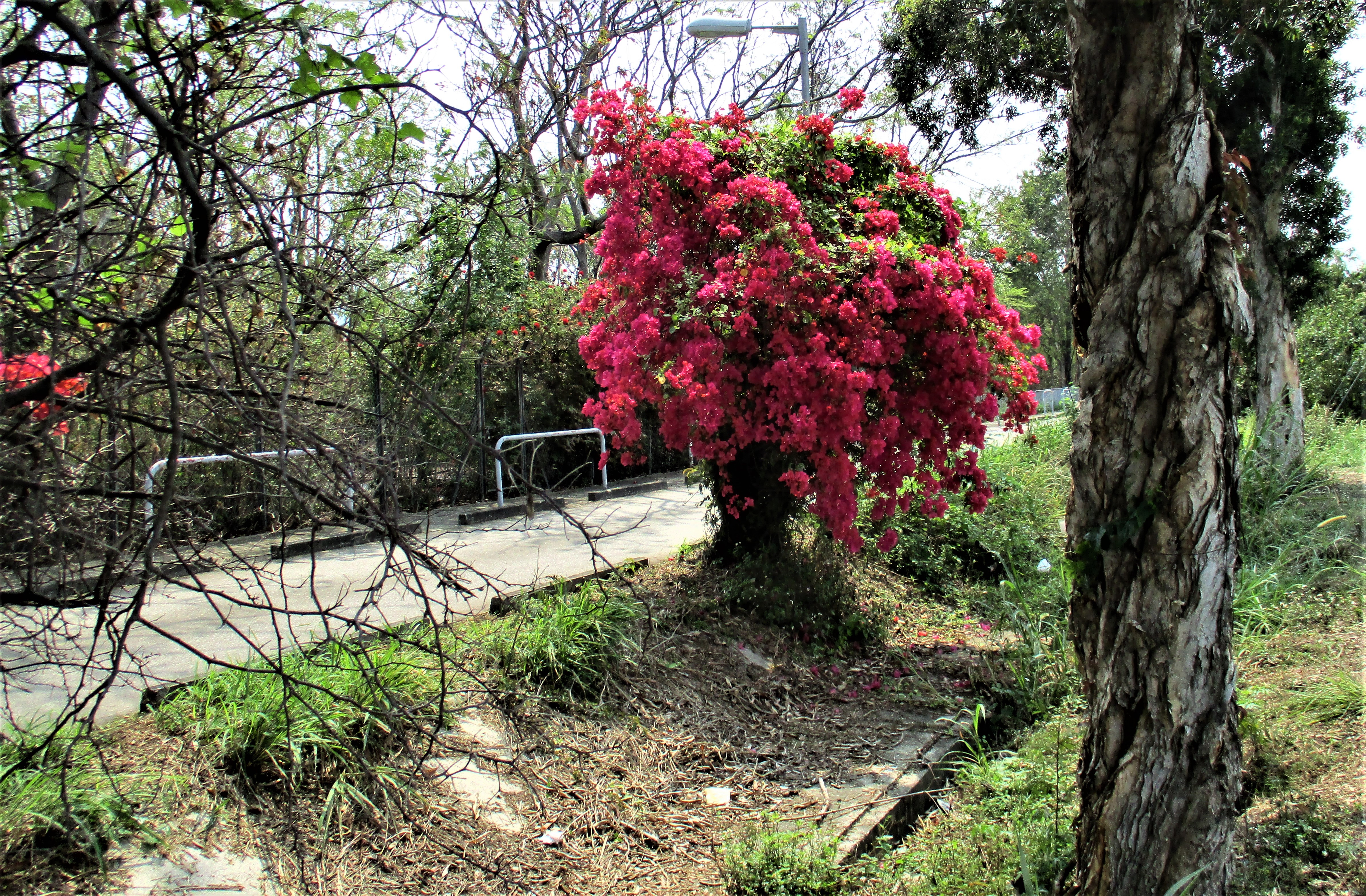
crossing the rubicon’, which I hadn’t done for some time. This leads, by an extremely circuitous route, to Sha Tau Kok Road, from where I could head home. Just before reaching the start of this entertaining segment, I stopped to take a photo of a bougainvillea that I’d included in
Bougainvillea Boogie #3:
I think this is a better picture.
Of course, I wasn’t finished. My route simply took me past our house, and I’d been out for just two hours, which doesn’t count as a bike ride in my lexicon.
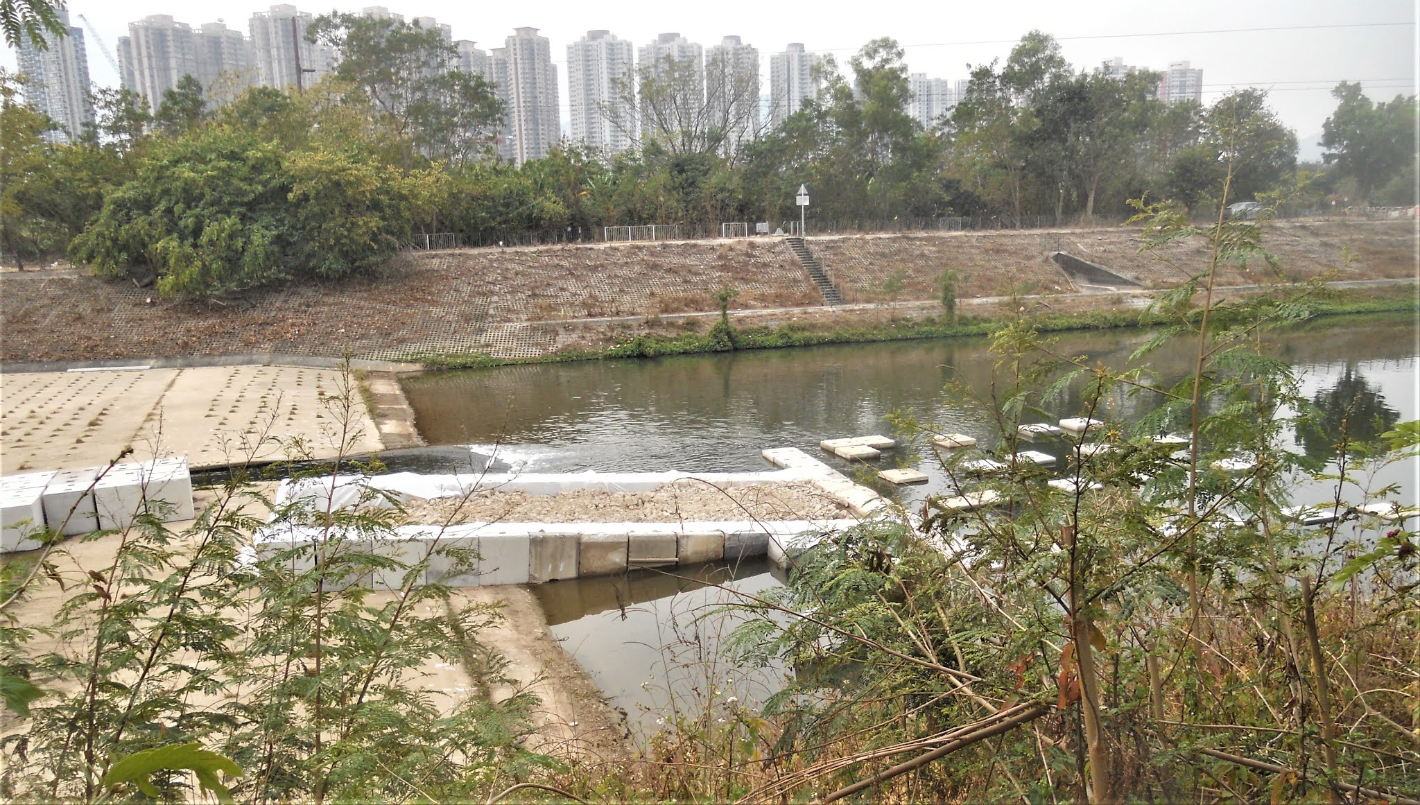
However, when I set off down our local river, I found the way blocked by a truck. Of course, I knew of ways to circumvent the obstruction, but I decided to cut across to Ma Sik Road and follow the cycle track there instead. It then occurred to me that since I’m passing, I might as well take a detour through ‘
ignoble hill’. That didn’t go well though. Some kind of work was being carried out in one of the narrowest alleys, so I had no option but to abort and return to the cycle track.
Whenever we cycled out west in the past, we always used to follow the Drainage Services Department (DSD) access road that runs alongside the Sheung Yue River, but we can now follow the newly opened cycle track that leads to the western New Territories. And the DSD access road is now blocked by construction—our local river isn’t the only place that is being blighted by new road development!
However, I was in for a surprise when I reached the expressway, which we usually cross using a footbridge:

This appears to be some kind of mini-temple, and it looks as though it has yet to be formally opened. The plaque on the right may list the names of donors to its building, and I originally thought that the characters on the roof plaque are the name of the village. However, the two small characters are Kwu Tung, which seems to be a generic name for the entire area, while the three large characters translate as ‘earth land temple’. Given the sheer amount of construction in the area, and how expensive this must have been to build, I can’t help but wonder who paid. One clue to this conundrum lies in the elevated highway that I referred to earlier. No fewer than four of the villages whose land the highway crosses have built elaborate village arches at their entrances in the past few years, and I’d already conjectured that this was a kind of compensation for building on village land.
Meanwhile, it's worth taking a closer look at the designs on the roof. I took this photo from the footbridge:
And this is an enlargement of the area of interest:
It’s easy to identify the two dragons facing a pearl on the roof ridge, but although I think that scenes from Chinese mythology are being depicted here, I shall have to take a closer look the next time I pass this way. I’ll probably devote an entire post to this temple at some time.
One curious thing about this obviously permanent structure is that when we last came this way just a week ago, we didn’t notice anything. Mind you, at the point where I might have noticed, I’m focused on executing quite a tight U-turn onto the ramp leading up to the footbridge. I wonder how long it will remain brightly coloured.
I crossed the expressway here, even though my intention was to follow the cycle track, because the first time I came this way, it took me more than five minutes to cross Ho Sheung Heung Road, which carries a lot of traffic. And I could follow a seldom used path and re-cross the expressway about 800 metres further on and thus avoid this obstruction. I believe that few of the many recreational cyclists who now come this way are aware of this dodge.
My intention in following the new cycle track was twofold. First, I wanted to avoid
the frontier road, because I’d become fed up dodging all the potholes caused by massive, fully laden tipper trucks hauling material for the new science park. Second, I wanted to see whether there were any worthwhile diversions off the cycle track.
At one point, I spotted a narrow lane that wound away up a hill, which I simply had to check out. It led, eventually, to a T-junction with a road that I recognized immediately. It was ‘the mountain road’, which we’ve started to follow on the way back to Fanling to avoid the frontier road, despite there being a couple of quite gruelling hills. I could have followed this backwards to the village of Chau Tau, because it’s all downhill, but I wanted to see whether there were any more potential diversions from the cycle track. For a start, I was able to follow a different road on my way back to the cycle track, but there were no further diversions before I reached the only way into Chau Tau. There is another road connecting this large village with the outside, but it’s one-way leading out!
Before heading further west, we always do
a circuit around the village, and I took this photo of bougainvillea where a narrow path crosses Chau Tau South Road, part of the one-way exit from the village:
Next on the itinerary was Lok Ma Chau Road, which leads to a major crossing point into China. We always avoided this road in the past, but the crossing has been closed since the start of the covid-19 pandemic, so traffic has been very sparse here. I next followed
Tunafish Road and
Psycho Road, both of which lead to unmanned crossing points and, at the moment, carry almost no traffic. A word about the nomenclature here: the first road is actually named Tun Yu Road, but
yu is Cantonese for ‘fish’; and the second is named Sai Kwo Road, so I simply removed one phoneme.
I then followed San Tin Tsuen Road, which loops around the historic village of
San Tin, separating it from
a large area of fish ponds that are still in use. I took several photos of bougainvillea along this road:
As usual, the colours are subdued when I’m pointing towards the sun, so I took a couple of photos from the other side:
The next photo was taken further along this road:
…while this is a photo of bougainvillea that is some distance away:
The buildings in the distance are in Shenzhen.
When I reached the end of San Tin Tsuen Road, I needed to cross Castle Peak Road if I wanted to continue further west. However, while I waited for an opportunity to cross this extremely busy traffic artery, I witnessed/experienced one of the most egregious examples of stupidity that I’ve ever seen. A school minibus from the left had stopped, because, I assumed, the driver wanted to turn right, and I was in his way. However, a truck pulled out to overtake the minibus. But that wasn’t the stupidity. A car pulled out to overtake the truck! Fortunately, I saw what was happening, and even though I was behind the give-way line, I quickly pulled back further. And once the truck and car had passed, I quickly crossed in front of the minibus, bumped up the kerb and rejoined the cycle track.
If I’d wanted to head to the Tam Mei valley, which I’ve been exploring during the past few months, I could cross the cycle track and follow a subway under the expressway to Shek Wu Wai Road, which leads via yet another steep hill and the PLA’s Tam Mei Barracks to that destination. However, my plan was to follow the cycle track west to see whether there were any potential alternative routes.
After about a kilometre, the cycle track crosses yet another road, so I turned left there to see whether the road led anywhere interesting. Curiously, this is a concrete road, which leads me to suspect that it was built originally by the British military. It went a long way, but it eventually came to an end. However, at this point, there was an extremely rough dirt track that I was bound to want to follow. This too went a long way, and at one point the surface changed from dirt to concrete. I just had time to think that there must be a way out when I found myself in a huge concreted area:

This is a closer view of the graves:
It’s unusual to see six graves alongside each other like this. In fact, it’s so unusual that when I showed Paula the photo, she immediately expressed an interest in seeing the site for herself. This interest persisted even when I told her how difficult the dirt track was—it crosses two badly weathered rock outcrops, and the uphill crossing on the way back (there really is no other way out) is both loose and steep.
I did think that I would have to backtrack all the way to the cycle track, but I’d spotted an alternative when I stopped for a drink on the ride in. It wasn’t a path, just a concrete ledge running along a small storm drain, but it did look feasible. I remember thinking as I rode along it what would happen if I came to grief here, surrounded by impenetrable vegetation. When I called the emergency services, how would I explain where I was?
However, although I had to cross three smaller drains, each about 30cm across, where I deemed it prudent to stop and lift my bike across, this impromptu route eventually led back to the start of Shek Wu Wai Road. My next objective was ‘the humdinger’, which I originally followed as a way to reach San Tin but hadn’t done since the Lok Ma Chau border crossing closure. First, I would have to reach Ka Lung Road, which leads to San Tin Barracks and from where this entertaining segment starts.
I knew that there was a path running alongside the expressway, and although it leads to a huge industrial yard, that had never been a problem in the past. However, although I could find a way through, there was a line of trucks more than 100m long waiting, presumably, to have their cargoes unloaded. When I did finally reach the road, I noticed more trucks waiting their turns to enter the yard, but I was going in the other direction, so I thought no more about it.
Not having been this way for a while though, I misidentified a side road beyond which the start of the humdinger couldn’t be and assumed therefore that it was now blocked by new industrial development. However, this was an opportunity to check out some of the other roads on the east side of Ka Lung Road. The first one I followed ended with a short path, and when I followed that, I found myself in a location I recognized immediately. It was part of
a link between the road over Ki Lun Shan Au (aka Saddle Pass) and Ka Lung Road that we used to follow on ‘journey to the west’.
I decided to follow it in the direction of the former. Between the two roads, there is a canalized stream with DSD access paths on both sides, so I decided to follow one side downstream until I reached Kwu Tung Road, even though our original route merely crossed the stream and continued down an exit path on the far side. However, when I reached the main road, I found that it was clogged with traffic, so I simply followed the DSD access path on the other side of the stream until it came to an end, where I was surprised to discover what appeared to be a newly constructed path that started with quite a steep ramp. Naturally, I followed it and was surprised to find myself on another path I recognized.
Wherever it was possible, I’d developed journey to the west so that there were two separate paths between two given points. The path I’d originally taken was part of the return journey, while this one, which I described in
Journey to the West as ‘the link path’, was followed on the outward part of the ride. I followed it backwards until I reached the road that leads over the pass, although I decided to follow the road in the opposite direction on this occasion. This blaze of colour hit me as I rounded a bend:
I thought it was worth a closer shot:
When I finally reached Kwu Tung Road, I found that it was still clogged with slow-moving traffic. I could have turned back the way I’d just come, but there was another option. All the major roads in the New Territories have pavements, even in the countryside, where they are never used by pedestrians. Although I would never cycle on a pavement in an urban area, I no longer have any scruples about doing so in this kind of situation, especially when I could travel faster than the traffic on the road!
When I finally reached the junction with Ka Lung Road, I discovered the reason for the congestion: it was the queue of big trucks waiting to have their cargoes unloaded that I referred to earlier. The jam had grown so large that the police were now on the case. And I had another dilemma: how to reach the cycle track. It was only about 150 metres away, but Kwu Tung Road crosses the expressway here before joining Castle Peak Road, and I wasn’t sure that there was a pavement on the bridge.
So I decided to follow Ka Lung Road while I worked out what to do next. I could pass through San Tin Barracks—all I would need to do was show my ID card to the sentries at the gate—but as I cycled along, I spotted the signpost to Siu Hum Tsuen and realized my earlier error. This was the start of ‘
the humdinger’, which would be the perfect solution to my problem. This is a photo from that link:
Unfortunately, this option didn’t work out. The first part of this segment is still open, but just before the route reaches ‘
the snake path’, I encountered a gate across the path. I had no option but to turn back. I tried following the original snake path backwards, but it is now so hopelessly blocked by vegetation and collapsed sections of path that I no longer recognized it.
When I re-emerged onto Ka Lung Road, I spotted this almost perfectly round tree:
This tree is a common sight on sections of journey to the west, and the blossom that appears at this time of year is extremely aromatic. There are also a lot of graves and ossuaries along this road, all of which are on the east side of the road, presumably to enhance the
fung shui by facing west. You can see some of them in the photo.
And I still hadn’t solved the problem of how to reach the cycle track. I decided to try my luck in the industrial yard, with its seemingly endless queue of waiting trucks. Luckily, I was able to find a way through without getting in anyone’s way. Once on the cycle track, I first backtracked along San Tin Tsuen Road then headed home, but I wasn’t finished yet.
I turned off at Dill’s Corner, because I fancied doing the ‘
serendipity’ alleyways in the opposite direction. I took this photo at the end/beginning of ‘serendipity #2’ and the beginning/end of ‘serendipity #3’, where the route crosses Ma Tso Lung Road:
Instead of following the usual route, I detoured onto the section of ‘serendipity #4’ that leads independently to Ho Sheung Heung Road. I hadn’t intended to do ‘
serendipity #6’, but the start of this alleyway is just a few metres from the end of #4, and I hadn’t done it for such a long time, so I thought: “Why not?”
When this diversion finally re-emerges onto Ho Sheung Heung Road, it is at the bottom of a tough hill that we join halfway up if we’ve been following the mountain road, but I wanted to go this way because I can safely break the speed limit (50km/hr) down the other side (no side roads from which someone can unexpectedly emerge).
I was now back on the new cycle track, but I had one last diversion that I wanted to try: ‘
farmland fandango’ backwards. If you watch the video, there are four outstanding examples of bougainvillea here. I didn’t stop to photograph the first three, but this is the last (or the first if you’re riding in the established direction—the route passes to the right of the house):
After a short road section, I could simply follow the established cycle track network to get home. The only hills are the exit ramps from
subterranean cycle track interchanges, but otherwise everything is nice and flat. It was almost 5 o’clock by the time I reached home. I’d managed to clock 92km during the course of the day, and the best adventure I’d had for quite some time ended with a couple of cold beers.