The other day, I decided to walk past one of the two completed apartment blocks that will eventually form part of the Fanling North NDA (New Development Area). Apart from these blocks, this whole patch is now a no-go area, which means that in order to reach Fanling from our village, we have to take a considerable detour. However, the path that I followed on this occasion doesn’t lead anywhere useful. I just wondered whether I might see something interesting. And I did.
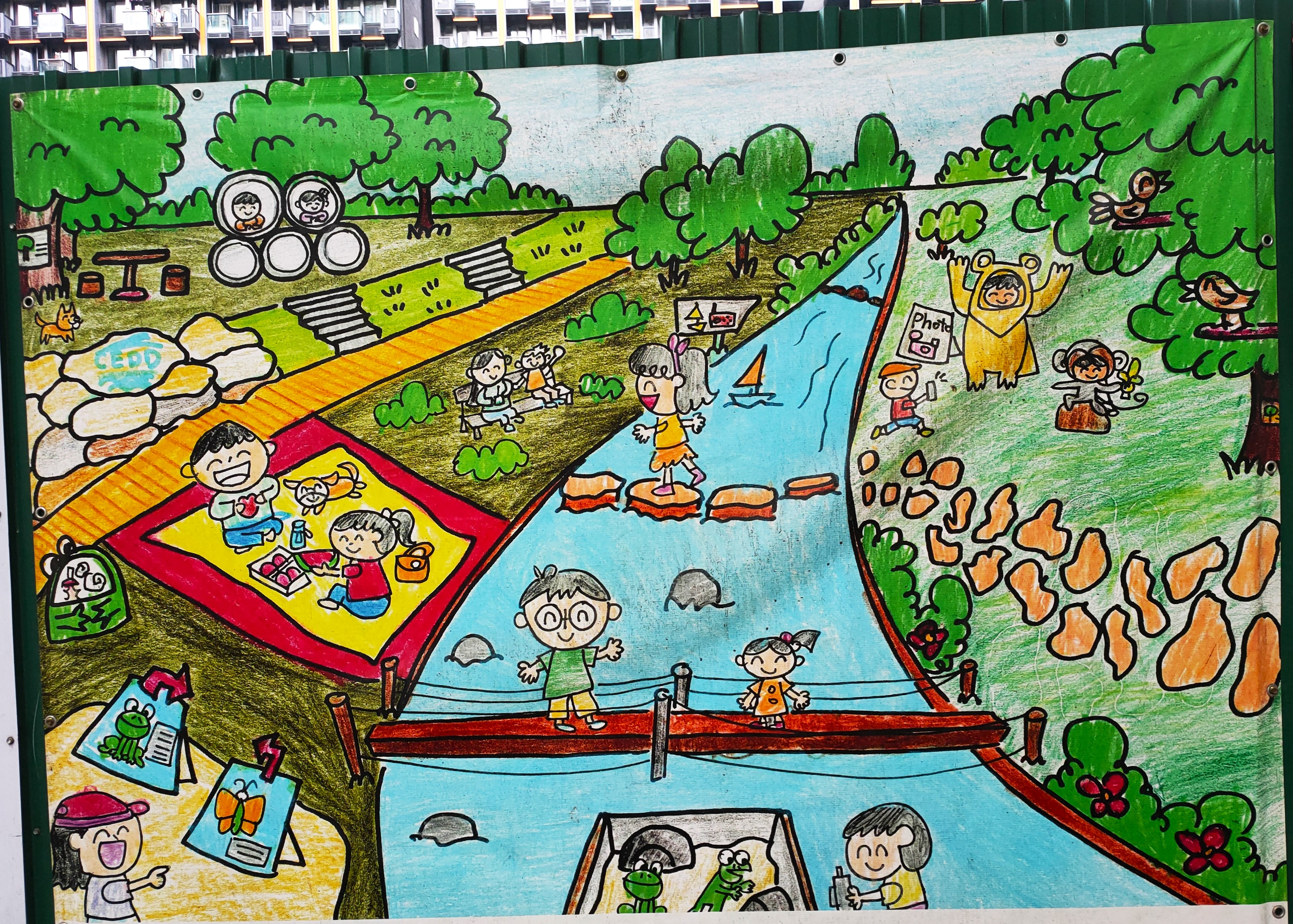
After passing the larger of the two completed blocks, I was surprised to discover a sequence of six images mounted on the barrier that runs alongside the path and is there to prevent access to the construction site. This is the first image (from left to right):
My first thought was that this is an ‘artist’s impression’ of what the site will look like when construction has been completed, even though it is obviously the work of a child. However, although the idea of the river as an amenity is appealing, there is no trace of the so-called ‘bypass’ currently under construction.
The next image does show what might be intended to represent the bypass, and we have seen tortoises in the river:
Nevertheless, it is also clearly not a reflection of future reality.
And neither is this, although children can certainly have a whale of a time:
The next image appears to be the most fanciful, although it does include some important clues as to what this artwork is all about:
In the background is a shopping mall—all housing estates have such a facility, although there is as yet no sign of one in the development thus far—and the blue flash near the bottom of the picture identifies the subject of this image as Hung Shui Kiu, part of the Ha Tsuen New Development Area. I suspect that this is a fictitious entity, although I don’t think that the original name of this area, Ma Shi Po (‘horseshit area’), is likely to be preserved when the development has been completed.
Incidentally, the four tent-like structures in the foreground of the image are labelled ‘Fish’, ‘Vegan’. ‘Cakes’ and ‘Organic soap’. And the ‘25th’ in the bottom right-hand corner of the image is a reference to the twenty-fifth anniversary of the handover from British rule in 1997, which appears to have been widely celebrated in Hong Kong. These images were apparently the winners in some kind of art competition in schools to mark the occasion.
An ornamental boating lake is unlikely to have been part of the plan in the development here:
The final image, of a child contemplating the setting sun, is probably the most realistic as a vision of the future:
My final photo should help to explain why all the above images are slightly skewed: the path is so narrow that I struggled to capture the entire image in a single photo at such close range:
The road in the photo is Ma Sik Road, which is a dual carriageway that in my opinion makes the new bypass currently under construction completely unnecessary.
You can also see the paintings featured above and the larger of the two new blocks in the photo. The new blocks also hint at an unanswered mystery: why are the new buildings only 20 storeys high. All the housing estates on the other side of Ma Sik Road—Green Code, Bel-Air Monte, Regentville and Union Plaza—are 40 storeys high. There are two estates downstream—Noble Hill and Hillcrest—that are only 15 storeys high, but they are quite clearly upmarket estates, while the others that I’ve mentioned are obviously more downmarket. Given that the rationale behind the NDAs is to tackle Hong Kong’s chronic housing shortage, why are the new blocks being built here not much higher?