Sunday, 31 October 2021

another abandoned house

In my last post, I mentioned that I intended to return to the ‘rotten row’ on Sunday, when no workmen would be on-site, to see whether I’d missed anything. I’ve now done so, but most of the houses have been covered in industrial sheeting since my last visit, and access is no longer possible. However, I was still able to enter the house with the gas canister outside the door, where I took three more photos, which I’ve appended to this account of an abandoned house nearby that I also visited today.
*  *  *
Having photographed everything that I wanted to in this house, I returned to the main path linking Ma Sik Road with the Ng Tung River, which is now my (much longer) way home. A short distance along this path, I reached the start of an overgrown path leading off to the right:
I will have checked out this path many years ago and found that it led just to someone’s house, so decided that it was of no further interest. However, in view of the recent developments in the area, I wondered whether this house might also now be abandoned. It was:
I didn’t take a photo from the doorway, because the interior looked decidedly dingy, but I was gobsmacked by what I discovered in a room leading off to the right about halfway along:
This is the only house I’ve visited with a private shrine! You will notice that the light has been left on in the room to the right of the shrine. I wonder who is paying the electricity bill.

And this is a view inside the room:
I didn’t think it prudent to try to climb up to the upper floor, because there wasn’t a separate handrail, and access was provided by what wasn’t much more than a ladder.

There is also a small kitchen leading off the main room:
Finally, this is a view of the main room from the end opposite the entrance to the house:
You will notice a dog in the doorway. I wonder whether it belonged to the last occupant of the house and has been abandoned like the house, or whether it’s merely a feral dog that has found a convenient place to sleep for the night. It was too nervous to come in once it became aware of my presence.

The path actually continues past the house, and I wondered to where it might lead. To my surprise, I came across a large area that had been planted with banana ‘trees’ neatly laid out in rows:
These photos were taken from the far side of the plot, first looking to the right and then to the left. Judging by the relative absence of weeds, this plot was still being tended until quite recently, although it won’t take long for either the jungle or the developers to reclaim it.

My last photo here is a view of the entrance to the house from the direction of the banana plantation:
*  *  *
Although I eschewed the climb up the ladder in the newly investigated house, I did decide to brave the steep climb to the upper floor in the only house in the ‘rotten row’ that is still accessible. At least it had a handrail. And this is what I saw upstairs:
From the top of the stairs, I had quite a striking view of the main room:
The people living here clearly left in a hurry!

I hadn’t noticed previously that this house also had a kitchen:
…and a toilet adjoining to the right, which didn’t strike me as a particularly hygienic location for such a facility.

I probably missed an opportunity to look inside other houses in the area that were demolished while I was in the UK this summer (Farewell Ma Shi Po), but there are many more further west that are still occupied—for now.

Friday, 29 October 2021

rotten row revisited

When I examined the photos of squatter houses that I’d taken to use in Rotten Row #2, which I posted three days ago, I realized that I’d missed a few obvious opportunities to take more. When I showed the photos that I’d already taken to Paula, she wanted to see the location for herself, which meant that we approached the path where these houses are located in the opposite direction, so the sequence in which I took additional photos at the site is the reverse of the original order.

When I looked at the interior shot that I took of the last house in the row, I spotted what was almost certainly a banister, so there had to be a staircase:
The staircase didn’t look particularly robust, but I thought I should venture upstairs. There was a door at the top of the stairs, which was closed, but I carefully pushed it open. This is the front of the two rooms I discovered:
…and this is the rear:
I conjecture that the pictures on the wall right of the window are of family members.

This is the view inside the house with the gas canister outside the main door:
…and this is a look inside the room, the entrance to which you can see in the previous photo:
…while this is a view of the first room from the entrance to the inner room:
While I was inside taking photos, Paula remained outside on the path, and a man, a member of a small team presumably from the company tasked with demolishing these houses, asked her what she was doing. I heard her explaining that her husband was inside, to which the man replied that it was dangerous! Of course, the staircases were rickety, but I’ve been used to danger for decades.

I felt that it probably wasn’t a good idea to hang around though, not because of any intrinsic danger but merely because I would have preferred to take more time to ensure I got as many relevant photos as possible.

However, I did venture up the stairs of what was the first house in my original report. This is a view from the top of the stairs:
…and this is a look inside the left-hand room:
Finally, this is a look inside the open door that you can see at the end of what I described in my original report as ‘the first side alley’, which I hadn’t ventured down:
It does seem to me that, given how much perfectly good furniture has been left behind, and all the casual debris, that the inhabitants of these houses were simply told to get out immediately. I plan to take another look this coming Sunday, when nobody will be working on the site, to see whether I’ve missed anything.

Tuesday, 26 October 2021

rotten row #2

The original ‘rotten row’, located along the path that represented the shortest way into Luen Wo Hui from our village, has probably been demolished, although I can’t confirm this because the path is now blocked. However, there is a more extensive row of squatter houses on a path that leads to nowhere other than the houses and is probably traversed only by the residents (apart from me). The location is indicated by a red circle on this map, which I used to illustrate my previous post:
At least one of the shacks along this path remains occupied, albeit not for much longer, but I’d noticed a few days ago that the others have been abandoned, and I’ve just been back to take a few photos. This is a view of the start of the path from the south:
…while this photo shows the only houses on the left-hand side of the path:
The white signs on the side of the first house read ‘Do not poison and damage the plants around here. Thanks!!!’. Strange, I remember thinking, but I’ve not seen the type of creeper adorning this house anywhere else. The remainder of the left-hand side was devoted to growing vegetables, although that activity has now ceased.

This is a view down the first side alley on the right:
There appears to have once been a gate across the entrance. Perhaps I should have ventured down for a closer look.

This is what the next house along looks like now:
The cryptic red writing on the right records that the occupants have now been rehoused. I wonder why they didn’t take the electronic keyboard.

And this is what the house looks like now inside:
It does appear that the occupants left in a hurry. I can only guess at the function of the small room with the white external walls. And notice the stairs: this house actually has two storeys.

The next house also has two storeys:
…and a chaotic internal layout:
This is a side alley between the previous house and the last two houses in the row:
Notice the Chinese flags.

I’m not sure why I didn’t photograph the outside of the last two houses in the row, but here is a view of the inside of the next house:
It appears to have been well furnished, but it begs the question: why did the occupants not take the furniture when they left? And this is what the interior of the final house in the row looks like now:
Judging by the writing on the wall right of the door—and the windows on each side—this was once the external door, and what you see in front of it was added on by subsequent occupants after the previous ones had been rehoused. And they left their washing machine behind! The Chinese writing reads ‘riches or poverty depends on heaven’ (left) and ‘all you need is peace’ (right). The characters above the door read ‘happiness’.

Finally, this is a view of the path looking back the way I’ve just come:
All these structures will be demolished in the near future.

Friday, 22 October 2021

farewell ma shi po

When we moved to our present house, in a village a short distance east of Fanling, in 2008, we quickly discovered that we needed to walk through an area that I somewhat idealistically referred to as ‘fields’, because the area was under cultivation, to reach the town. However, this is Hong Kong, so there have been many changes here during the intervening 13 years.

Naturally, I’ve been documenting these changes as they’ve come to my attention, and if you have time, all these links contain contemporary photos as well as descriptions of the latest developments:

Hong Kong Country (January 2010)
Return to Koon Garden (November 2010)
Turf Wars (June 2011)
Owt Fresh? (September 2011)
The Cat Man’s Hut (January 2013)
A Blot on the Landscape (February 2015)
Art Promenade (March 2016)
Turf Wars Update (October 2016)
Terracotta? Ah Me! (April 2017)
Rotten Row (February 2020)
A Farming Mystery (March 2020)
An Unwelcome Development (December 2020)

While we were away in the UK during the summer, we received the following flier in the mail:
Obviously, it’s some kind of notification to residents of where they can and cannot go now. The green lines are paths that are still accessible, but my attention was drawn to the red line towards the east of the map, which is the path we always followed in order to reach Fanling. It’s now closed, so we have to walk a much longer way round!

However, last Sunday, because I guessed that no work would be taking place, I thought that it would be worthwhile to check whether I could still get through, starting from the western end. I took the following photos to record my progress:
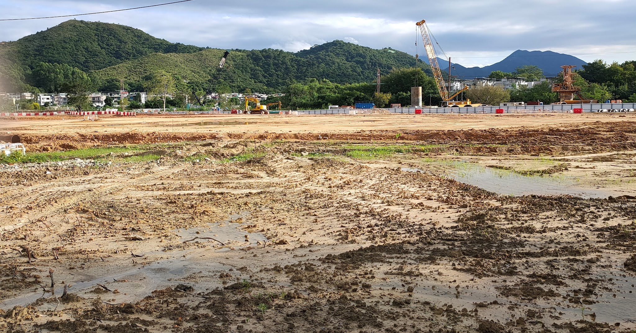
Before we went to the UK, we could still follow the path seen in the first photo on our way back home, and the area on the right was still under cultivation. The second photo, taken a short distance further along the path, shows the flattened area more clearly. You can also see in the distance the industrial steel panel fence that effectively blocks the path before it reaches the bridge over the Ma Wat River. The third photo shows all that is left of a substantial two-storey house that the path passes, while the fourth photo is a view of the flattened area from a different angle.

I took the next three photos on a section of the path that is still open. They are all that remains of what were once substantial houses:
Finally, in case you were wondering about the title of this post:
I’ve no idea who was responsible for this display, which reads ‘Goodbye Ma Shi Po’ from right to left. Ma Shi Po (horseshit area) is the generic name for the entire devastated area.