Thursday, 9 December 2021

the big tree temple

Whenever I’m exploring a new area on my bike, my main purpose is to find new paths that I can incorporate into a longer ride. However, I do find other things of interest, such as the murals that I discovered last winter in the Tam Mei valley, none of which I would ever have seen had I not been looking to extend my original route through the valley.

Another example of a serendipitous discovery has been the ‘big tree temple’. I started to explore the area known as Shap Pat Heung (‘eighteen villages’), south of Yuen Long, last winter. I’d started by following a path that ran alongside an unnamed tributary of the Kam Tin River as far as a gazebo that is erroneously included on Google Maps as an ‘historical landmark’ (it isn’t; such structures are ubiquitous throughout the northern New Territories), with the intention of returning along the opposite bank of the river.

However, I couldn’t help but notice how many paths and alleyways led off the path I was on, and naturally I wanted to see whether any of them led anywhere interesting. One of the first paths I ventured down led, eventually, to a temple, although on that first visit I didn’t stop to take any photos. I did want to see, though, whether I could find a second route to the temple and thus have a contiguous circuit.

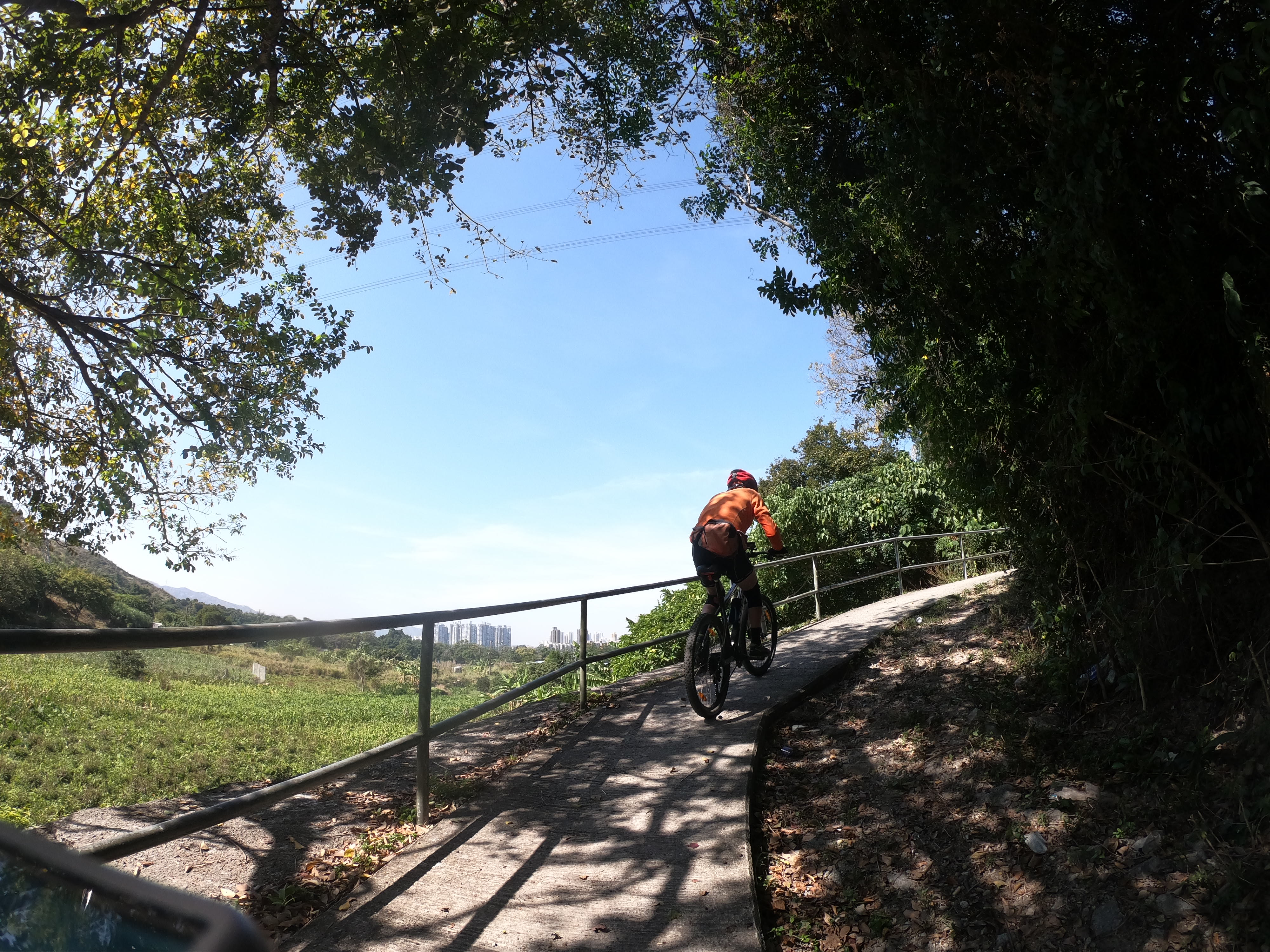
I’ve now done this. The following photo shows where I decided to turn off my original route (continuing straight on at this point leads to the temple):
Following this path leads to a large area of modern village houses with narrow roads in between, and at one point I came to what I thought was a dead end. However, I spotted a possible exit, which did look rather tricky, but it was the only option:
…and it did lead, eventually, to the temple.

The Tai Shu Ha Tin Hau Temple (‘Tin Hau temple under the big tree’—Tin Hau is the Taoist goddess of the sea) was probably built in 1786. I’ve found several references to a date stone, which I’ve not seen. Local tradition has it that the temple is even older, but I suspect that this refers to an earlier structure on the same site. The temple underwent extensive renovation in 1856—also recorded somewhere on a stone tablet. Ceramic tiles were added to both the interior and exterior walls in 2004, which according to the government website I consulted “very much diminished the authenticity of the temple”. However, it is a Grade II listed building and is definitely worth a visit.

This is a general view of the front of the temple:
I took the next three photos (from left to right) to highlight the denigrated ceramic tiles on the front elevation:
These photos also show the complex array of flowers and birds on the roof ridge—the round red object directly above the left-hand door represents a pearl.

This is a closer look at the left-hand doorway:
…while this is a close-up of the traditional Chinese landscape painting directly above the doorway:
And this is the right-hand doorway:
…followed by a close-up of the area above the doorway:
The murals probably depict scenes from Chinese literature, although that is just a guess based on having seen such scenes adorning other temples.

You may have noticed a QR code within a green border in several of the photos, which is part of the local anti-covid strategy. You are expected to scan it if you enter the temple, and although I do have the necessary app on my phone, I had no intention of venturing inside. First, I don’t wear a mask when cycling; and, second, I don’t want to upset or offend people for whom this is an important cultural centre by going inside and taking photos, although I have seen photos of the interior, and it does look interesting.

And you’re probably wondering about the reference to a big tree:
It’s a banyan, and it’s purported to be hundreds of years old. I suspect that this is an exaggeration. It certainly cannot have been planted deliberately, because banyans are epiphytes, starting life in the crevices of other trees and as they send down roots, slowly strangling the host tree. It also appears that the roots that have reached the ground have been trained deliberately to remain close to the main trunk, because, if left unchecked, aerial roots thicken and become woody some distance from the main trunk. I’ve seen such ‘prop roots’ up to 35–40cm in diameter.

On the way back to my starting point beside the river, my route passes a bougainvillea, which adds some pleasant colour to the ride:
I could simply continue to follow my original route in reverse, but at the point where I turned left on the route to the temple, I decided to turn right:
…because, after a very short distance, I could turn left where the route to the temple turns right:
All the cycling photos in this post are the result of a mysterious malfunction with Paula’s video camera. We were supposed to be shooting a video, but what we got instead was a long series of still photos. I expect to rectify this in due course. Unfortunately, however, I recently aggravated a long-term lower back injury that hadn’t bothered me for years, and I haven’t been able to get on a bike for the past two weeks. I should be getting back to business fairly soon though.

Monday, 29 November 2021

cycling action

Towards the end of our sojourn in Hong Kong last winter, as part of my exploration of the area south of Yuen Long, we discovered an ‘interesting’ path that at the time I didn’t think was a viable cycling option. We’d just finished shooting a video of what I’d named simply ‘Yuen Long (south) path #1’, and when we reached a road where the route I’d already established turned left, I decided, on the spur of the moment, to turn right, merely to see whether the road led anywhere:
And it did! After about 200 metres, the road came to an end, but there was a path that continued in the same direction. Straightforward at first, but then it plunged steeply down towards a cultivated area. And while the initial path had been concrete, we now had to contend with a rough dirt path. That wasn’t a problem at first, but once it started to climb, we had to get off and push.

That might have been it, but during the summer, I figured out that if we tackled the path in the opposite direction, it ought to be possible to ride through. And so it has proved, although I did have some initial problems finding the start of the path in this direction, even though I did remember where, having reached a dirt road, it reconnected with the original route:
The original route turns left here, but the obvious turn to the right is the way to go now.

Having reached the path, after going the wrong way at one point, I have to admit that I did have to put my foot down the first time, because there was a point where a series of oblong blocks had been placed on the path, presumably because the path gets extremely wet during the rainy season, to allow people to keep their feet dry. However, once I knew that this hazard was coming up, I could miss the blocks entirely. And after riding the path three times, I decided that it was time to shoot a video.

Unfortunately, for reasons that I’m unable to explain, instead of a video, we got a series of photos taken at roughly one-second intervals. And because it was a bright, sunny day, the photos of the initial part of the path, which is shaded by many trees, are much too dark to show anything. The main hazard on the first part of the path is the encroaching vegetation on both sides, which makes it difficult to see the edge of the path. And there’s a significant drop on the left, so if you go off the path inadvertently, then you aren’t going to be able to stay on your bike!

Anyway, the following photos, of the second part of the path, provide a good indication of why I consider it a good test of my bike-handling skills:
You can see the exit ramp in the next photo:
Approaching the climax of this extremely tricky path:
And this sequence shows the exit ramp:
It’s as steep as it looks! I don’t think it would even be possible if it continued to be a dirt path instead of concrete. You would get too much wheel spin.

Of course, I still want to shoot a video here. Watch this space.

Sunday, 21 November 2021

red legs

I don’t consider myself to be a birdwatcher, but I do like to know the identity of birds that I see around my home and when I’m out cycling. Mind you, Paula and I have our own names for many of the birds we see or hear regularly, based on either their calls or their appearance. For example, the large hawk cuckoo is the ‘telephone ringer’—it doesn’t actually sound like a telephone ringing, but the cadence is the same. Black-collared starlings are ‘noisy buggers’—Paula’s coinage, although if you hear a pair ‘arguing’ you will understand. And red-whiskered bulbuls are ‘pointy heads’, an allusion to their prominent crests.

This is also the case with ‘red legs’, more formally known as black-winged stilts. You may guess from the formal name that they have extremely long legs, and from our name that these legs are bright red, although you can’t tell this from any of the photos below. I’ve seen the odd individual bird in my local river (Ng Tung River), and also on the upper reaches of the Sheung Yue River, which is part of the same catchment. However, to see these birds in large numbers, the Kam Tin River, in the western New Territories, is the place. Yesterday, I took the following photo at the point where we first reach the river:
I’ve seen cormorants, spoonbills and avocets here, which are all seasonal visitors, in addition to the local herons and egrets, although avian activity is limited when the tide is high. You can just make out a group of red legs to the left of the solitary mangrove tree. The high-rise buildings in the distance are in Shenzhen.

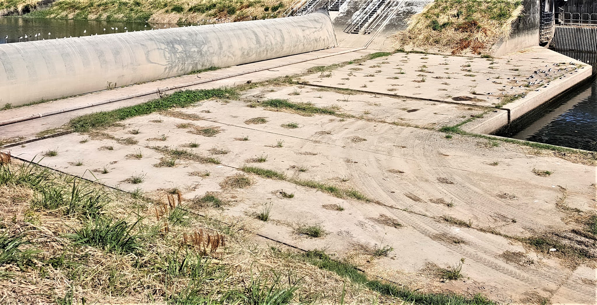
From this point, our route continues upstream to Hung Mo Bridge, which we cross. We then follow a Drainage Services access road along the west bank of the river to a point where the river divides into two. A short distance upstream from the confluence, there is a dam across the more westerly tributary, and there was a large group of red legs spread out across it:
This is a closer view:
We’ve often seen red legs here, but I don’t think we’ve seen quite this many at one time.

There were so many that there was a spillover group a few metres behind the dam, which we’d never seen before:
You can see the MTR’s West Rail Line in the background, and also what I believe is a water treatment plant.

And this is a closer view of the second group of red legs:
…while this photo provides a general view of the two groups:
A few individuals were foraging for food in the water behind the dam:
The last photo that I took here is a view looking downstream, also showing the two groups of red legs:
The mouth of the eastern tributary can be seen between the right-hand and central reflections of the support pillars of the rail line.

Finally, on the previous Saturday, the water level was high when we arrived at the river, and there seemed to be no activity to record. Suddenly, however, there were a couple of loud croaks, I think from egrets further up the unnamed tributary that joins the main river here, and this spooked a large group of red legs that had been assembled at a point on the opposite bank. They flew off in tight formation—an incredibly impressive sight that prompted a frantic scrabble to get our phones out. Unfortunately, I was too late, and Paula just managed to record the last 10 seconds as they returned to where they’d started, by which time the formation had become somewhat ragged:
I cycle this way at least once a week at this time of year, and now is the time for seasonal visitors, so look out for more reports on bird life on the Kam Tin River.

Friday, 19 November 2021

scrawl on the wall

Sha Tau Kok Road is the only road that runs east out of Fanling. It is a major highway, a dual carriageway starting next to Fanling station and leading, eventually, to Sha Tau Kok in the far northeast of the New Territories. In the urban area, it separates Fanling’s industrial zone to the south from the habitable part of town.

Because of the development that I’ve been recording recently, we’ve found it necessary to follow the cycle track network through town instead of simply following the Drainage Services access road that runs alongside our local river whenever we want to cycle out west, which is most of the time. And I couldn’t help but notice the graffiti on the walls of the industrial buildings as I passed.

This is a general view from the residential side of the road:
The next two photos are also general views, each of which shows several ‘tags’, which, as far as I understand the culture, is the name given to these works:
Each tag will have been drawn by a different person, and if they’ve been active on walls elsewhere, the same design will have been repeated. In other words, they function as a kind of signature (the nearest tag in the second photo appears to read ‘CRIS’).

Most of the graffiti here are too plain and unimaginative—or merely crude—to be worth further attention, but the next two photos are closer views of the two most distant tags in the first photo:
…while this is a close-up of the most distant tag in the second photo:
Not all the graffiti here are tags. This is my favourite among all the works here:
I assume that this is a dog, but I can’t read what it appears to be barking.

Next to the dog is this graffito, which is crude but amusing:
A short distance further east, the cycle track bends around the back of a Shell filling station, where I spotted this image:
I assume that the number refers to the Great Beast in that well-known work of fiction, the Revelation of St John the Divine, although this creature does not seem capable of bringing about the end of the world!

Much to my surprise, there is also one wall painting here, almost directly opposite the previous image:
I have a strange feeling that I recognize the person portrayed here, although from where I have no idea. And I can’t read the writing, although the last word is obviously ‘die’.The Chinese character right of the person is ‘Buddha’, while the character on the shoulder is ‘Guan’, which may be the person’s name.

In Hong Kong, graffiti are widely considered a form of vandalism, so I’ve only ever recorded one location in the territory with polychrome tags, since painted over, and what I’ve recorded here is of limited interest. However, I’m a huge fan of graffiti, and if you want to see graffiti that I have no hesitation in labelling as ‘art’, check out The Writing on the Fence, which I photographed in Manchester in 2018, or click the ‘graffiti’ label in the right-hand sidebar.