* from Old Norse bekkr, stream.Everything went well for the first kilometre or so—the path was clearly visible and easy to follow—but it gradually became apparent that not many people walked this way, and I decided to turn back in the middle of a field when the path could no longer be seen. The apparently well-trodden first kilometre I account for by people walking their dogs along this section of the path.
After this fruitless foray, I turned my attention elsewhere, and a couple of weeks ago, I found myself at the beginning of a public bridleway about 5km out of town, which ran roughly parallel to and west of the path I’d explored earlier. This didn’t start out well when I encountered a small herd of cows in a short section of green lane:
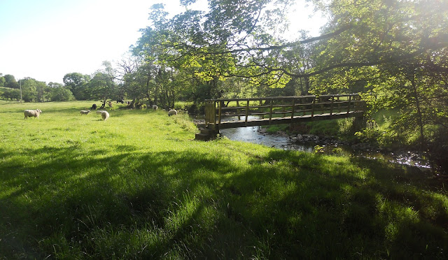
I don’t expect to be attacked by cows, but they are big beasts, and the road was narrow, so I decided that the sensible option would be to avoid them altogether by climbing over the fence, from where the photograph was taken. This path wasn’t easy to follow either, and it seems likely that not many people come this way. However, when I reached the River Petteril, everything seemed to slot into place. For a start, there was a footbridge over the river, and a clearly defined path leading away from the other side:
The path crosses a field to join an overgrown green lane, which leads eventually, without further navigational difficulties, to Thacka Lane:
It occurred to me that I should go back to the path I’d abandoned earlier to see whether, with a bit of effort, I could reach the Petteril and thus have a complete circuit. This time, I encountered another unexpected hazard:
This photo was taken looking back along the path, and I reached this position by once again climbing the fence alongside the path, having noted from a safe distance what appeared to be a mare standing guard over a dead foal. You can see from the photo that it isn’t possible to pass the mare without coming within range of her hind legs, and you should never walk that close to the back end of a horse.
The path continued to be easy to follow, either being confined between stone walls (first photo below) or featuring a friendly ‘kissing gate’ (second photo) to let me know that I was still on course.
Even when the line of the path is defined only by a straggly line of bushes, it’s impossible to go astray…
…but soon after this section, the path disappears altogether. However, by continuing in the same direction, parallel to the railway, I was able to pick up sporadic signs of worn ground, so I was in a position to spot when the path swung away from the railway across a large area of rough pasture.
This is what my Chinese friends would call a ‘two-fingered’ oak, and it makes a good way marker. The path is clearly visible just right of the tree, but note the line in the grass to the right of the tree and parallel to the horizon. This is a roughly circular area where the grass and reeds have been flattened, creating a phenomenon that might be considered analogous to a crop circle:
The ash is one of the commonest trees around these parts, but this one is unusual in having had its top half violently removed, presumably by a lightning strike. The debris in the foreground is a dead hawthorn and isn’t connected to this cataclysmic event:
During the 1970s, 20 million elm trees died in England and Wales as a result of Dutch elm disease, a micro-fungus spread by bark beetles, but some did survive. There are actually three in the following photograph, much closer together than you would usually see trees of this size:
Shortly after passing the elms, the path reaches the River Petteril and follows the south bank upstream until a rough stile over a fence is reached. This leads to a footbridge over the river.
It is tempting to follow what appears to be a path off to the left in this photo instead of crossing the stile, but if you do, you will either face a very awkward climb over a fence to reach the bridleway, or a long trudge back to this point.
I’ve included the following photograph because when I first saw this blaze of white in the water I thought it was scum. It isn’t. It’s thousands of tiny flowers, like daisies.
The footbridge over the river shown in the third photograph above is soon reached, and I knew at this point that it would be completely straightforward to find my way back to Thacka Lane.


Beautiful country~ It reminds me of the west in the US. Hello, horse!
ReplyDeleteI don’t think she heard you Momma.
Delete