However, it never occurred to me to look south of Sha Tau Kok Road (the main road out of Fanling to the east) until a couple of weeks before I was due to head back to the UK in May last year. In Reservoir Dodges, I described how I’d found an unexpected path that led to an area south of the main road that I simply had to take a closer look at. As part of that exploration, I followed one path that led back to Sha Tau Kok Road, which is a dual carriageway only as far as its junction with Ping Che Road.
I crossed to the north side of the road and followed a narrow lane and path as far as a Drainage Services access road (X on the following map):

As you can see, turning right only leads back to Sha Tau Kok Road. The road to the left is the kind of road that I ride only once. It leads to the Ping Che Service Reservoir, which is effectively a giant water tank at the top of quite a gruelling climb. Did I say “only once”? Naturally, I had to show Paula, and to make it really interesting, I pitched it as a ‘four-hill challenge’, the other three hills being the climb up to Hok Tau Reservoir, Hok Tau Road and Liu Pok Hill). This is by far the toughest of the four.
However, on this first visit to the area, I saw a much more obvious way to go:

I simply had to find out where the bridge over the drainage channel might lead to. It was certainly a good path:


As you have probably already noticed, the images I’m using to illustrate this excursion are not photographs but stills from a video, hence the distortion and, in some pictures, the crazy angles.
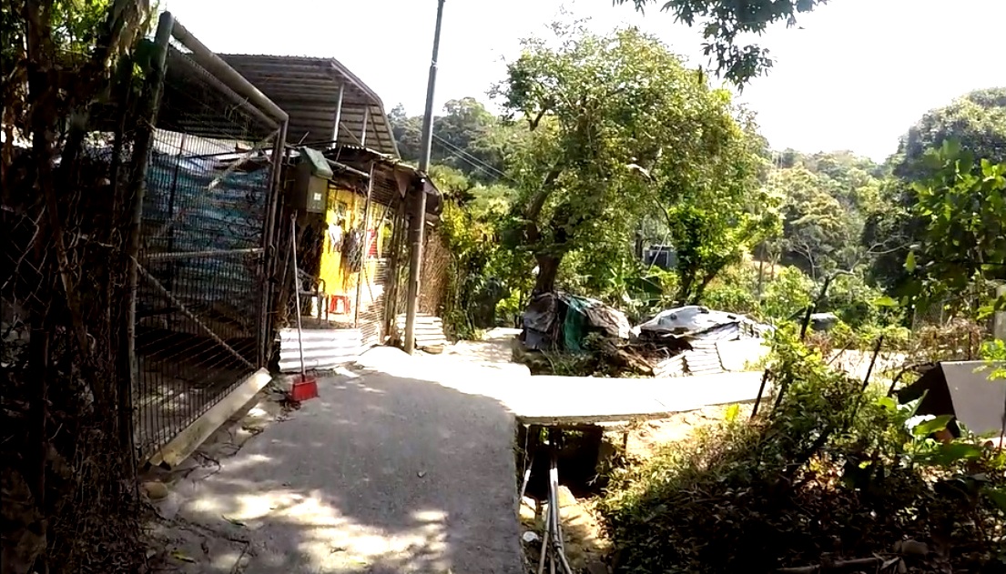
Solid yellow railings are always a sign that the path they border is going somewhere. But where? The first decision isn’t long in coming:

In my initial exploration, I chose to go straight on here, although as you will discover, I eventually returned via the right-hand path. And it’s all flat:


However, that is about to change. Radically! The ramp is not technically difficult, but it’s a lot steeper than it looks:

Around this point, I met a man who informed me that there was no way through. I’d like to see for myself, I replied. Keep to the right, he suggested. However, I kept left at the top of the ramp:

It’s the kind of question that I’ll never know the answer to: I have a vague feeling that the steps alongside the ramp weren’t there when I first came this way. The ramp was blocked a few weeks ago, I think for the concrete of the ramp to be renewed, and I now wonder if the steps were added then. The exit from the ramp seen in the previous image does seem easier now.
It’s still uphill though:


On my first visit, I continued up to the left:

…but it was a dead end, so I followed the path past the pavilion on the right:


The path here is obvious, contouring across the hillside:


…with one final uphill section:

…and a short level section:

…before an abrupt right turn:
The turn is an easy decision to make because, although it isn’t obvious in the picture, straight ahead is a flight of steps!
And it’s now downhill all the way:


You don’t want to allow your concentration to lapse here though:

…because the left-hand third of the path is a flight of steps!
There are no further difficulties, and we’re soon back on the flat:


The far end of the yellow railing in the previous image marks the junction seen in the fifth picture above:


And then it’s back the way I came earlier:


I’ve just described a circuit of the village of Wang Shan Keuk San Tsuen, which, as you have seen, is located on a hillside. The route follows the more westerly of the two paths north of the X on the map and returns via the more easterly. The path that connects the two is not marked on the map above, as I’ve come to expect from Google Maps.
San Tsuen means ‘new village’ in Cantonese, and I know of several such new villages in the Fanling area. I don’t know how or why such villages exist, whether they’re some kind of overspill from the ‘parent’ village, which is always located nearby. In this case, Wang Shan Keuk is located between Sha Tau Kok Road and the X on the map, and I do have to say that I find siting an overspill village on a hillside rather than on a flat area strange. It must be quite new though, because until 40 years ago New Territories villages were self-sufficient in rice, and there is nowhere here where rice could have been grown.
Finally, give yourself a bonus point if you spotted the Steeleye Span reference. Hark! The Village Wait is the title of an early album by my favourite folk band. I always do this round nowadays whenever I’m in the area, but to paraphrase Doctor Johnson’s assessment of the Giant’s Causeway, it may be worth doing, but it probably isn’t worth the trouble of going to do. After all, it doesn’t actually go anywhere.


No comments:
Post a Comment
Please leave a comment if you have time, even if you disagree with the opinions expressed in this post, although you must expect a robust defence of those opinions if you choose to challenge them. Anonymous comments may not be accepted.