This diversion into the history of the republic of Rome does have a point: I’ve decided to call my most recently developed cycling segment ‘crossing the rubicon’. The reason for this name will be explained in due course, but I will say that this is one of the best I’ve discovered to date. It is located 2–3km east of Fanling and is now an integral part of ‘the final frontier’.
I originally worked out ‘crossing the rubicon’ in December, when, because of a mystery injury, I wasn’t able to do any cycling but I could still walk. I cycled it for the first time just last week—and I was not disappointed! This is what it looks like:
The first photo shows the road junction where the original ‘final frontier’ turned left:

I did think I’d checked that continuing straight on here led to a dead end, but I must have missed something:

The previous photo was taken 30–40 metres past the junction, and it seems obvious that the right-hand option here leads into a private industrial yard (notice the guard dog on the right; a second is also fast asleep behind the parked car):

Yes it does, but if you keep going (to the left of the white truck):

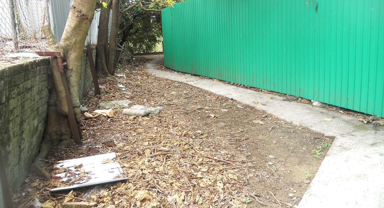
At this point, I should probably confess that the reason I know there is an alleyway next to the lamp-post is that I originally explored this (on foot) in the opposite direction. This is the start of that alleyway:

And this is why the point of no return starts precisely at the start of the alleyway:

The height of this drop ranges from 20cm on the right to 25cm on the left, which would make it extremely difficult to bump up, because the approach is uphill, although you can always get off and push. Unless you’re me, that is. The drop is hard enough to control if you’re going in the downhill direction!
The next few turns are straightforward:


…and we’ve now reached the river:

It isn’t the Rubicon, merely the upper reaches of the Ng Tung River, but there’s a footbridge across:

The continuation on the far side of the river may look innocuous:

…but there’s sure to be something nasty:

…and there is!

You may think that this ramp doesn’t look too steep, but it isn’t possible to take a run at it, and the right turn here is awkward partly because the approach is slightly uphill and partly because you need to avoid going over the edge on the left:

After the ramp, the going is much easier:


This is a closer view of the short ramp seen in the distance in the previous photo:

Short, not too steep, plenty of wobble room. Easy!
This is a view from the top of the short ramp. It isn’t obvious from the photo, but that is a T-junction in the distance. A right turn leads almost immediately to the main road:

…but there is more fun to be had by turning left:

I believe that I can add some enhancements to this segment by continuing straight on in the next photo, but for now the route turns right where there is an obvious red cloth in the fence:


There is an obvious right turn next to the lamp-post:


…followed by a forced left turn onto a brick path:

I’ve no idea what is underneath these boards, but because hitting them awkwardly isn’t easy to avoid, the danger, given the narrowness of the passage, is that you will crash into the fence on the left:

I’ve already done that once!
The planks in the next photo weren’t there last Sunday, but it poured down on Tuesday, and when I came through here on Wednesday they’d been added, so pedestrians do pass this way:

The next section is interesting because I encountered an old man here on Wednesday, and I imagine that he must have wondered what a crazy gweilo on a bike was doing around these parts:


I’ve tended to keep left of the red flowers in the next photo, but I should probably try going right:

The path may be a bit broken here, but it certainly isn’t difficult:


The path seen in the previous two photos eventually joins a bigger path:

If you turn left at this junction, you will eventually come to the stepladder, which is the most difficult ramp that I’ve come across to date. I’ve succeeded in cycling up this formidable obstacle just once to date. However, the right-turn offers no such difficulties:


The main road can be glimpsed in the distance in the last photo. Where to go next is a different question.


I'm sure that most people who haven't been there assume Hong Kong is just an array of glittering skyscrapers. Without your pictures, I would never have known how rural and scruffy much of it is
ReplyDelete‘Rural and scruffy’! I like that characterization Peter. And how about ‘quiet country roads’? These also exist in Hong Kong.
DeleteWhere is the broad wide boring cycling path? The answer is that it IS the fun part that you like, twisty tricky trail and the proper path is not an option for cycling...
ReplyDelete‘Where is the broad wide boring cycling path?’ Not on this route, that’s for sure. This one is much more fun.
Delete