When we moved to our present house, in a village a short distance east of Fanling, in 2008, we quickly discovered that we needed to walk through an area that I somewhat idealistically referred to as ‘fields’, because the area was under cultivation, to reach the town. However, this is Hong Kong, so there have been many changes here during the intervening 13 years.
Naturally, I’ve been documenting these changes as they’ve come to my attention, and if you have time, all these links contain contemporary photos as well as descriptions of the latest developments:
Hong Kong Country (January 2010)
Return to Koon Garden (November 2010)
Turf Wars (June 2011)
Owt Fresh? (September 2011)
The Cat Man’s Hut (January 2013)
A Blot on the Landscape (February 2015)
Art Promenade (March 2016)
Turf Wars Update (October 2016)
Terracotta? Ah Me! (April 2017)
Rotten Row (February 2020)
A Farming Mystery (March 2020)
An Unwelcome Development (December 2020)
While we were away in the UK during the summer, we received the following flier in the mail:
Obviously, it’s some kind of notification to residents of where they can and cannot go now. The green lines are paths that are still accessible, but my attention was drawn to the red line towards the east of the map, which is the path we always followed in order to reach Fanling. It’s now closed, so we have to walk a much longer way round!
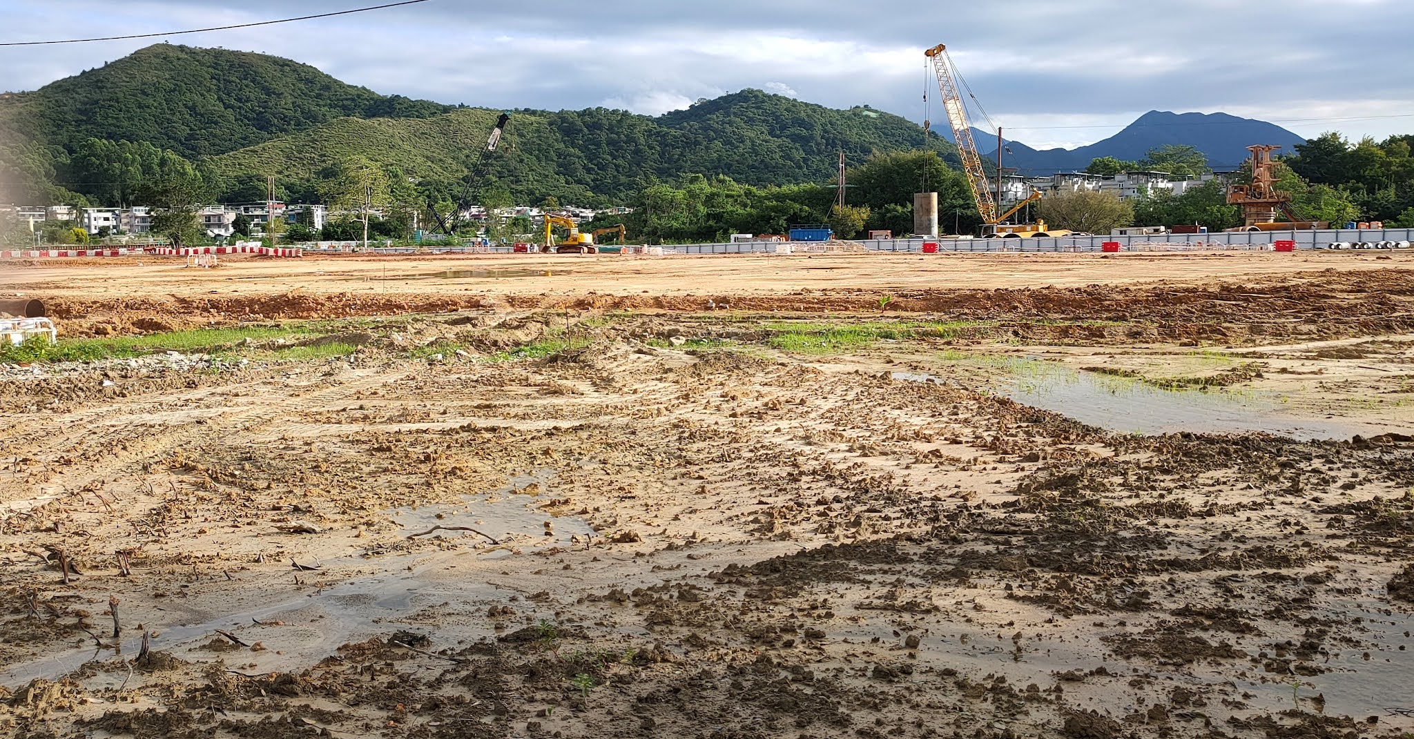
However, last Sunday, because I guessed that no work would be taking place, I thought that it would be worthwhile to check whether I could still get through, starting from the western end. I took the following photos to record my progress:
Before we went to the UK, we could still follow the path seen in the first photo on our way back home, and the area on the right was still under cultivation. The second photo, taken a short distance further along the path, shows the flattened area more clearly. You can also see in the distance the industrial steel panel fence that effectively blocks the path before it reaches the bridge over the Ma Wat River. The third photo shows all that is left of a substantial two-storey house that the path passes, while the fourth photo is a view of the flattened area from a different angle.
I took the next three photos on a section of the path that is still open. They are all that remains of what were once substantial houses:
Finally, in case you were wondering about the title of this post:
I’ve no idea who was responsible for this display, which reads ‘Goodbye Ma Shi Po’ from right to left. Ma Shi Po (horseshit area) is the generic name for the entire devastated area.


it IS sad to see the changes especially when reading posts of former features around the area. However, change is unavoidable and a total face lift may bring another wave of life for future generations.
ReplyDeleteI hope you’re right. The area is certainly a mess at the moment.
Delete