I hadn’t been up the valley containing what is now a reservoir for many years, and Paula had never seen Haweswater, so, given that nowadays I’m constantly thinking about new cycling routes, ones that we’ve never done before, I decided that a ride to Haweswater would be a good idea last Monday. The following map, which is a photo of a section of an Ordnance Survey road atlas with a scale of three miles to the inch, will allow me to describe the day’s ride (because the apparent scale of the photo will depend on the kind of device you’re reading this on, you can get an idea of the true scale from the fact that the village of Askham is about five miles from Penrith).

I don’t think we’ll come this way again. Not only is this road extremely rough, probably because it carries very little traffic, but we encountered two closed gates, which we could pass through, but having to stop to open and close the gates breaks up your rhythm. However, we eventually reached Bampton Grange, which isn’t marked on the map but is just a short distance east of Bampton. I took a photo here of a bridge over the River Lowther in which you can also see this village’s church tower:


While we considered whether to continue, we scrambled to the top of a rocky spur between the road and the lake, where I took quite a few photos. The following three photos show the view down, across and up the valley, respectively:

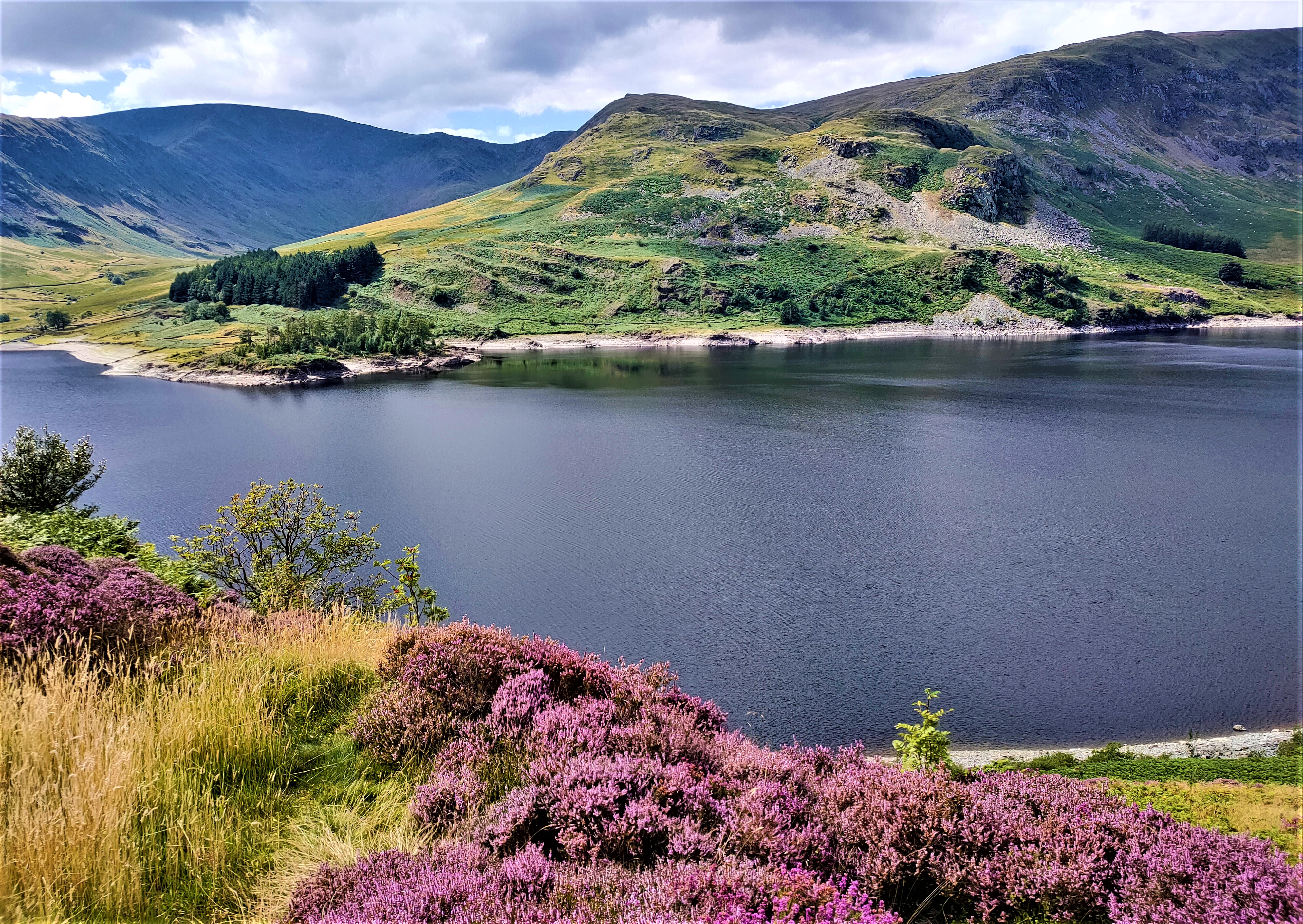

I then shifted my position and took another photo looking up the valley in which you can see the continuation of the road:

When we finally continued up the valley, I couldn’t help thinking that the hill we were descending would be quite a tough one to ascend, but it turned out to be easy!
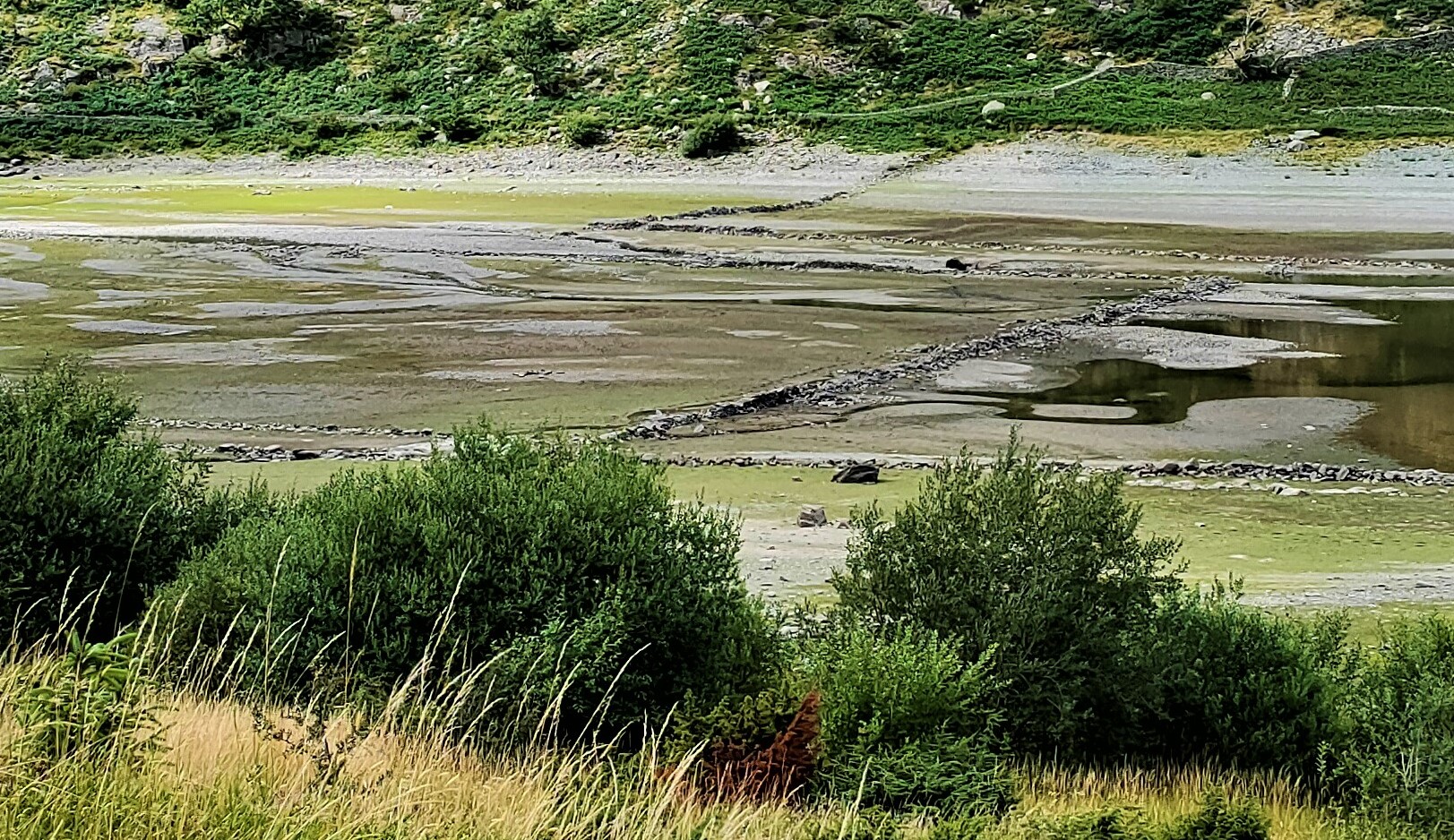
One of the sad effects of the construction of the dam was the drowning of the village of Mardale Green. The inhabitants were rehoused elsewhere, and all the buildings were demolished, including the Dun Bull Hotel and the seventeenth-century church of the Holy Trinity, although the interior fittings of the latter, which included a Jacobean oak pulpit, went to other churches. The corpses buried in the churchyard were exhumed and reburied in Shap.
Although nothing now remains of the village itself, the stone walls enclosing fields and marking narrow lanes can be seen when the water level in the reservoir is low, and given that there has been very little rain since we came back to Penrith in June, I wondered whether these features might be visible. They were:


We returned home through Bampton and Helton and saw no sign anywhere of roadworks or road closures. However, due to the sheer volume of traffic on the B5320, we abandoned my original plan to return to Penrith via Pooley Bridge. Mind you, Eamont Bridge is a notorious traffic bottleneck, with its light-controlled humped bridge over the river, that took a while to negotiate. Nevertheless, another grand day out.


Beautiful photos. I once visited the lake with my parents and some old friends of theirs, who exchanged memories of where the pub stood, where there was a tennis court, and so forth.
ReplyDeleteThanks for your comment. Although I grew up in Penrith, I never knew anyone who remembered the pub, Or anywhere else in the village for that matter,
DeleteSURELY it WAS a TERRIFIC day under the cloudy blue sky and the full bloom heather flowers made it even more BEAUTIFUL!!!!
ReplyDeleteI agree, naturally.
Delete