* * *
My first photo is a view of the bridge that carries the West Coast main line across the M6 motorway a short distance west of Penrith:The bridge also carries a public footpath, signposted to the village of Stainton, and there is a graffito, not easily seen in this photo, on this side of the bridge. In fact, there are graffiti on all four corners of the bridge.
From the top of our street in Penrith, there is a lane that runs parallel to the railway. When I was growing up, this merely led to a private abattoir and beyond, a nondescript area of open fields. However, this area is now Penrith Industrial Estate, sandwiched between the town and the M6 motorway (which also wasn’t there when I was growing up). There is a footpath linking the end of the lane (Myers Lane) with the industrial estate, and although short, it is quite scenic:
I don’t know the identity of the pink flowers here, and I’ve not seen them anywhere else, but the yellow flowers are Welsh poppies, which are extremely common.
The wooded hill that you can see in the distance in the first photo above is the Beacon, which is inextricably linked to Penrith’s history (the name reflects the practice, until quite recently, of lighting bonfires on the top of the hill to warn the town’s population that yet another Scottish raiding party was on its way south. This is a view from the top of the Beacon, looking west:
Nowadays, the Beacon is a commercially managed forest, but the area immediately surrounding the summit has always been accessible to the public during my lifetime. I took the next two photos on the way back down after taking the previous photo from the top of the hill. This is what happens when you grow trees too close together:
Even the bracken develops attenuated stalks in response to the limited availability of light:
After leaving the Beacon plantation, we always follow the same path, which leads to an area of extensive housing development on the southeast corner of town (all fields when I was growing up). The one surviving field here always seems to contain a few Highland cattle:
However, sheep are probably the most common animal to be seen in the fields around Penrith. This field is located next to the lane connecting Thacka Lane and the Newton Rigg Agricultural College:
On the other hand, horses are also surprisingly common. This photo was taken from Thacka Lane, looking east:
The Beacon is on the skyline on the right of the photo.
We often walk along the banks of the River Eamont, a mile or so south of town, between Eamont Bridge and Brougham. There are plenty of opportunities for scenic photos like these:
Another horsey pic:
…this one was taken west of Penrith. I don’t know why its bridle has been left on.
This view of Penrith was taken a couple of miles west of town:
In fact, most of the town isn’t visible, because if you start in the town centre, whichever direction you choose to drive or cycle in order to leave town, you will have to travel uphill. The faint mountains in the distance are the Pennines, ‘the backbone of England’, and the highest point you can see in the photo is Cross Fell, which is the highest point in England outside the Lake District.
I mentioned Eamont Bridge above. This is the eponymous bridge:
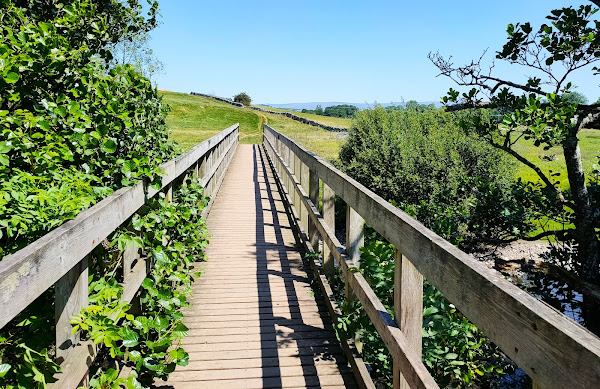
And this is the bridge over the Eamont that carries the public footpath from Sockbridge to Penrith, a couple of miles upstream from Eamont Bridge:
…while this is a ewe and two lambs that I photographed further along the same path towards Penrith:
…and this is the tunnel whereby the same path crosses the railway:
This is a view of the main railway line from a bridge a couple of miles north of Penrith:
Paula and I decided to eat dinner at the North Lakes Hotel, on the western edge of town, to mark our 34th wedding anniversary. We couldn’t help but notice these ‘stick sheep’ in the grounds:
The next photo is of the public footpath between Penrith’s golf course and Beacon Edge, the road that marks the boundary between the Beacon plantation and the town:
The town’s cemetery is on the left, and the plantation is on the right.
I took the next photo, which I believe is of a cluster of wild rose flowers, because of the bee that appears to be drinking nectar:
The next photo shows houses on Folly Lane, which I remember being built in the 1950s because I grew up on the same public housing estate (Scaws):
This is a photo of Brougham Castle, about 1.5 miles southeast of Penrith on the south bank of the River Eamont:
This castle was founded by the Clifford family in the early thirteenth century and is now a ruin. Entry used to be free, but it is currently run by English Heritage, so you have to pay to enter.
And this is a photo of the nearby Brougham Hall:
The gatehouse that you can see in this photo is the oldest part of the hall, dating to the thirteenth century. Although most of the hall is currently in a ruinous condition, it is being renovated by volunteers and is open to visitors.
Finally, how’s this for a door knocker…?
It’s located on a door well to the right of the gatehouse in the previous photo.
Continued in Part 2…


The June walks were memorable while the weather was pleasant as ever.
ReplyDeleteMany of the photos here were taken during the walks you refer to.
DeleteThank you, Dennis. Some very nostalgic pictures here!
ReplyDeleteNostalgic for me too, as you can probably guess from the text.
DeleteLike you Dennis the memories of Scawes being built and the green fields where we could wander freely very nostalgic, magic days 👍
ReplyDelete