Thursday, 12 October 2023

favourite photos: summer 2023 (part 1)

I usually post my summer photo collections before heading back to Hong Kong for the winter, but sitting in front of a computer for long periods remains uncomfortable. However, I’ve been back in Hong Kong for more than a week now, and I do want to maintain some semblance of continuity, so here is Part 1 of this summer’s collection. I should point out that all the photos in this latest collection were taken either in June or the first half of July, a period during which I took over 1,200 photos, but being confined to the house for several weeks, followed by severe restrictions on how far I could walk without a rest, meant that I took very few photos in the second half of my latest stay in Penrith. All the photos here are posted in chronological order rather than being grouped according to their subjects.
*  *  *
My first photo is a view of the bridge that carries the West Coast main line across the M6 motorway a short distance west of Penrith:
The bridge also carries a public footpath, signposted to the village of Stainton, and there is a graffito, not easily seen in this photo, on this side of the bridge. In fact, there are graffiti on all four corners of the bridge.

From the top of our street in Penrith, there is a lane that runs parallel to the railway. When I was growing up, this merely led to a private abattoir and beyond, a nondescript area of open fields. However, this area is now Penrith Industrial Estate, sandwiched between the town and the M6 motorway (which also wasn’t there when I was growing up). There is a footpath linking the end of the lane (Myers Lane) with the industrial estate, and although short, it is quite scenic:
I don’t know the identity of the pink flowers here, and I’ve not seen them anywhere else, but the yellow flowers are Welsh poppies, which are extremely common.

The wooded hill that you can see in the distance in the first photo above is the Beacon, which is inextricably linked to Penrith’s history (the name reflects the practice, until quite recently, of lighting bonfires on the top of the hill to warn the town’s population that yet another Scottish raiding party was on its way south. This is a view from the top of the Beacon, looking west:
Nowadays, the Beacon is a commercially managed forest, but the area immediately surrounding the summit has always been accessible to the public during my lifetime. I took the next two photos on the way back down after taking the previous photo from the top of the hill. This is what happens when you grow trees too close together:
Even the bracken develops attenuated stalks in response to the limited availability of light:
After leaving the Beacon plantation, we always follow the same path, which leads to an area of extensive housing development on the southeast corner of town (all fields when I was growing up). The one surviving field here always seems to contain a few Highland cattle:
However, sheep are probably the most common animal to be seen in the fields around Penrith. This field is located next to the lane connecting Thacka Lane and the Newton Rigg Agricultural College:
On the other hand, horses are also surprisingly common. This photo was taken from Thacka Lane, looking east:
The Beacon is on the skyline on the right of the photo.

We often walk along the banks of the River Eamont, a mile or so south of town, between Eamont Bridge and Brougham. There are plenty of opportunities for scenic photos like these:
Another horsey pic:
…this one was taken west of Penrith. I don’t know why its bridle has been left on.

This view of Penrith was taken a couple of miles west of town:
In fact, most of the town isn’t visible, because if you start in the town centre, whichever direction you choose to drive or cycle in order to leave town, you will have to travel uphill. The faint mountains in the distance are the Pennines, ‘the backbone of England’, and the highest point you can see in the photo is Cross Fell, which is the highest point in England outside the Lake District.

I mentioned Eamont Bridge above. This is the eponymous bridge:
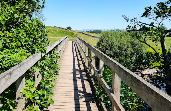
And this is the bridge over the Eamont that carries the public footpath from Sockbridge to Penrith, a couple of miles upstream from Eamont Bridge:
…while this is a ewe and two lambs that I photographed further along the same path towards Penrith:
…and this is the tunnel whereby the same path crosses the railway:
This is a view of the main railway line from a bridge a couple of miles north of Penrith:
Paula and I decided to eat dinner at the North Lakes Hotel, on the western edge of town, to mark our 34th wedding anniversary. We couldn’t help but notice these ‘stick sheep’ in the grounds:
The next photo is of the public footpath between Penrith’s golf course and Beacon Edge, the road that marks the boundary between the Beacon plantation and the town:
The town’s cemetery is on the left, and the plantation is on the right.

I took the next photo, which I believe is of a cluster of wild rose flowers, because of the bee that appears to be drinking nectar:
The next photo shows houses on Folly Lane, which I remember being built in the 1950s because I grew up on the same public housing estate (Scaws):
This is a photo of Brougham Castle, about 1.5 miles southeast of Penrith on the south bank of the River Eamont:
This castle was founded by the Clifford family in the early thirteenth century and is now a ruin. Entry used to be free, but it is currently run by English Heritage, so you have to pay to enter.

And this is a photo of the nearby Brougham Hall:
The gatehouse that you can see in this photo is the oldest part of the hall, dating to the thirteenth century. Although most of the hall is currently in a ruinous condition, it is being renovated by volunteers and is open to visitors.

Finally, how’s this for a door knocker…?
It’s located on a door well to the right of the gatehouse in the previous photo.

Continued in Part 2

Friday, 29 September 2023

swiss made

I’ve just returned from a trip to Switzerland, a country that I’d never previously visited. As a result of this visit, I have a few things to write about, but I’m still finding it difficult to sit in front of a computer for extended periods (see my previous post), so this post is merely a trailer for what will appear on this blog after I return to Hong Kong, currently scheduled for next week.

One of the main highlights of our trip was a visit to St. Gallen old town, which is a world heritage site. The street architecture here is fascinating, and we were able to go inside a very impressive church:
This is the Episcopal Cathedral of the Diocese of St. Gallen. I couldn’t identify the architectural style, although it obviously isn’t Gothic. However, when we entered the church, I saw immediately from the flamboyant décor that the style was Baroque, even though I’d never previously been inside a Baroque church:
According to a leaflet that we picked up as we entered the church, it was built between 1755 and 1766. I will be posting more photos of the interior next month, together with photos taken in the streets around the church, like this one:
Another place that we visited was the Walensee, a large lake in the mountains south of where we were staying. I’d actually commented on the absence of mountains in the area where we were staying, so it was good to see something of the Alps up close. Unfortunately, I wasn’t able to walk far, but I like this photo of a narrow waterfall that cascaded down the side of the valley containing the lake:
…and this is a view of the Walensee taken from a similar position to the previous photo:
We also visited Lake Konstanz, where I took this photo of a pair of swans:
As a Cumbrian, this lake reminded me of the Solway Firth, viewed from a small village like Allonby. In other words, the lake is so large that the opposite side is so far away that it reminded me of the experience of just being able to make out the shore of Galloway in the far distance from Allonby.

I also plan to write a separate feature about the guest house where we stayed:
The reasoning behind wanting to write about this place in detail is the sheer number of quirky ‘installations’ here, like this one in the corridor outside our room:
And then there were the rabbits! I took a lot of photos of these outsized rodents, which had quite a large grassy area to cavort around, although I was more likely to see them lolling around, as they were in this photo:
In addition to writing up more detailed accounts of what I’ve described above, I will be finishing an account of a bike ride south of Penrith that Paula and I did in early July, before my accident, and a collection of my favourite photos from this ill-starred summer (I took almost 1,200 photos before this unfortunate event).

Friday, 1 September 2023

a message to my readers

If you are a regular reader of this blog, you will probably have noticed that I haven’t posted any new material since the beginning of last month. The problem started in the middle of last month. I’d just been for a short bike ride (35km), and when I got home, I found a note in my letterbox to inform me that someone had tried to deliver a parcel, realized that I wasn’t in and left it with a neighbour across the street.

When I went across the street to retrieve this parcel, I found that it was too heavy for me to lift. I could raise it just clear of the ground, but there was no way that I could have carried it across the street. However, the neighbour had a child’s push-chair, but when I tried to lift it onto this conveyance, I felt a slight pull in my lower back.

You probably think that I should have sought the assistance of a younger—and stronger—neighbour, because I have a long history of lower back problems, which started in 1968. I was working in Libya, on oil rigs in the desert, and I was driving a Land Rover across what appeared to be a gently undulating plain of firm sand at about 50mph when suddenly I was airborne. As I touched down, I felt a sharp stab of pain in my back. I did need some treatment by the rig’s medic, but I recovered quite quickly, and because my lifestyle has always involved a lot of physical exercise, adverse back episodes have been quite rare and easily dealt with, apart from one in 1983 when I was hospitalized on traction for two weeks after an incident when I was working at the Outward Bound School in Hong Kong. The school had just been hit by a severe squall that had caused the school’s pontoon jetty to break free from its moorings, and effecting a suitable temporary repair involved doing things that my back didn’t like. The problem was that I couldn’t just stop, which probably explains the eventual severe outcome. Incidentally, although I quickly returned to full fitness after the hospital stay, I was refused a new contract and kicked out when my existing contract expired on the grounds of ‘doubts’ about my fitness.

The parcel incident that I described above also seemed quite trivial. I expected my back to be okay within a few days, but a few days later, I woke up to a slight feeling of numbness in my right leg. This also didn’t seem significant, and I continued with my routine of long walks in the morning and evening as usual. I seemed to be able to ‘walk off’ the numbness in my leg.

Unfortunately, this numbness has slowly changed to pain, which means that I haven’t been able to do any cycling since the ride I referred to earlier. I haven’t even been out of the house for more than three weeks, apart from a visit to the local health centre for a detailed assessment of my condition, because I can’t place any weight on the affected leg without triggering excruciating pain. And I can’t sit in front of a computer for any length of time either (it has taken me almost two weeks to finish writing this short note). I don’t expect to produce any more posts for quite a while, although I do have a few posts in the pipeline, including a hold-over from last year that will answer the question of where you would take someone who had one day to ‘see’ the Lake District; a detailed description of a bike ride that Paula and I did south of Penrith at the beginning of July (with videos); and the usual selection of photos that I post every year after my stay in my home town.

We’ll be heading back to Hong Kong at the beginning of October, and I’m optimistic that I will have fully recovered by then (I am making progress).

Wednesday, 5 July 2023

an incredibull encownter

In my last post, I described how Paula and I failed to find the continuation of the public footpath to Catterlen after we’d crossed the River Petteril, and as a result we followed an alternative path that led to a few problems with cows as we crossed their field. Well, a few days later we were back to make another attempt to follow the missed path, and this time we succeeded, albeit not without more problems with cows.

I took a few photos of the first section of the ‘path’, which to start with can be more accurately described as a ‘track’:
Although the track starts off by running parallel to the motorway, this first photo shows the point where it starts to diverge away.

More photos:
After we passed the open gate that I described in my previous post, the way becomes considerably overgrown:
…but we eventually reach a gate on the left, from where the path crosses an open field towards the first footbridge over the River Petteril:
The way ahead, up the hill on the far side of the river, isn’t at all obvious. Before tackling the hill, I took this photo of masonry ruins:
I can only guess its original purpose, although I suspect that it had something to do with drainage in the area.

From a point further up the hill, I took this photo looking back down towards the river:
You can see the second footbridge, which we crossed during our earlier venture into this area, to the right of centre.

And then things started to get really interesting!
Thou shalt not pass! That was my impression, but I was having none of it:
I cleared a comfortable path across the field, but when we reached the gate into the next field, which was empty, we could see another herd massing behind the next gate. They were waiting for us when we reached the gate:
However, this was definitely the way to go, and I was able to induce these cantankerous cattle to get out of our way quite easily:
We reached Catterlen without further problems. Although the original signpost we had followed merely indicated the name of the village, the signpost in Catterlen specifically identified the path as a ‘bridleway to Penrith’, which means that there is a legal right to ride a horse along the route we’d just followed. I don’t think anyone does this nowadays though. In fact, I don’t think this path is followed by many walkers either.

Having reached Catterlen, there is no obvious off-road alternative to the way we’ve just come, so we simply followed the road, which carries very little traffic, to Newton Reigny, where we made an interesting discovery. I’ve cycled along this road in the opposite direction many, many times, but I never knew that this is Catterlen Hall (even though it’s in Newton Reigny):
The name is inscribed on the millstone partially embedded in the ground to the right of the bridge, but you can see how you would never notice it if you’re riding a bike:
At the bottom of this hill, the road crosses the River Petteril before joining a busier road that leads eventually to Penrith:
A separate footbridge strikes me as unnecessary!

This is the view downstream:
There is a direction/distance signpost at the junction I mentioned above:
I’ve included what seems like a trivial photo because of the lettering on the post: ‘Cumberland County Council’. Cumberland ceased to exist following local government reorganization in the 1970s, when Cumberland and Westmorland, together with the Furness District of Lancashire and a small part of the Yorkshire Dales, became a new county: Cumbria. This has now been abolished, and Penrith, which was in Cumberland fifty years ago, is now in Westmorland. What!?

Although the road from Newton Reigny to Penrith is unclassified, it does carry quite a lot of traffic. That is not a problem for cycling, but I didn’t fancy walking along it. However, I noticed a parallel track on the map to the southwest, which seemed like a much safer option. However, the middle section turned out to be heavily overgrown, which caused a few problems. This photo shows where the overgrown section reaches a good track, which we followed through Sewborwens Farm:
…and thus to Penrith
…without further problems.