Another example of this worthiness is the ‘panty park path’, which I still can’t believe I discovered only earlier this month, because it’s within walking distance of my home. My excuse is that it leads off a road that is itself a dead end, although I’m still not sure how I missed it in the past. The streetlight should have been enough of an incentive to take a closer look.
The start looks like a routine countryside narrow path:

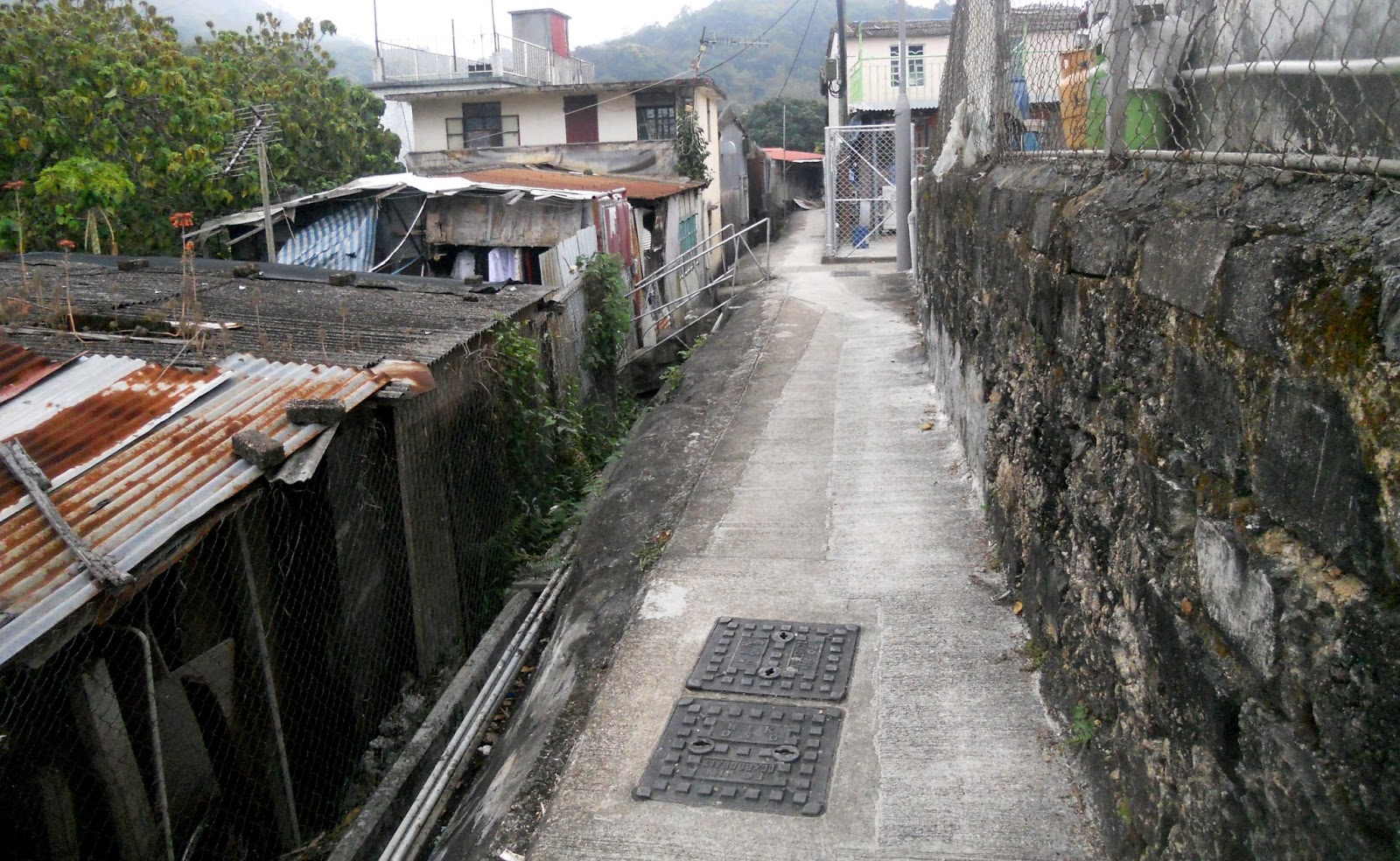
…and as it continues there is nothing unusual to pique one’s interest:

Aha! The green railings herald a steeper section, which requires some effort:

When I reached the bottom of the hill shown in the next photograph for the first time, I dismounted and walked ahead to see whether the path continued ahead, not because it was too steep but because it can be quite awkward to turn around in this kind of location should the path go no further. And it did appear to lead only to the gate at the top:

However, it did continue beyond the gate:

There are two rather hysterical dogs behind the gate that will do their best to put you off as you continue (one is visible in the photograph).
This short bridge is quite narrow:

…and awkward too, given that you have almost no forward momentum following the steep hill that precedes it. It would be desperately nerve-racking without the railings, although the drop against which the railings protect is not extreme.
Having established that there is a through route, my first attempt to ride it failed at a point in the next photo. Because I was moving far too slowly, I lost my balance and toppled into the pile of wood on the right (the path is too narrow to actually fall off):

…and on my second attempt, I passed the pile of wood only to overbalance into the wall on the left in the following photograph, again because of my lack of forward momentum:

You may be wondering why I’ve given such a bizarre name to this path. Well, take a look at the following photograph, which was taken from the furthest point visible in the last photo, looking back:

I have absolutely no idea why there is such an elaborately executed graffito on the wall of a squatter hut, and I’m equally ignorant as to its meaning, but I think that it’s fair to assume that the anonymous artist doesn’t live anywhere along the path. And if you think I’m misreading it, here’s a close-up (the alley is too narrow to get it all in):

By the way, if you live in the city, you will know that the large squatter settlements that once characterized Hong Kong were cleared decades ago, but you may not be aware that there are still hundreds of smaller locations on the edges of the major towns in the New Territories (the path with the yellow railings featured in Ping Kong Ping Pong is another example). I frequently come across red signs with the following warning:
…although this particular path is obviously deemed safe, because there are no such signs hereabouts. And paths like this are clearly on the government’s radar, because there are streetlights, and although not obvious, mains electricity and piped water.DANGERThe areas in the vicinity of this sign are subject to landslip risk. Some squatter huts have been recommended for clearance. … Please stay away from the areas during Landslip Warning Signal, Typhoon Signal No. 8, or heavy rain.
The last few photos show the remainder of the path, but looking backwards. You may be surprised at how substantial some of these dwellings are.


The last photo provides a clue as to why I’ve described riding this path in the direction I have done. This ramp is much easier than the one depicted above, and the path levels off immediately here instead of continuing to climb. You would notice this immediately if instead of following the path as I’ve described it, you followed the road. The difference in elevation between the start and finish of the path is very noticeable.
There is one further loose end to tie up before concluding: did I manage to ride the path after two successive failures? Well of course I did, or I wouldn’t be writing about it! The problem had been a lack of forward momentum, causing me to wobble when there was no room to wobble. I calculated that if I didn’t engage the small chainring on the initial ramp, I could accelerate more easily once I’d crossed the bridge and therefore avoid the wobbles. I was right.


Looks like a fun challenge.
ReplyDeleteIt certainly is Martin.
DeleteIn places it looks like an obstacle course. Very interesting! You really become part of the neighborhood while riding on them.
ReplyDeleteA stern test of your bike handling Pat. And there isn’t much scope for admiring the scenery!
Delete